Framed Print > Exploration
Framed Print : EXPL2A-00035


![]()
Framed Photos from North Wind
EXPL2A-00035
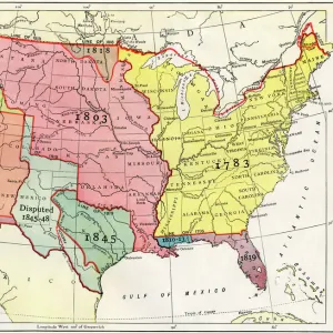
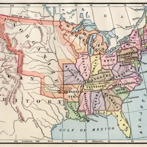
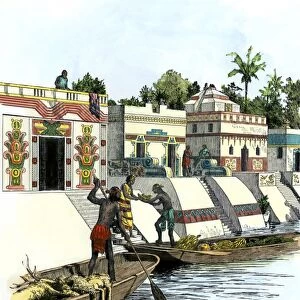
Map of the Lewis and Clark route across Louisiana Territory, 1804-1806.
Hand-colored woodcut of a 19th-century illustration
Media ID 5880185
© North Wind Picture Archives
1804 1805 1806 Corps Of Discovery Dakota Discover Expansion Expedition Exploration Explore Frontier Great Plains Idaho Land Claim Lewis And Clark Louisiana Purchase Louisiana Territory Meriwether Lewis Missouri Missouri River Montana North Dakota North West Oregon Pacific Northwest River Route South Dakota Territory West Western William Clark
18"x14" Modern Frame
16x12 Print in an MDF Wooden Frame with 180 gsm Satin Finish Paper. Glazed using shatter proof thin plexiglass. Frame thickness is 1 inch and depth 0.75 inch. Fluted cardboard backing held with clips. Supplied ready to hang with sawtooth hanger and rubber bumpers. Spot clean with a damp cloth. Packaged foam wrapped in a card.
Contemporary Framed and Mounted Prints - Professionally Made and Ready to Hang
Estimated Image Size (if not cropped) is 40.6cm x 35.6cm (16" x 14")
Estimated Product Size is 45.7cm x 35.6cm (18" x 14")
These are individually made so all sizes are approximate
Artwork printed orientated as per the preview above, with landscape (horizontal) orientation to match the source image.
FEATURES IN THESE COLLECTIONS
> Maps
MADE IN THE USA
Safe Shipping with 30 Day Money Back Guarantee
FREE PERSONALISATION*
We are proud to offer a range of customisation features including Personalised Captions, Color Filters and Picture Zoom Tools
SECURE PAYMENTS
We happily accept a wide range of payment options so you can pay for the things you need in the way that is most convenient for you
* Options may vary by product and licensing agreement. Zoomed Pictures can be adjusted in the Cart.