mail_outline sales@mediastorehouse.com
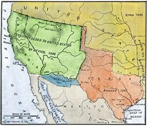
EXPL2A-00265Map of the territory ceded by Mexico to the US after the Mexican-American War, 1848-1853. Hand-colored woodcut of a 19th-century illustration
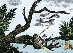
EXPL2A-00269Meriwether Lewis and William Clark expedition losing notes and specimens in a canoe accident on the upper Missouri River. Hand-colored woodcut reproduction of sketch by Patrick Goss
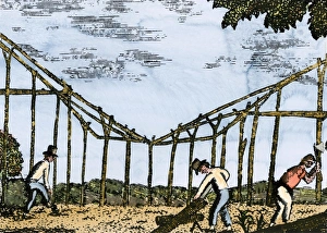
Fort Mandan constructed by Lewis and Clark, 1803Lewis and Clark expedition overwintering along the Missouri River near a Mandan village, 1803-1804. Hand-colored woodcut of a Patrick Goss drawing, a member of the expedition
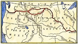
EXPL2A-00035Map of the Lewis and Clark route across Louisiana Territory, 1804-1806. Hand-colored woodcut of a 19th-century illustration
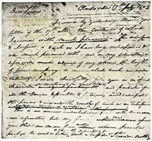
EXPL2A-00339William Clarks letter accepting Lewiss invitation to join the Corps of Discovery expedition, dated Clarksville 1803. Printed halftone reproduction with a watercolor wash
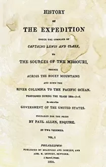
EXPL2A-00351Title page of the first publication of Lewis and Clarks journal and notes, 1814. Woodcut with a watercolor wash
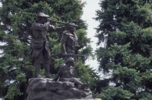
Lewis and Clark monument at Fort Benton, MontanaStatue of Sacagawea guiding Lewis and Clark at Fort Benton, Montana. Photograph
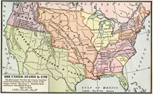
EXPL2A-00039Map of the US in 1792, showing colonial claims on Oregon Territory. Printed color halftone of a 19th century illustration
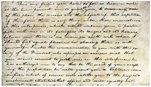
William Clarks invitation from Meriwether Lewis, 1804Meriwether Lewiss letter inviting William Clark to join the expedition to explore the Louisiana Territory. Printed halftone reproduction with a watercolor wash
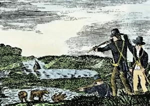
EXPL2A-00092Lewis and Clark shoot a grizzly bear, unknown to whites, during their exploration of Louisiana Territory. Hand-colored woodcut reproduction of sketch by Patrick Goss
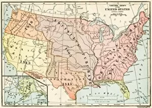
EXPL2A-00041Map of territorial growth of the United States from 1783-1867. Printed color lithograph of a 19th-century illustration
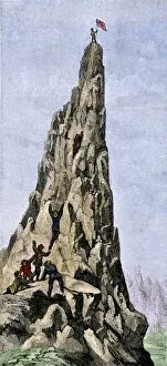
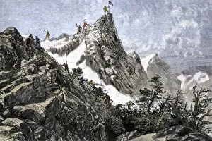
EXPL2A-00348Fremont expedition raising the American flag on the Rockies, 1842. Hand-colored woodcut of a 19th-century illustration
EXPL2A-00349John C. Freemont planting the US flag on the Colorado Rockies, 1842. Hand-colored woodcut of a 19th-century illustration