mail_outline sales@mediastorehouse.com
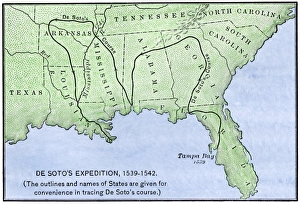
Map of DeSotos route, 1540sDe Soto expeditions route across southeast North America, 1539-1542. Hand-colored woodcut of a 19th-century illustration
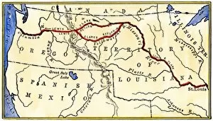
EXPL2A-00035Map of the Lewis and Clark route across Louisiana Territory, 1804-1806. Hand-colored woodcut of a 19th-century illustration
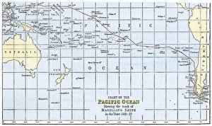
Magellans route across the PacificRoute of Magellans ships across the Pacific while circumnavigating the earth, 1519-1522. Hand-colored woodcut of a 19th-century illustration
EXPL2A-00149Route of Zebulon Pike across western territory to explore Colorado region 1805 - 1806. Hand-colored woodcut of a 19th-century illustration
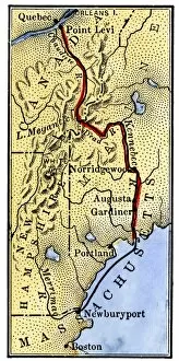
EVRV2A-00085Map of Benedict Arnolds route to invade Quebec during the American Revolution, 1775. Hand-colored woodcut of a 19th-century illustration
Map of part of DeSotos route, 1500sEastern portion of De Sotos route across southeastern North America, 1500s. Hand-colored woodcut reproduction of a 1593 illustration
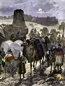
BUSN2A-00075Trade caravans on the Silk Road, the great highway of Central Asia. Hand-colored woodcut of a 19th-century illustration
BUSN2A-00049Transporting merchandise on the great Silk Road in the Middle Ages. Hand-colored woodcut reproduction of a medieval illustration
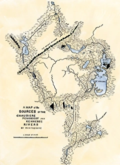
Maine map used in Arnolds invasion of Quebec, 1775Montresors map of inland Maine, used for Arnolds march to Quebec, 1775. Hand-colored woodcut of a 19th-century illustration
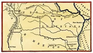
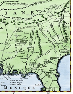
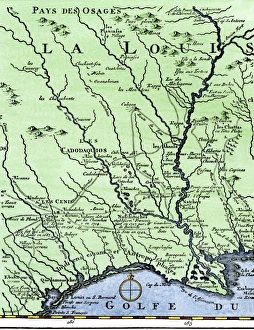
DeSotos route in LouisianaWestern part of De Sotos route, from Desisles map published in 1707. Hand-colored woodcut reproduction of an 18th-century illustration
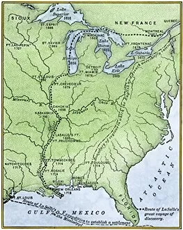
EXPL2A-00171Map showing the route of La Salles explorations in North America, late 1600s. Hand-colored woodcut of a 19th-century illustration