Home > American history
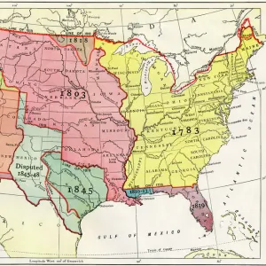
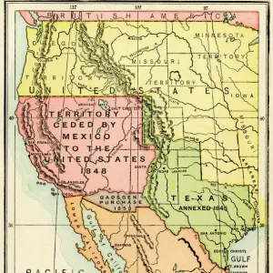
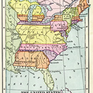
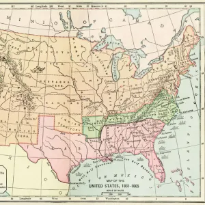
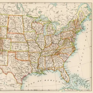
US territorial acquisition during the 1800s

![]()
Wall Art and Photo Gifts from North Wind
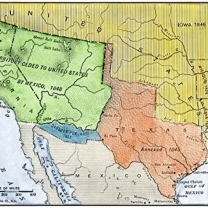
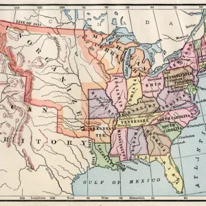
US territorial acquisition during the 1800s
Map showiing the territorial growth of the continental US 1776 to 1899.
Hand-colored woodcut of a 19th-century illustration
Media ID 5877358
© North Wind Picture Archives
America Border Boundary Louisiana Louisiana Purchase Louisiana Territory Mexico New World Oregon Oregon Territory Spanish States Territory Texas War Of 1812
FEATURES IN THESE COLLECTIONS
> Maps
MADE IN THE UK
Safe Shipping with 30 Day Money Back Guarantee
FREE PERSONALISATION*
We are proud to offer a range of customisation features including Personalised Captions, Color Filters and Picture Zoom Tools
SECURE PAYMENTS
We happily accept a wide range of payment options so you can pay for the things you need in the way that is most convenient for you
* Options may vary by product and licensing agreement. Zoomed Pictures can be adjusted in the Basket.