mail_outline sales@mediastorehouse.com
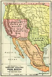
U. S. territory gained from MexicoMap of territory acquired by the U.S. from Mexico. Color lithograph of a 19th-century illustration
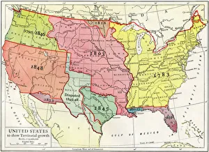
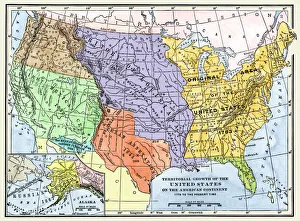
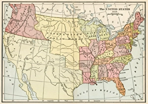
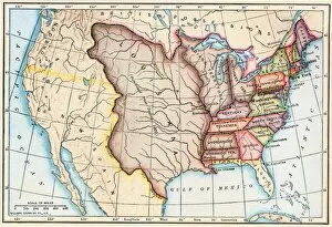
Growth of the United States to 1853U.S. map, showing territorial growth to 1853. Printed color lithograph of a 19th-century illustration
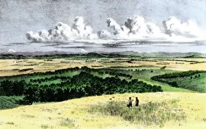
Oregon wheatfields, late 1800sFarmland of Polk County, Oregon, as seen from Mount Pizgah, 1880s. Hand-colored woodcut of a 19th-century illustration
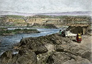
Columbia River campsite of Native American fishermenNative American fishing camp on the banks of the Columbia River. Hand-colored woodcut of a 19th-century illustration
US territorial acquisition during the 1800sMap showiing the territorial growth of the continental US 1776 to 1899. Hand-colored woodcut of a 19th-century illustration
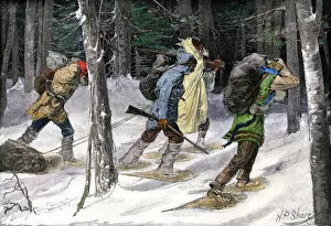
BUSN2A-00177Native American trappers carrying furs on snowshoes in a forest of the Pacific Northwest Hand-colored woodcut of a 19th-century Frederic Reminigton illustration
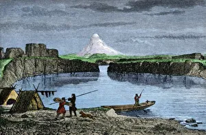
Columbia River fishing camp of Native AmericansNative American fishing camp by the Columbia River, 1800s. Hand-colored woodcut of a 19th-century illustration
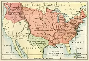
United States map in 1830Territories of the United States in 1830. Printed color lithograph
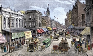
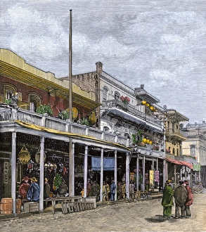
Businss district of Portland, Oregon, late 1800sCarriages and stores in Portland, Oregon, late 1800s. Hand-colored woodcut of a 19th-century illustration
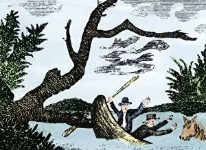
EXPL2A-00269Meriwether Lewis and William Clark expedition losing notes and specimens in a canoe accident on the upper Missouri River. Hand-colored woodcut reproduction of sketch by Patrick Goss
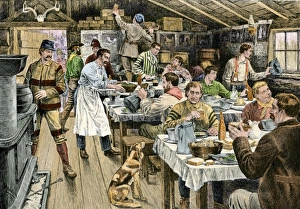
Lumberjacks having dinner, 1800sDinner in a logging camp in the Northwest, 1880s. Hand-colored woodcut of a 19th-century illustration
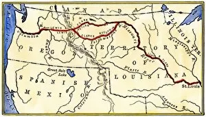
EXPL2A-00035Map of the Lewis and Clark route across Louisiana Territory, 1804-1806. Hand-colored woodcut of a 19th-century illustration
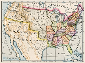
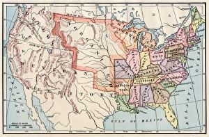
United States in 1825Map of the United States and Unorganized Public Lands in 1825. Printed color lithograph
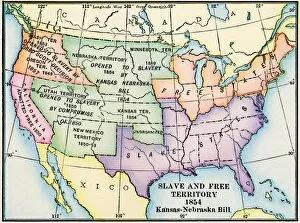
EXPL2A-00312Map of slave and free areas of the United States in 1854, at the time of the Kansas-Nebraska Bill. Printed color lithograph 19th century
Oregon City, terminus of the Oregon Trail, 1850sOregon City on the Willamette River, first capital of Oregon Territory, 1850s. Hand-colored woodcut of a 19th-century illustration
Chinese quarter of Portland, Oregon, 1880sAsian immigrants in Portland, Oregon, near the post office, 1880s. Hand-colored woodcut of a 19th-century illustration
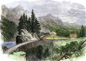
Railroad in Oregons Cascade Mountains, 1860sRailroad trestle in the Cascade Mountains of Oregon, 1866. Hand-colored woodcut of a 19th-century illustration
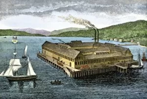
BUSN2A-00182Salmon cannery on the Pacific coast at Astoria, Oregon, 1880s. Hand-colored woodcut of a 19th century illustration
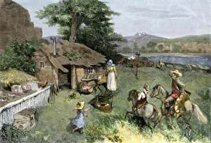
Homesteaders in the Rocky MountainsPioneer familys homestead in the far west. Hand-colored woodcut of a 19th-century illustration
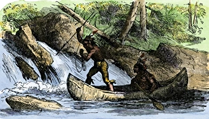
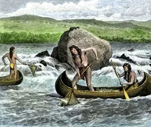
Native Americans spearing fishNative Americans fishing from a canoe. Hand-colored woodcut of a 19th-century illustration
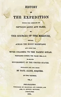
EXPL2A-00351Title page of the first publication of Lewis and Clarks journal and notes, 1814. Woodcut with a watercolor wash
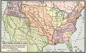
EXPL2A-00039Map of the US in 1792, showing colonial claims on Oregon Territory. Printed color halftone of a 19th century illustration
EXPL2A-00038Map of the U.S. boundary disputes with Spain and Great Britain, 1810-1812. Printed color lithograph of a 19th-century illustration
United States territory in 1830Map of the United States in 1830. Printed color lithograph
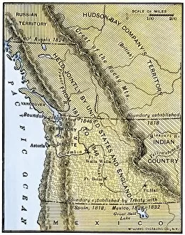
EXPL2A-00210Map of Oregon Territory showing boundary of US with English Canada under dispute until 1846. Hand-colored woodcut of a 19th-century illustration
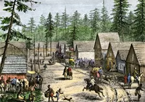
HSET2A-00124New settlers in a frontier town in the Pacific Northwest, 1800s. Hand-colored woodcut of a 19th-century illustration
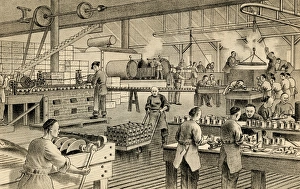
Chinese immigrants working at a salmon cannery in OregonChinese-Americans working at the Kinney Salmon Cannery in Astoria, Oregon, 1880s. Engraving of a 19th-century illustration
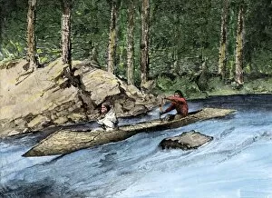
NATI2A-00156Native Americans in a dugout canoe on the Columbia River. Hand-colored woodcut of a 19th-century illustration
NATI2A-00093Native Americans using spears during fish run, Salmon Falls. Hand-colored woodcut of a 19th-century illustration
NATI2A-00083Native Americans catching salmon in the Columbia River. Hand-colored woodcut of a 19th-century illustration
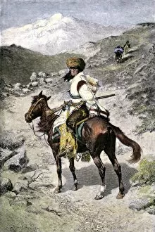
BUSN2A-00021Native American trapper in the Rocky Mountains of the Northwest. Hand-colored 19th-century woodcut of a Frederic Remington Illustration
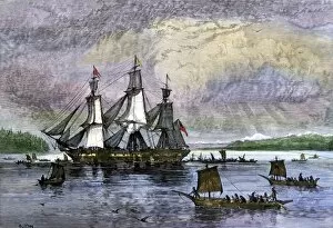
BUSN2A-00223Native Americans paddling canoes to a trading ship on the Pacific Northwest coast. Hand-colored woodcut of a 19th century illustration
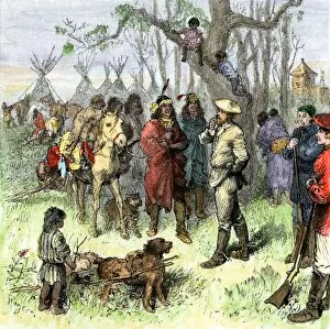
BUSN2A-00038Hudson Bay Company traders discuss the price of a horse with Native Americans Hand-colored woodcut of a 19th-century illustration
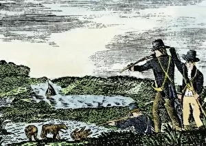
EXPL2A-00092Lewis and Clark shoot a grizzly bear, unknown to whites, during their exploration of Louisiana Territory. Hand-colored woodcut reproduction of sketch by Patrick Goss
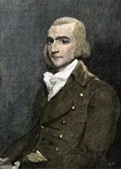
PBUS2A-00002Fur trader John Jacob Astor, founder of Astoria on the Columbia River, 1811. Hand colored woodcut of a painting
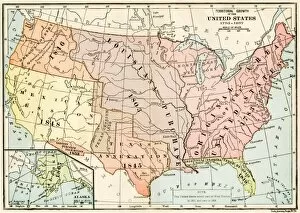
EXPL2A-00041Map of territorial growth of the United States from 1783-1867. Printed color lithograph of a 19th-century illustration
EXPL2A-00062Map of the Louisiana Purchase as understood in 1803, later modified by treaty. Printed color lithograph of a 19th-century illustration
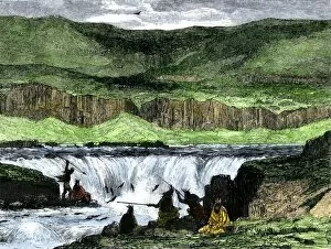
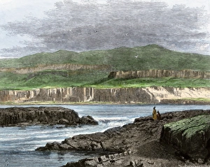
Columbia River Dalles when a wildernessNative Americans overlooking the Dalles of the Columbia River. Hand-colored woodcut of a 19th-century illustration
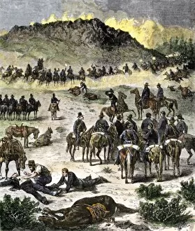
EVNT2A-00076Battle of Birch Creek during the Nez Perce War in eastern Oregon, 1878. Hand-colored woodcut of a 19th century illustration