mail_outline sales@mediastorehouse.com
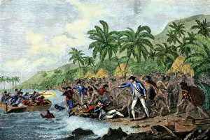
Captain Cook killed by Hawaiian natives, 1779Death of English explorer Captain James Cook in the Sandwich Islands (Hawaii), 1779. Hand-colored woodcut reproduction of a painting
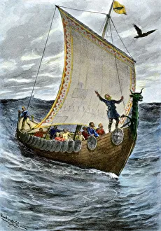
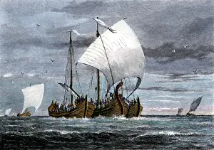
Viking ship at seaNorsemen at sea following their raven pilot. Hand-colored halftone reproduction of a 19th-century illustration
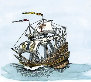
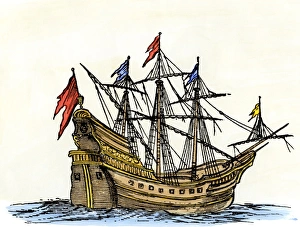
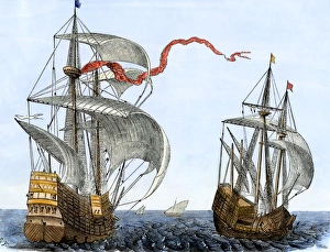
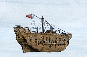
Spanish galleon at seaSpanish galleon, an improved caravel three times longer than wide, used in the 1500s and 1600s. Hand-colored woodcut of a 19th-century illustration
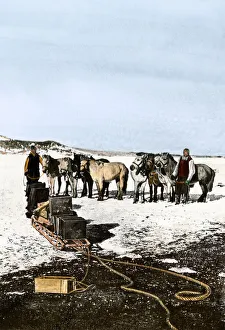
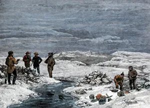
Shackletons Manchurian ponies, Antarctica, 1908Manchurian ponies used by Shackleton in the Antarctic, 1908-09. Hand-colored halftone reproduction of a photograph
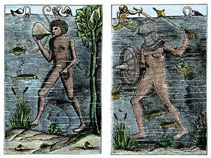
Undersea exploration in 16th-century EuropeUnderwater diver and man-at-arms, France, 1532. Hand-colored woodcut of a 19th century illustration
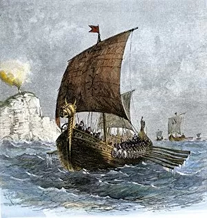
Fleet of Viking raiders in the Middle AgesViking ships at sea with warriors on board. Hand-colored woodcut of a 19th-century illustration
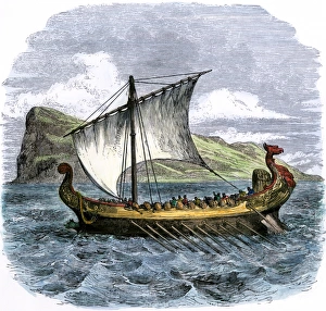
Phoenician ship in the MediterraneanPhoenician galley passing the Rock of Gibraltar. Hand-colored woodcut of a 19th-century illustration
EXPL2A-00238Danish Viking ship " Raven" at sea, showing oars and sails. Hand-colored woodcut of a 19th-century illustration
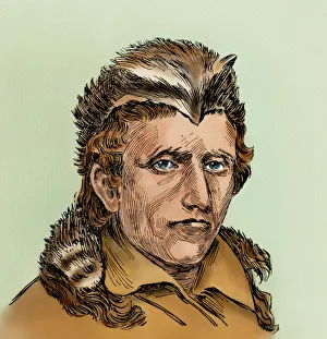
Daniel BoonePortrait of Daniel Boone wearing a coonskin cap. Digitally colored woodcut reproduction of a 19th-century illustration
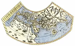
EXPL2A-00014Ptolemys map of the world, illustrating a concept of the flat earth. Hand-colored 19th-century woodcut reproduction
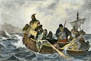
EXPL2A-00034Leif Erikssen off the coast of Vineland in a Viking landing boat. Hand-colored photogravure of a 19th-century illustration
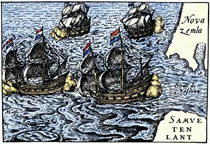
Dutch ships in the Arctic, 1600sDutch ships of Henry Hudsons time near Novaya Zemlya, early 1600s. Hand-colored 19th-century woodcut reproduction of an earlier illustration
Schwatkas discovery of Franklin expedition grave, 1880Grave of Franklin Expedition member Lt. John Irving found by Schwatkas American search party in Greenland, 1880. Hand-colored woodcut of a 19th century illustration
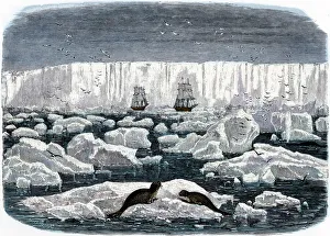
Ships off the Antarctic ice-shelf, 1800sTwo sailing-ships near the ice-shelf of Antarctica, 1800s. Hand-colored woodcut of a 19th-century illustration
EXPL2A-00128Landing of Jean Nicolet on the Wisconsin shore of Lake Michigan, 1634, the first European to reach that region. Hand-colored halftone of a 19th-century illustration
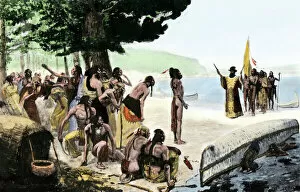
Native Americans meet Lewis and Clark at Council BluffsLewis and Clark meeting with Native Americans at Council Bluffs, Iowa. Hand-colored woodcut by Patrick Goss, a member of the expedition
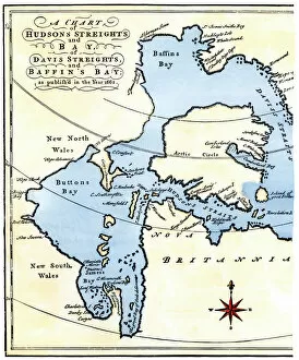
EXPL2A-00284Early map of Hudsons Strait and Hudsons Bay, 1662, in Arctic Canada. Hand-colored 19th-century woodcut reproduction
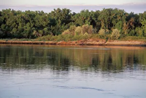
Missouri River near Mandan, North DakotaMissouri River between Pierre and Mandan, North Dakota, explored by Lewis and Clark. Photograph
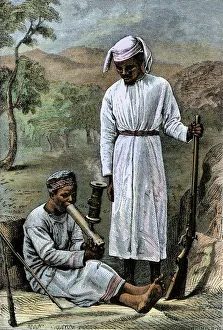
Dr Livingstones African servants, 1800sChuma and Susi, David Livingstones loyal African servants, 1870s. Hand-colored woodcut of a 19th-century illustration
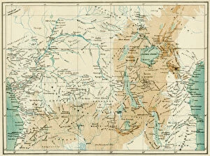
EXPL2A-00366Map of equatorial Africa as known in the 1870s. Printed color lithograph, 19th century
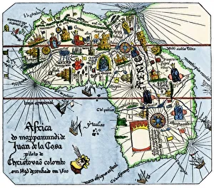
Vasco da Gamas route around Africa, 1400sAfrica as known after Vasco da Gamas discoveries, from map of Juan de la Cosa, 1500. Hand-colored woodcut reproduction
EXPL2A-00169John C. Fremonts second western expedition at Pyramid Lake, Nevada, 1842-1843. Hand-colored woodcut of a 19th-century illustration
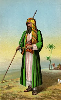
Sir Richard Burton en route to Mecca, 1850sBritish explorer Richard Burton disguised as a Muslim pilgrim in Arabia. Color lithograph reproduction of a 19th-century illustration
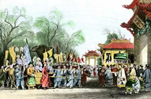
EXPL2A-00146Marco Polo welcomed at the court of Kublai Khan in China, 1200s. Hand-colored halftone of a 19th-century illustration
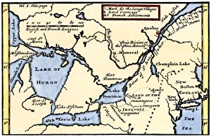
EXPL2A-00184Part of the 1613 Samuel de Champlain map of New France. Hand-colored woodcut of a 19th-century reproduction of the original ma
Florida explored by De Soto, 1539Bivouac of De Sotos expedition in the Florida wilderness, 1539. Hand-colored woodcut of a 19th-century illustration
Ship in the 1600sSailing-ship of the seventeenth century. Hand-colored 19th-century woodcut reproduction of an earlier illustration
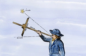
Use of a quadrant for navigationSailor sighting on a star with a quadrant for navigation. Hand-colored woodcut of a 19th-century illustration
Dutch galleons, 1600sDutch traders galleons at sea in the 1600s. Hand colored 19th-century woodcut reproduction of an earlier illustration
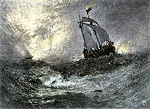
Sailing-ships at seaSailing ships on the high seas. Hand-colored woodcut of a 19th-century illustration
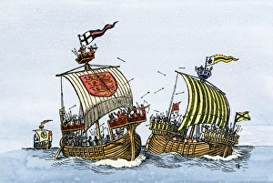
Sea battle in the Middle AgesShips of the thirteenth century, with forecastles, sterncastles, and fighting-tops. Hand-colored woodcut of a 19th-century illustration
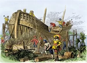
French colonists building a ship, South Carolina, 1560sShipbuilding at Archers Creek, South Carolina, by French colonists left behind by Ribault, 1562. Hand-colored woodcut of a 19th-century illustration
Ship of explorer James Cook, 1700sCaptain James Cooks ship " Discovery." Hand-colored woodcut from a drawing by E. W. Cook, R.A
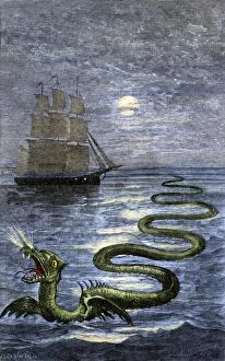
PMYT2A-00003Sea serpent of Hans Egidius. Hand colored woodcut of a 19th-century illustration
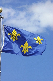
Flag of France, 1700sFrench flag marking La Verendrye expeditions claim of the northern Great Plains for France in 1743, Pierre, South Dakota. Digital photograph
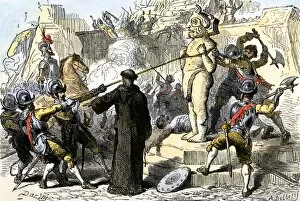
EXPL2A-00112Spanish priests destroying Aztec idols in Mexico. Hand-colored woodcut of a 19th-century illustration
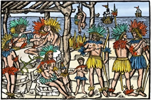
Brazilian cannibalism, 1500sNatives eating and cooking human flesh, northern Brazil, circa 1500. Hand-colored woodcut reproduction of a 16th-century illustration
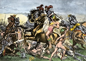
Incas battling Spanish conquistadors in PeruManco Inca Yupanqui leads attack on the Spanish in Cusco, Peru, 1536. Hand-colored halftone reproduction of a 19th-century illustration
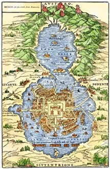
EXPL2A-00294Tenochtitlan, capital city of Aztec Mexico, an Island connected by causeways to land, 1520s. Hand-colored 19th-century woodcut reproduction of an early Spanish colonial map
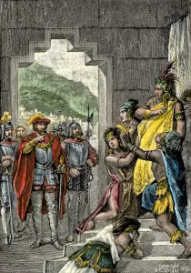
Inca leader Atahualpa sentenced to execution, 1533Spanish conqueror Pizarro orders the Inca ruler Atahualpa to be led instantly to execution in Peru, 1533. Hand-colored woodcut of a 19th-century illustration
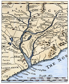
Rio de la Plata, 1698Mouth of the Rio de la Plata in South America, in a map of 1698. Hand-colored woodcut of a 19th-century illustration
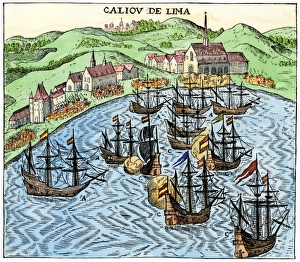
Callao, Peru, under Spanish rule, 1620Spanish colonial port of Callao, Peru, circa 1620. Hand-colored woodcut reproduction of a 17th-century illustration
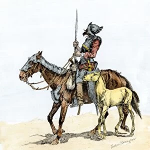
EXPL2A-00173Spanish conquistador on a horse with foal - the origin of the horse in colonial America. Hand-colored woodcut of a 19th-century Frederic Remington illustration
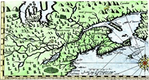
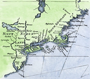
Dutch map of New Netherland and New EnglandNew Netherland and New England, circa 1630. Hand-colored 19th-century woodcut reproduction of DeLaets map
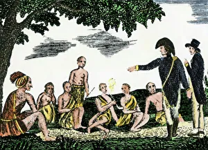
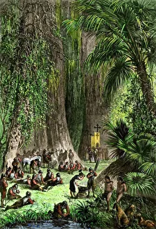
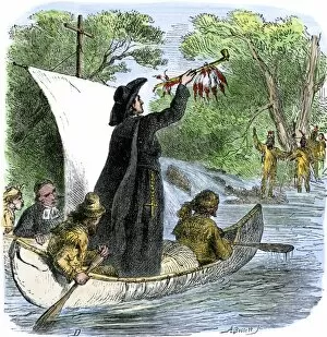
EXPL2A-00194Father Jacques Marquette holding a peace pipe to greet Native Americans during his journey to the upper Mississippi River, 1673. Hand-colored woodcut of a 19th-century illustration
DeSoto expedition retreating down the Mississippi, 1542Spaniards descending Mississippi River after De Sotos death, 1542. Hand-colored woodcut of a 19th-century illustration
French map of the Great Lakes, 1703La Hontans map of the Great Lakes and Saint Lawrence valley, 1703. Hand-colored 19th-century woodcut reproduction of an 18th century illustration
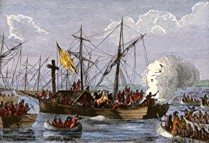
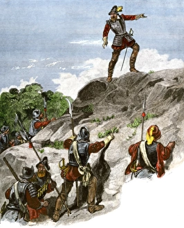
Balboa discovering the Pacific, 1513Spanish expedition under Balboa discovering the Pacific Ocean, 1513. Hand-colored woodcut of a 19th-century illustration