mail_outline sales@mediastorehouse.com
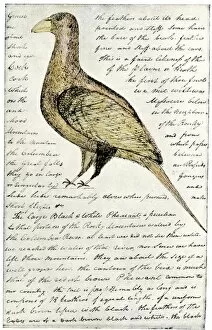
EXPL2A-00117Sketch by William Clark of Cock of the Plains in the Lewis and Clark expedition diary. Hand-colored halftone of a 19th-century reproduction of the diary
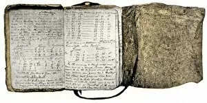
EXPL2A-00116Diary kept by William Clark of the Lewis and Clark expedition 1804 - 1806. Hand-colored halftone of a 19th-century reproduction of the diary
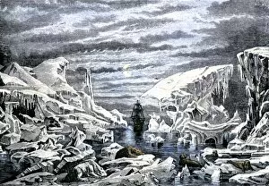
EXPL2A-00106Arctic icebergs surrounding a sailing ship. Hand-colored woodcut of a 19th-century illustration
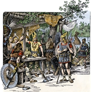
Vikings in the New WorldNorsemen celebrating their discovery of the New World. Hand-colored woodcut of a 19th-century illustration
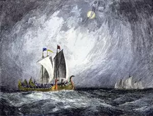
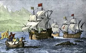
EXPL2A-00103Fleet of Viking ships at sea. Hand colored woodcut of a 19th-century illustration
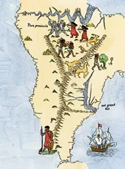
EXPL2A-00026Map of South America, from Sebastian Cabots map of the world, 1544. Hand colored 19th-century woodcut reproduction of the original map
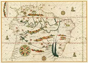
EXPL2A-00021Map of South America from the Spanish atlas executed at Messina in 1582 by Joan Martines. Printed color lithograph reproduction 19th century
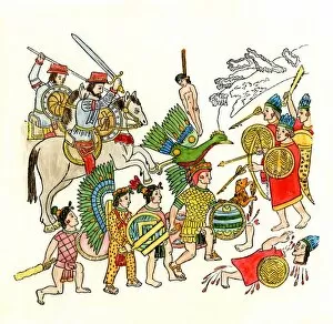
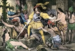
EXPL2A-00019Battles of the Spanish conquistadors in Mexico, 1500s. Hand-colored woodcut from an Aztec drawing
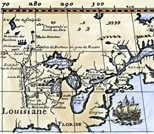
EXPL2A-00016Hennepins map of New France and Louisiana - La Carte de la Nouvelle France, 1683. Hand-colored 19th-century woodcut reproduction of the original map
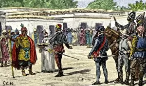
EXPL2A-00015Meeting between Spanish conqueror Pizarro and Inca leader Atahualpa. Hand-colored woodcut of a 19th-century illustration
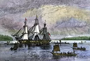
EXPL2A-00010Columbus expedition coasting along the northern shore of Cuba. Hand-colored woodcut of a 19th-century illustration
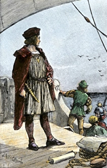
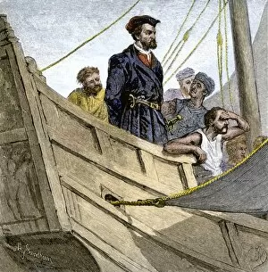
EXPL3A-00008Columbus watching for land from the deck of the caravel Santa Maria, 1492. Hand-colored woodcut of a 19th-century illustration
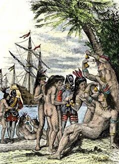
EXPL2A-00005Columbus giving hawks bells to natives after landing in the Caribbean, 1492. Hand-colored woodcut of a 19th-century illustration
EXPL2A-00003Cuban native chief addresses Christopher Columbus on the immortality of the soul. Hand-colored woodcut of a 19th-century illustration
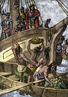
EXPL2A-00002Caribbean natives bring provisions to the shipwrecked crew of Columbus, 1492. Hand-colored woodcut of a 19th-century illustration
BUSN2A-00223Native Americans paddling canoes to a trading ship on the Pacific Northwest coast. Hand-colored woodcut of a 19th century illustration
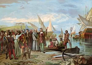
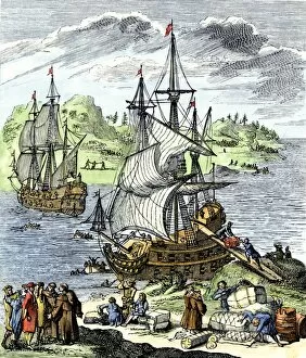
EXPL2A-00067Departure of Columbuss first expedition from Palos, Spain, 1492. Printed color lithograph of a painting by Ricardo Balaca
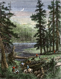
Wheelers expedition in the southern Rockies, 1870sGeorge M. Wheelers expedition exploring the Sangre de Cristo range in Colorado and New Mexico, 1870s. Hand-colored woodcut of a 19th-century illustration
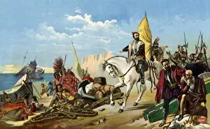
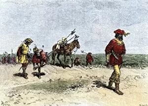
EXPL2A-00031Francisco Pizarro expedition ascending the Andes to conquer the Inca empire in Peru. Printed color lithograph of a 19th-century illustration
EXPL2A-00077Cortes scuttling his ships to cut off any chance of his mens retreat after landing in Mexico, 1518. Printed color lithograph of a 19th-century illustration
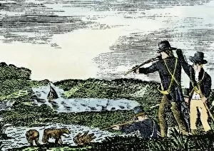
EXPL2A-00092Lewis and Clark shoot a grizzly bear, unknown to whites, during their exploration of Louisiana Territory. Hand-colored woodcut reproduction of sketch by Patrick Goss
EXPL2A-00093Cortes orders an end to the Aztec practice of human sacrifice after the Spanish conquest of Mexico City. Hand-colored halftone of a 19th-century illustration
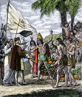
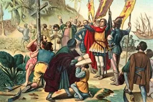
EXPL2A-00056Christopher Columbus taking possession of the New World for Spain, 1492 Printed color lithograph of a 19th-century illustration
EXPL2A-00054Henry Hudsons ship " Half Moon" meets Native Americans in the Hudson River highlands, 1609. Hand-colored engraving of a 19th-century illustration
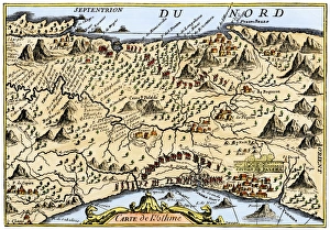
Isthmus of Panama, 1744Map from Oexmelins Histoire of the Isthmus of Panama, 1744. Hand-colored woodcut
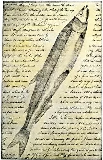
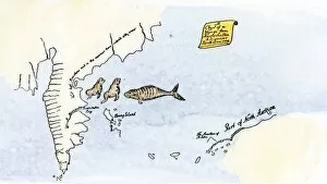
EXPL2A-00166William Clarks sketch of a trout in the Lewis and Clark expedition diary. Hand-colored halftone reproduction of a 19th-century photograph of Clarks handwritten page
EXPL2A-00163Alvar Nunez Cabeza de Vaca crossing the Great American Desert from Texas to Mexico, early 1500s. Hand-colored woodcut of a 19th-century illustration
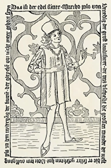
Marco Polos Voyages published in 1477Title page of Marco Polos " Voyages" published in Nuremberg in 1477. Woodcut with a watercolor wash
EXPL2A-00150Chart of Vitus Berings voyage from Kamchatka, Russia, to North America, 1700s. Hand-colored 19th-century woodcut reproduction
EXPL2A-00143La Salle landing in Matagorda Bay Texas to colonize Louisiana Terrritory and the Mississippi valley area, 1685. Hand-colored 19th-century woodcut reproduction of an earlier illustration
EXPL2A-00129Secret burial of Hernando de Soto at night in the Mississippi River, 1542. Hand-colored woodcut of a 19th-century illustration
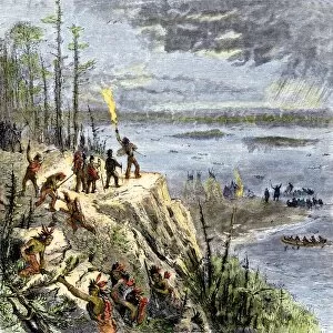
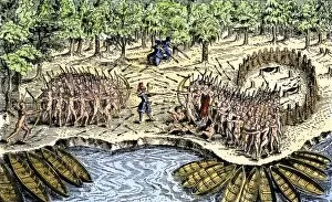
EXPL2A-00109Samuel de Champlain and his Huron allies going to fight the Iroquois, Lake Champlain, 1600s. Hand-colored woodcut of a 19th-century illustration
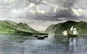
EXPL2A-00110Samuel de Champlains defeat of the Iroquois at Lake Champlain, opening the settlement of New France, 1600s. Hand-colored woodcut
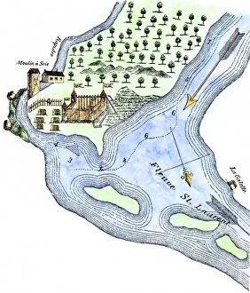
EXPL2A-00183Samuel de Champlains fortified camp at Quebec on the St Lawrence River, 1600s Hand-colored 19th-century woodcut of a 17th-century map
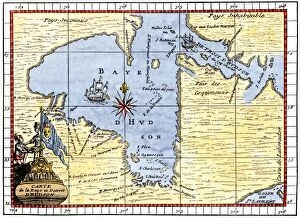
EXPL2A-00190Map of Hudsons Bay, Canada, showing Hudsons Strait, 1722. Hand-colored 19th-century woodcut reproduction of an 18th-century map
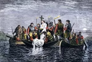
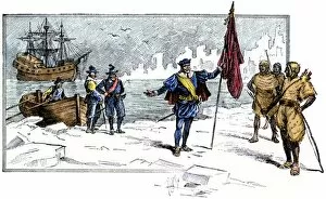
EXPL2A-00232Jacques Cartier aboard ship arriving on the shore of Canada, 1534. Hand-colored woodcut of a 19th-century illustration
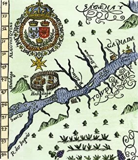
EXPL2A-00246Hochelaga, site of Montreal, shown as a Native American village in Lescarbots map, 1609. Hand-colored 19th-century woodcut reproduction of a 17th-century document
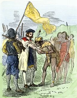
EXPL2A-00247Jacques Cartier embraced by Donnacona, a native Canadian Huron chief, Gaspee Peninsula, 1535. Hand-colored woodcut of a 19th-century illustration
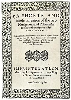
EXPL2A-00251Title page of the London edition of Jacques Cartiers book about his discoveries in Canada, printed in 1580. Watercolor wash over a 19th-century printed halftone reproduction
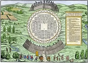
EXPL2A-00249French colonists building fort at Hochelaga, a native village and the site of Montreal, Canada, 1600s. Hand-colored halftone reproduction of a 17th-century illustration
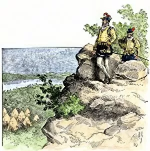
EXPL2A-00087Jacques Cartier on the summit of Mont Real, now Montreal, Canada, 1535. Hand-colored woodcut of a 19th-century illustration
EXPL2A-00085English Explorer John Cabot landing on the shore of Canada, 1484. Hand-colored woodcut of a 19th-century illustration
EXPL2A-00058Samuel de Champlains map of the Gaspee and Gulf of the Saint Lawrence River, 1632. Hand-colored woodcut reproduction of the original map
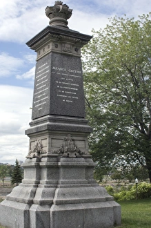
Cartier monument on the St Lawrence, QuebecMonument marking Jacques Cartiers landing place on the St Lawrence River in Quebec. Digital photograph
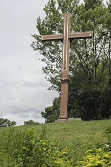
Cartiers landing place on the St Lawrence, QuebecReplica cross marking Jacques Cartiers landing place on the St Lawrence River in Quebec. Digital photograph
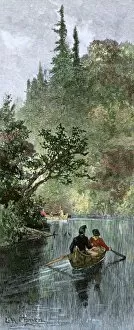
BUSN2A-00204French traders canoeing on a river in the forests of North America. Hand-colored woodcut of a 19th century illustration
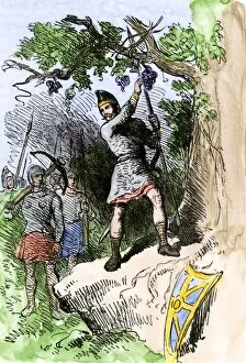
EXPL2A-00306Discovery of grapes by Leif Erikssons expedition, 1001 AD, leading to naming the new land Vinland. Hand-colored woodcut of a 19th-century illustration
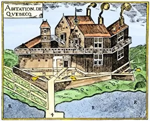
EXPL2A-00295Champlains Quebec fort, 1613, showing the dwellings (C, D), drawbridge (I), Moat (M), cannon (N), garden (O). Hand-colored 19th-century woodcut reproduction of Champlains drawing