mail_outline sales@mediastorehouse.com
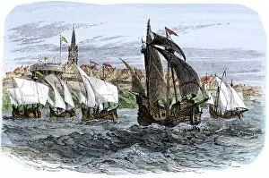
EXPL2A-00233Cartiers ships leaving St. Malo, France, to sail for North America, 1530s. Hand-colored woodcut of a 19th-century illustration
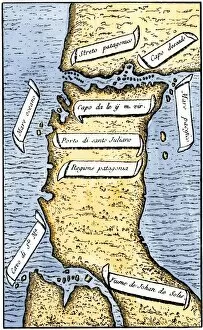
EXPL2A-00239First map of the Strait of Magellan from Magellans circumnavigation of the earth in 1519 showing north at the bottom. Hand-colored 19th-century woodcut reproduction of Pigafettas 16th century map
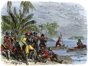
Balboa expeditions canoes on the Pacific, 1513Balboas first embarkation on the Pacific Ocean (South Sea), 1513. Hand-colored woodcut of a 19th-century illustration
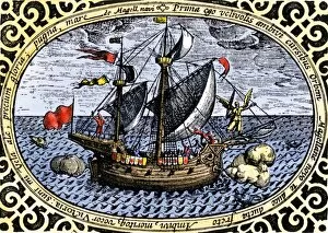
EXPL2A-00240Ship " Victoria, " one of Magellans fleet which circumnavigated the earth, 1519-1520. Hand-colored 19th-century woodcut reproduction of an earlier illustration
Portuguese traders in India and Ceylon, 1500Calcutta and the southern coast of India, from Juan de la Cosas map, 1500. Hand-colored woodcut reproduction of a 16th-century illustration
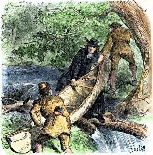
EXPL2A-00256French missionary and fur traders carrying a canoe at a portage in North America. Hand-colored woodcut of a 19th-century illustration
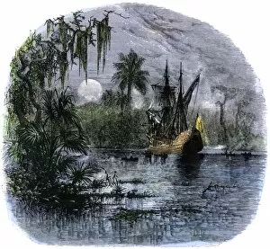
EXPL2A-00262Early explorers coming ashore along a tropical coast in the New World. Hand-colored woodcut of a 19th-century illustration
EXPL2A-00266Jacques Marquette and Louis Joliet in a canoe on the upper Mississippi River, 1673. Hand-colored halftone of a 19th-century illustration
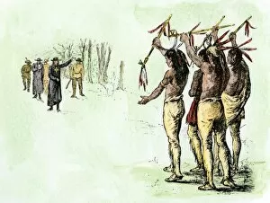
EXPL2A-00264De Soto greeted by native Cofitachequi queen in Carolina, circa 1540. Hand-colored woodcut of a 19th-century illustration
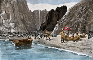
Borchgrevink marking the Antarctic mainland for Norway, 1894Borchgrevinks expedition planting the Norwegian flag amidst penguins on the Antarctic mainland, 1894. Hand-colored halftone reproduction of a 19th-century illustration
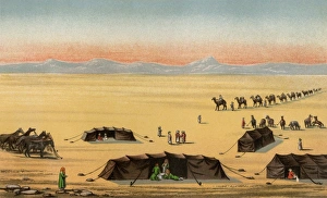
Sir Richard Burtons journey to Mecca, 1850sExplorer Richard Burtons desert camp in Arabia during his journey to Mecca, 1850s. Color lithograph
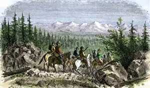
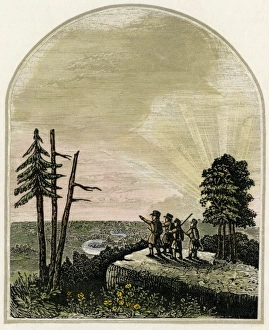
EXPL2A-00299Group of pioneer horsemen getting their first glimpse of the Sierra Nevada range 1800s. Hand colored woodcut of a 19th-century illustration
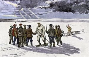
EXPL2A-00308Arctic explorer Robert Peary meeting the Relief Expedition on the Greenland Ice-cap, August 5, 1892. Hand-colored woodcut of a 19th-century illustration
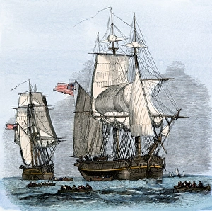
The search for Sir John Franklins Arctic expedition, 1850s" Resolute" and four other ships leaving England to search for Franklins lost Arctic expedition, 1852. Hand-colored woodcut of a 19th-century illustration
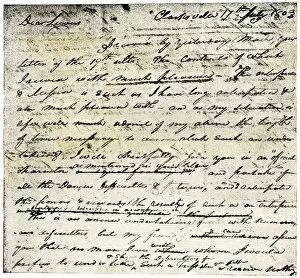
EXPL2A-00339William Clarks letter accepting Lewiss invitation to join the Corps of Discovery expedition, dated Clarksville 1803. Printed halftone reproduction with a watercolor wash
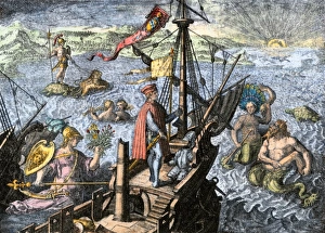
Sailing unknown seas in the Age of DiscoveryNavigating the Sea of Darkness. Hand-colored woodcut reproduction
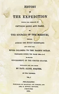
EXPL2A-00351Title page of the first publication of Lewis and Clarks journal and notes, 1814. Woodcut with a watercolor wash
EXPL2A-00369Burial of Hernando DeSoto in the Mississippi River to keep his death secret from hostile Native Americans, 1542. Hand-colored woodcut of a 19th-century illustration
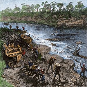
Portage around whitewater on a frontier riverExpedition pulling boats overland on a portage around rapids on a river. Hand-colored woodcut of a 19th-century illustration
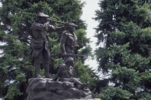
Lewis and Clark monument at Fort Benton, MontanaStatue of Sacagawea guiding Lewis and Clark at Fort Benton, Montana. Photograph
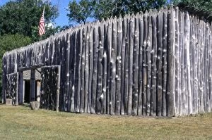
EXPL2P-00031Fort Mandan, a reconstructed Lewis and Clark campsite on the Missouri River, North Dakota. Photograph
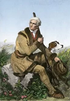
PEXP2A-00014Daniel Boone, pioneer of Kentucky, with his rifle and dog. Hand-colored engraving of a painting
Kentucky viewed by Daniel BooneDaniel Boones first view of Kentucky. Digitally colored etching of a 19th-century illustration
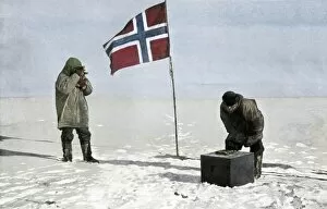
PEXP2A-00120Roald Amundsen, first to reach the South Pole, fixing position at the pole, 1911. Hand-colored halftone reproduction of a photograph
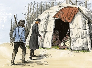
Father Hennepin in Minnesota, 1680Father Louis Hennepin at a Native American bark-covered dwelling in Minnesota, 1680. Hand-colored woodcut of a 19th-century illustration
Verrazano in Narragansett Bay, 1520sGiovanni da Verrazano landing in Newport harbor, 1500s. Hand-colored woodcut of a 19th-century illustration
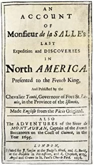
PEXP2A-00051Title page of Henri de Tontis account of the La Salle expedition. Woodcut with a watercolor wash of the English edition, printed in London 1698
EXPL2A-00127Father Marquette and Louis Joliet, the first white men on the upper Mississippi River, 1673. Hand-colored woodcut of a 19th-century illustration
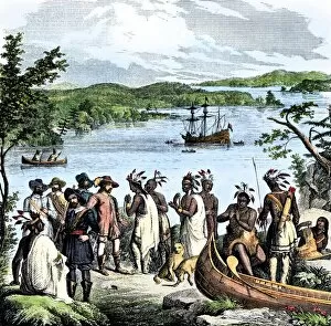
EXPL2A-00115Henry Hudson meeting with Native Americans along the Hudson River, 1609. Hand-colored woodcut of a 19th-century illustration
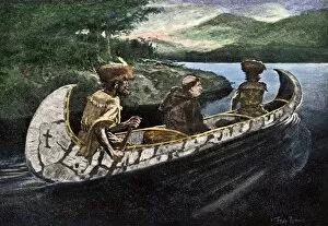
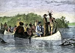
EXPL2A-00113Marquette and Joliet meeting Native Americans in Illinois during their exploration of the upper Mississippi River region, 1670s. Hand-colored woodcut of a 19th-century illustration
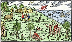
Early depiction of Brazil in the Age of DiscoveryBrazil coast, natives, and New World flora and fauna as known in 1586. Hand-colored woodcut from De Lery
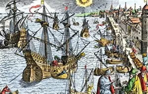
EXPL2A-00107Ships in busy Lisbon harbor, circa 1600. Hand-colored woodcut of a 19th-century reproduction of the original illustration from DeBry
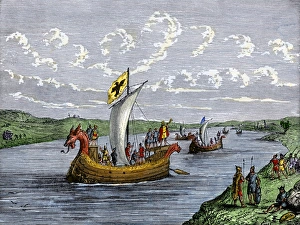
Viking explorers on the North American coastViking settlers exploring the North American coast. Hand-colored woodcut of a 19th-century illustration
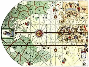
EXPL2A-00024Map of the Atlantic with the New World coast, drawn in 1500 by Juan de la Cosa, Columbus pilot. Hand colored 19th-century woodcut reproduction of the original chart
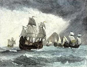
EXPL2A-00020Ships of Ferdinand Magellan rounding Tierra del Fuego to circumnavigate the earth 1519 to 1521. Hand-colored woodcut of a 19th-century illustration
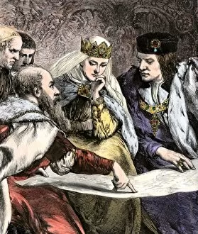
EXPL2A-00018Columbus showing a map to Ferdinand and Isabella of Spain. Hand-colored woodcut of a 19th-century illustration
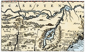
Dutch map of eastern North America, 1670Nova Belgh Tabula, map of New Netherland and New England, 1670. Hand-colored woodcut reproduction
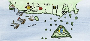
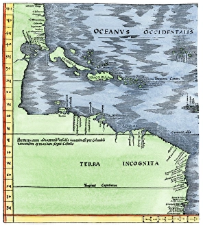
Early map of the New World, 1513Tabula Terre Nove 1513: the Admirals Map of the Caribbean and Terra Incognita (unknown lands). Hand-colored woodcut reproduction
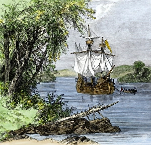
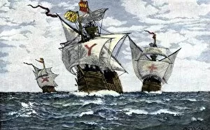
EXPL2A-00009Three ships of Columbus approaching the New World, 1492. Hand-colored woodcut of a 19th-century illustration
Columbus first sighting the New WorldColumbus getting his first sight of the New World from the deck of the Santa Maria, 1492. Hand-colored woodcut of a 19th-century illustration
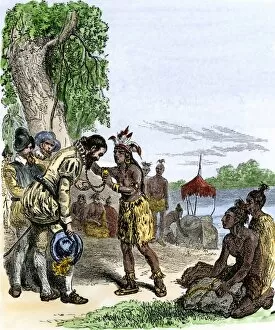
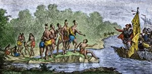
EXPL2A-00006Columbuss hospitable reception by Guacanagari, Caribbean chief, after shipwreck of Santa Maria, 1492. Hand-colored woodcut of a 19th-century illustration
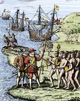
EXPL2A-00004Expedition of Christopher Columbus landing at Hispaniola, 1492. Hand-colored woodcut of a 19th-century illustration
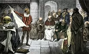
EXPL2A-00001Christopher Columbus promoting his ideas before the Council at Salamanca. Hand-colored woodcut of a 19th-century illustration
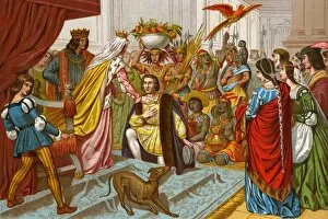
EXPL2A-00057Columbus bringing gifts from the New World to Queen Isabella of Spain 1492. Printed color lithograph of a 19th-century illustration
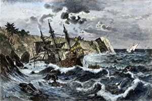
EXPL2A-00036Wreck of Columbuss flagship Santa Maria on the coast of Hispaniola, 1492. Hand-colored woodcut of a 19th-century illustration
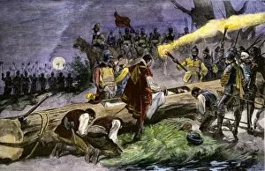
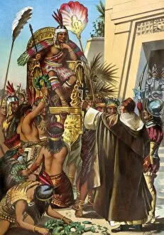
EXPL2A-00030Missionary Father Valverde addresses the Inca king Atahualpa during the Spanish conquest of Peru, 1532. Printed color lithograph of a 19th-century illustration
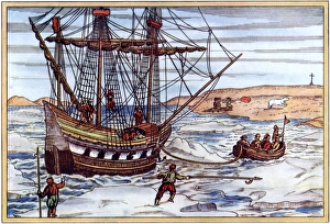
Arctic voyage of Willem Barents, 1500sWillem Barents ship in the Artic ice, 1590s. Printed color woodcut by Gerard de Veer, 1598
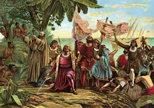
EXPL2A-00066Landing of Columbus expedition on the island of Guanahane in 1492. Printed color lithograph of a 19th-century painting by Dioscoro Puebla