mail_outline sales@mediastorehouse.com
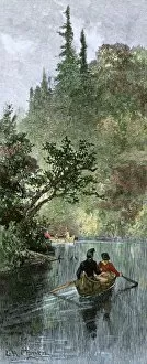
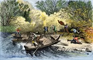
BUSN2A-00204French traders canoeing on a river in the forests of North America. Hand-colored woodcut of a 19th century illustration
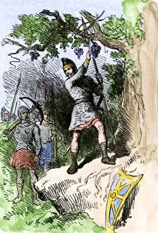
EXPL2A-00306Discovery of grapes by Leif Erikssons expedition, 1001 AD, leading to naming the new land Vinland. Hand-colored woodcut of a 19th-century illustration
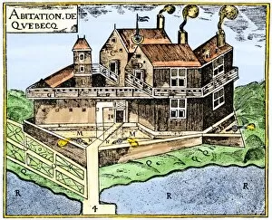
EXPL2A-00295Champlains Quebec fort, 1613, showing the dwellings (C, D), drawbridge (I), Moat (M), cannon (N), garden (O). Hand-colored 19th-century woodcut reproduction of Champlains drawing
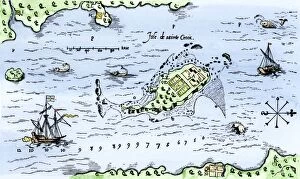
EXPL2A-00296Map of Champlains settlement on the Isle de Sainte Croix, Canada, 1613. Hand-colored 19th-century woodcut reproduction of the original map
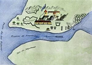
EXPL2A-00267Fort Frontenac on Lake Ontario, 1600s, at the head of the St Lawrence River, now Kingston, Ontario. Hand-colored 19th century halftone reproduction of the original map
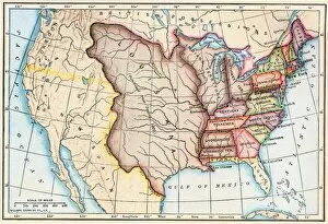
EXPL2A-00062Map of the Louisiana Purchase as understood in 1803, later modified by treaty. Printed color lithograph of a 19th-century illustration
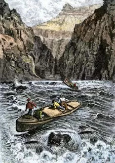
EXPL2A-00144John Wesley Powells Grand Canyon expedition running rapids on the Colorado River, 1870s. Hand colored woodcut from Powells published account 1870s
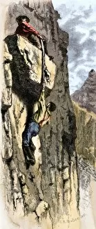
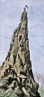
EXPL2A-00145Rescue of John Wesley Powells Colorado River expedition by climbing out of the Grand Canyon, 1870s. Hand colored woodcut from Powells published account, 1870s
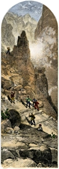
Powells expedition surveying the Grand Canyon, 1870sJohn Wesley Powells Colorado River expedition climbing out of the Grand Canyon, Arizona, circa 1870. Hand-colored woodcut of a 19th-century illustration
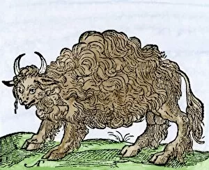
EXPL2A-00244Possibly the earliest engraving of an American buffalo, 1558 - first mentioned by Cabeza de Vaca. Hand-colored 19th-century woodcut reproduction of the original 16th-century engraving
EXPL2A-00300Fire destroying the camp of John Wesley Powell during his exploration of the Grand Canyon 1870s. Hand colored woodcut of an illustration from publication of the Powell expedition report
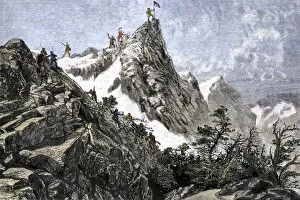
EXPL2A-00348Fremont expedition raising the American flag on the Rockies, 1842. Hand-colored woodcut of a 19th-century illustration
EXPL2A-00349John C. Freemont planting the US flag on the Colorado Rockies, 1842. Hand-colored woodcut of a 19th-century illustration
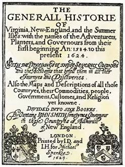
EXPL2A-00290Title page of John Smiths " General Historie of Virginia, New England, and the Summer Isles..." printed in 1624. Woodcut with a watercolor wash
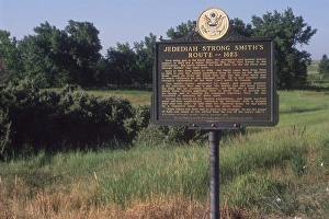
Jedediah Smith route marker in the Black HillsJedediah Smiths route in 1823 through Buffalo Gap in the Black Hills, South Dakota. Photograph
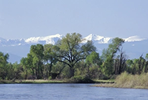
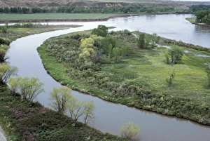
Madison River near its junction to form the Missouri River, MontanaMadison River approaching the Missouri River headwaters at Three Forks, Tobacco Root Mountains in the distance. Digital photograph
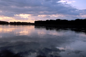
Coalbanks Landing on the Missouri River, MontanaDawn over the Missouri River at Coalbanks Landing, a Lewis and Clark campsite in Montana. Photograph
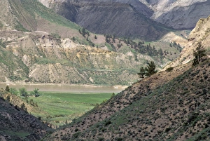
White Cliffs area of the Missouri River, MontanaMissouri River in the White Cliffs backcountry, described by Lewis and Clark, now a wild and scenic river area. Photograph
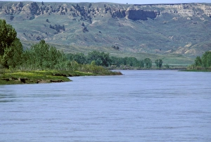
Judith Landing on the Missouri River, MontanaMissouri River at Judith Landing, a Lewis and Clark campsite in Montana. Photograph
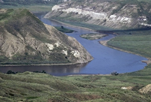
Marias River joining the Missouri River, MontanaMarias River junction with the Missouri River, a Lewis and Clark campsite in Montana. Photograph
Missouri River in the Missouri Breaks area, MontanaMissouri Breaks backcountry of the Missouri River, first described by Lewis and Clark, Montana. Photograph
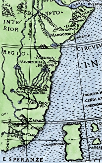
Cape of Good Hope mapped at its correct latitude, 1508First map showing Africas southern point at the correct latitude, from Ruysch 1508. Hand-colored woodcut reproduction of a 16th-century illustration
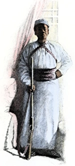
Stanleys African servant, 1880sSali, African servant of explorer Henry Stanley throughout the 1887-1889 expedition and in Cairo. Hand-colored halftone reproduction of a 19th-century illustration