mail_outline sales@mediastorehouse.com
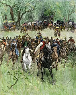
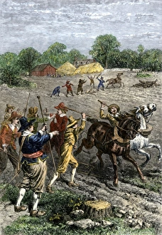
Oklahoma Territory opened to settlers, 1891Homesteaders charge at the start signal, western Oklahoma Land Rush, 1891. Hand-colored woodcut of a 19th-century illustration
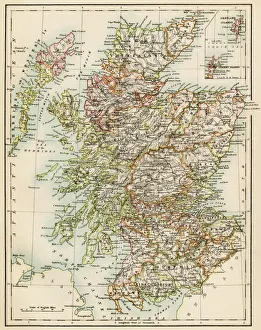
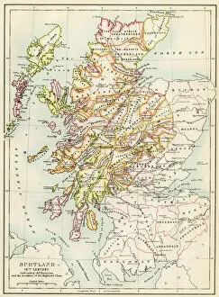
Scotland map, 1870sMap of Scotland, 1870s. Printed color lithograph
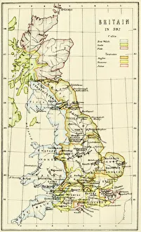
Map of Britain in 597 ADMap of territory controlled by Celts, Picts, Anglos, Saxons, and other tribes in Britain in 597 AD. Printed color lithograph of a 19th-century illustration
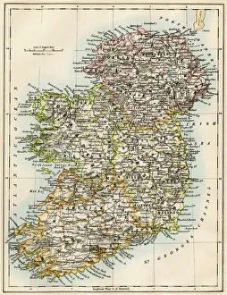
Ireland map, 1870sMap of Ireland, or Eire, 1870s. Printed color lithograph
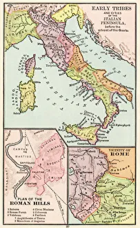
Maps of Italy in ancient timesMap of early tribes in Italy (top). of the Roman hills (lower left). and the vicinity of Rome (right) in the time of the Roman Empire. Printed color lithograph of a 19th-century illustration
GGBR2A-00076Map of Scotland in the 1520s, showing territories of the Highland Clans. Printed color lithograph of a 19th century illustration
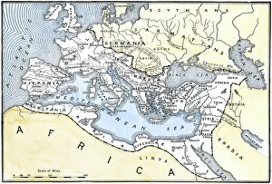
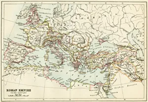
Map of the Roman EmpireMap showing the extent of the Roman Empire. Hand-colored woodcut of a 19th-century illustration
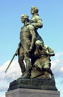
PEXP2D-00013Explorers Meriwether Lewis and William Clark with their Native American guide Sacagawea. Digital photograph of a bronze statue in Charlottesville Virginia
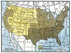
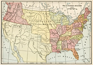
United States in 1860United States and territories at the beginning of the Civil War. Printed lithograph map
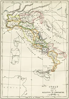
Regions of Italy in the Roman EmpireMap of Italy, during the time of Caesar Augustus to Emperor Constantine. Color lithograph of a 19th-century illustration
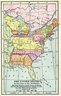
EXPL2A-00164Map of the United States at the close of the American Revolution, 1783. Printed color lithograph of a 19th-century illustration
EVCW2A-00100US map showing seceding states by date, American Civil War, 1860 and 1861. Printed color lithograph 19th century
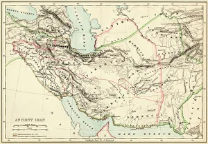
Extent of the Persian empireMap of the ancient Persian empire. Printed color lithograph of a 19th-century illustration
Roman Empire, circa 200 ADMap of the Roman Empire in the third century. Printed color lithograph of a 19th-century illustration
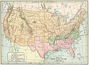
United States during the Civil WarMap of the United States 1861 to 1865. Printed color lithograph of a 19th-century illustration
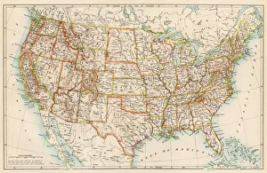
United States in the 1870sUnited States map, 1870s. Color lithograph
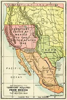
U. S. territory gained from MexicoMap of territory acquired by the U.S. from Mexico. Color lithograph of a 19th-century illustration
GMDE2A-00054Map of Arabia, 1870s. Printed color lithograph, 19th century
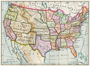
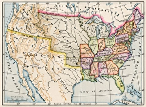
Growth of the United States to 1853U.S. map, showing territorial growth to 1853. Printed color lithograph of a 19th-century illustration
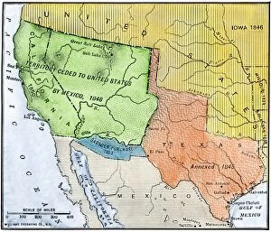
EXPL2A-00265Map of the territory ceded by Mexico to the US after the Mexican-American War, 1848-1853. Hand-colored woodcut of a 19th-century illustration
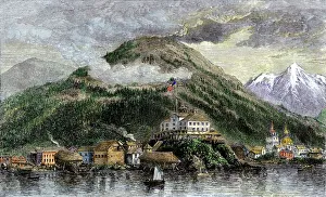
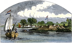
New Archangel, Russian town in Alaska, now called SitkaSitka, or New Archangel, capital of Alaska in 1869, when purchased from Russia. Hand-colored woodcut of a 19th-century illustration
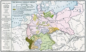
Germany before World War IMap of the German Empire before World War I, circa 1912. Printed color lithograph
EXPL2A-00128Landing of Jean Nicolet on the Wisconsin shore of Lake Michigan, 1634, the first European to reach that region. Hand-colored halftone of a 19th-century illustration
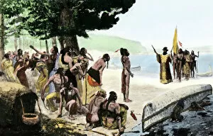
Native Americans meet Lewis and Clark at Council BluffsLewis and Clark meeting with Native Americans at Council Bluffs, Iowa. Hand-colored woodcut by Patrick Goss, a member of the expedition
Civil War territory map, 1861Map showing Confederate-held territory at the end of 1861. Hand-colored woodcut of a 19th-century illustration
EVNT2A-00048British capturing Quebec in the Battle of the Plains of Abraham, French and Indian War, 1759. Hand-colored woodcut
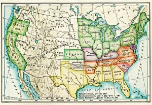
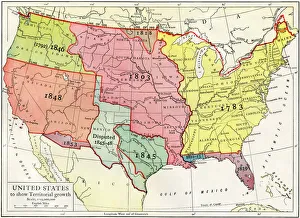
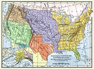
US territorial acquisition during the 1800sMap showiing the territorial growth of the continental US 1776 to 1899. Hand-colored woodcut of a 19th-century illustration
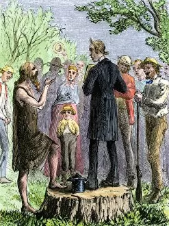
PEXP2A-00057Johnny Appleseed addressing a preacher among settlers of Ohio Territory. Hand-colored woodcut of a 19th-century illustration
United States map in 1830Territories of the United States in 1830. Printed color lithograph
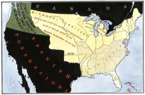
US after the Missouri Compromise, 1820Slave and free territories in the United States after the Missouri Compromise Act, 1820. Hand-colored woodcut of a 19th-century illustration
Flag of France, 1700sFrench flag marking La Verendrye expeditions claim of the northern Great Plains for France in 1743, Pierre, South Dakota. Digital photograph
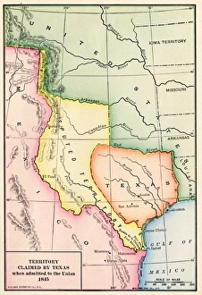
Territory claimed by Texas, 1845Map of the territory claimed by Texas when admitted to the U.S. in 1845. Printed color lithograph of a 19th-century illustration
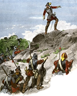
Balboa discovering the Pacific, 1513Spanish expedition under Balboa discovering the Pacific Ocean, 1513. Hand-colored woodcut of a 19th-century illustration
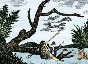
EXPL2A-00269Meriwether Lewis and William Clark expedition losing notes and specimens in a canoe accident on the upper Missouri River. Hand-colored woodcut reproduction of sketch by Patrick Goss
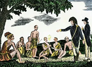
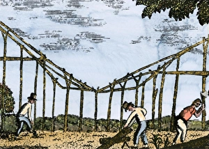
Fort Mandan constructed by Lewis and Clark, 1803Lewis and Clark expedition overwintering along the Missouri River near a Mandan village, 1803-1804. Hand-colored woodcut of a Patrick Goss drawing, a member of the expedition
Conflict between English and Dutch colonists in ConnecticutEnglish and Dutch farmers quarreling in colonial Connecticut, 1600s. Hand-colored woodcut of a 19th-century illustration
EXPL2A-00123Spanish explorer Hernando De Soto discovering the Mississippi River, 1540. Hand-colored engraving of a 19th-century illustration
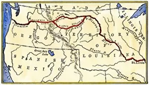
EXPL2A-00035Map of the Lewis and Clark route across Louisiana Territory, 1804-1806. Hand-colored woodcut of a 19th-century illustration
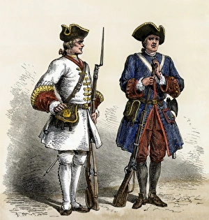
French soldiers in North America, early 1700sCanada and Louisiana defended by French soldiers in the early 1700s. Hand-colored woodcut of a 19th-century illustration
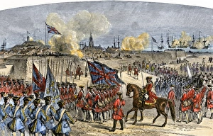
Louisbourg surrendered by the French in Canada, 1758Surrender of Louisbourg to the British under General Jeffrey Amherst, French and Indian War. Hand-colored woodcut of a 19th-century illustration
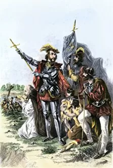
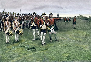
British army gathering to capture Quebec, 1759General Wolfe assembling the British army on the Plains of Abraham to take Quebec, 1759. Hand-colored halftone reproduction of a Frederic Remington illustration
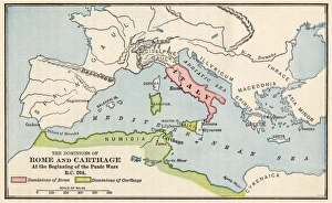
Rome and Carthage, 264 BCTerritories of Rome and Carthage at the outset of the Punic Wars, 264 BC. Color lithograph
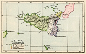
Sicily during the First Punic War, 264 BC. Color lithograph
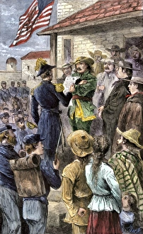
US takes New Mexico during the Mexican-American WarStephen Kearny captures New Mexico Territory from Mexico, 1846. Hand-colored woodcut of a 19th-century illustration
Dutch ship threatening English colonists in ConnecticutDutch ship passing Fort Good Hope on the Connecticut shore of Long Island Sound, 1600s. Hand-colored woodcut of a 19th-century illustration
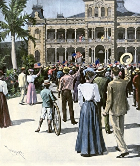
U. S. annexation of Hawaii cheered in Honolulu, 1898Hawaiians receive news of annexation by the U.S. Honolulu, 1898. Hand-colored halftone reproduction of a 19th-century illustration
United States in 1825Map of the United States and Unorganized Public Lands in 1825. Printed color lithograph
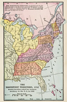
Northwest Territory mapMap of the old Northwest Territory, 1787. Printed color lithograph of a 19th-century illustration