mail_outline sales@mediastorehouse.com
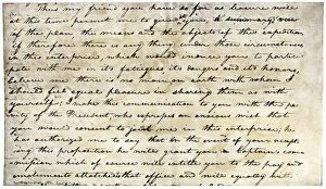
William Clarks invitation from Meriwether Lewis, 1804Meriwether Lewiss letter inviting William Clark to join the expedition to explore the Louisiana Territory. Printed halftone reproduction with a watercolor wash
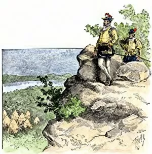
PEXP2A-00099Christopher Gist exploring the wilderness of Ohio, western Pennsylvania, and Kentucky. Hand-colored woodcut of a 19th-century illustration
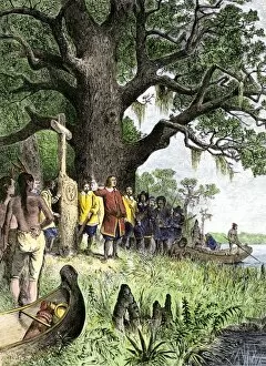
EXPL2A-00118LaSalle at the mouth of the Mississippi River claims Louisiana for France 1682. Hand-colored woodcut of a 19th-century illustration
EXPL2A-00117Sketch by William Clark of Cock of the Plains in the Lewis and Clark expedition diary. Hand-colored halftone of a 19th-century reproduction of the diary
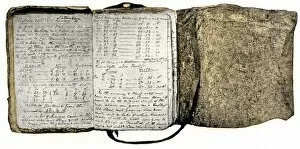
EXPL2A-00116Diary kept by William Clark of the Lewis and Clark expedition 1804 - 1806. Hand-colored halftone of a 19th-century reproduction of the diary
EXPL2A-00022Map of the United States in 1819, showing territory under Spanish and British control. Printed color halftone of a 19th-century illustration
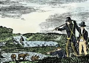
EXPL2A-00092Lewis and Clark shoot a grizzly bear, unknown to whites, during their exploration of Louisiana Territory. Hand-colored woodcut reproduction of sketch by Patrick Goss
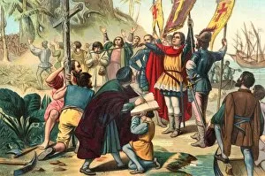
EXPL2A-00056Christopher Columbus taking possession of the New World for Spain, 1492 Printed color lithograph of a 19th-century illustration
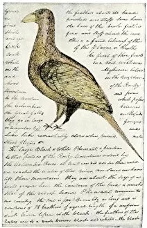
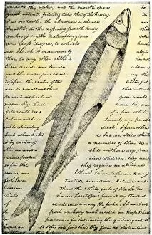
EXPL2A-00166William Clarks sketch of a trout in the Lewis and Clark expedition diary. Hand-colored halftone reproduction of a 19th-century photograph of Clarks handwritten page
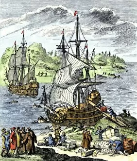
EXPL2A-00143La Salle landing in Matagorda Bay Texas to colonize Louisiana Terrritory and the Mississippi valley area, 1685. Hand-colored 19th-century woodcut reproduction of an earlier illustration
EXPL2A-00087Jacques Cartier on the summit of Mont Real, now Montreal, Canada, 1535. Hand-colored woodcut of a 19th-century illustration
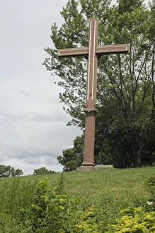
Cartiers landing place on the St Lawrence, QuebecReplica cross marking Jacques Cartiers landing place on the St Lawrence River in Quebec. Digital photograph
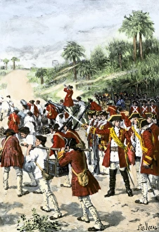
English in Georgia against the Spanish at St. AugustineJames Oglethorpes expedition against the Spanish at St. Augustine, Florida. Hand-colored halftone reproduction of a 19th-century illustration
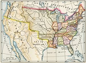
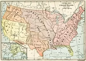
EXPL2A-00041Map of territorial growth of the United States from 1783-1867. Printed color lithograph of a 19th-century illustration
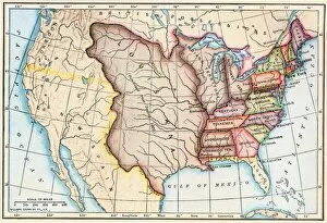
EXPL2A-00062Map of the Louisiana Purchase as understood in 1803, later modified by treaty. Printed color lithograph of a 19th-century illustration
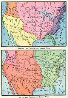
EXPL2A-00151Maps of North American colonies before and after the French and Indian War, 1700s. Printed color lithograph of a 19th century illustration
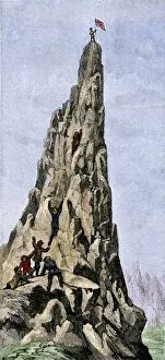
EXPL2A-00348Fremont expedition raising the American flag on the Rockies, 1842. Hand-colored woodcut of a 19th-century illustration
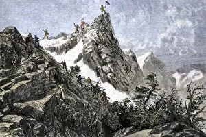
EXPL2A-00349John C. Freemont planting the US flag on the Colorado Rockies, 1842. Hand-colored woodcut of a 19th-century illustration
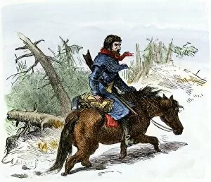
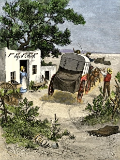
Stagecoach carrying mail to the southwest, 1870sMail delivered by stagecoach to a post office in the Southwest, 1870s. Hand-colored woodcut of a 19th-century illustration
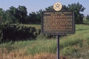
Jedediah Smith route marker in the Black HillsJedediah Smiths route in 1823 through Buffalo Gap in the Black Hills, South Dakota. Photograph
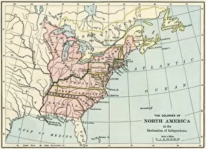
EVRV2A-00230British North American colonies in 1776. Printed color lithograph of a 19th-century illustration