mail_outline sales@mediastorehouse.com
Choose a picture from our Maps Framed Print Collection for your Wall Art and Photo Gifts
222 Framed Prints
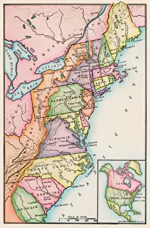
Thirteen original colonies in 1776American colonies at the outbreak of the Revolution. Printed color lithograph of a 19th-century illustration
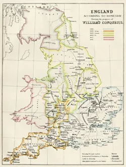
Map of England in 1066England at the time of the Norman conquest, 1066-1081. Color lithograph of a 19th-century illustration
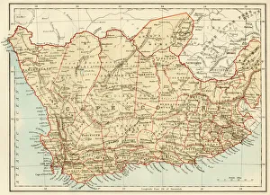
Map of Cape Colony, South AfricaSouth Africa when a British colony, 1870s. Printed color lithograph of a 19th-century illustration
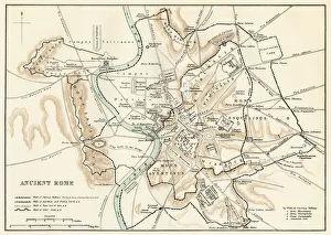
Map of ancient RomeCity plan of ancient Rome. Lithograph
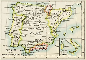
Medieval Spain and Portugal mapMap of the Iberian Peninsula in the 1300s and 1400s. Printed color lithograph reproduction of a 19th-century illustration
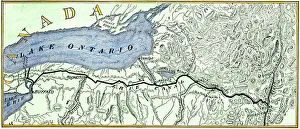
Erie Canal routeMap of the Erie Canal across New York state, 1800s. Hand-colored woodcut of a 19th-century illustration
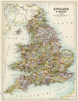
Map of England, 1800sMap of England and Wales, 1870s. Color lithograph reproduction of a 19th-century illustration
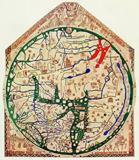
EXPL2A-00352The Hereford Mappa Mundi of 1280 - Jerusalem is at the center, Europe lower left, Africa lower right. Printed color halftone reproduction 19th century
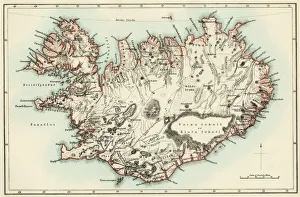
Iceland map, 1800sMap of Iceland, 1870s. Printed color lithograph reproduction of a 19th-century illustratioin
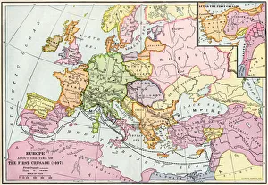
Medieval Europe at the start of the CrusadesMap of Europe at the time of the First Crusade, 1097 AD. Printed color lithograph of a 19th-century illustration
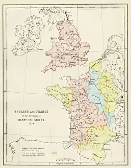
Map of England and France, 1154England and France at the accession of Henry II, 1154. Color lithograph reproduction of a 19th-century illustration
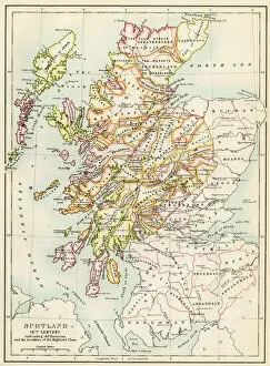
GGBR2A-00076Map of Scotland in the 1520s, showing territories of the Highland Clans. Printed color lithograph of a 19th century illustration
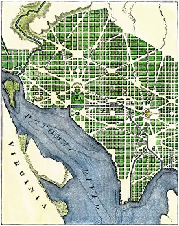
Plan of Washington DC, 1793Washington DC as originally laid out, 1700s. Hand-colored woodcut reproduction of a 1793 engraving
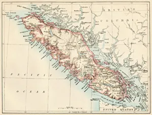
Vancouver Island map, 1870sMap of Vancouver Island, British Columbia, Canada, 1870s. Lithograph reproduction of a 19th-century illustration
Map of ancient Palestine kingdoms of Judah and IsraelMap of Phoenicia and Judea in the time of King Solomon, 10th century BC. Hand-colored woodcut of a 19th-century illustration
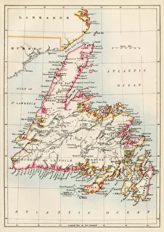
Newfoundland, 1870sMap of Newfoundland, Canada, 1870s. Printed color lithograph
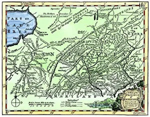
Colonial Pennsylvania map, 1750sMap of the " Province of Pennsilvania, " 1756. Hand-colored 19th-century woodcut reproduction of an 18th-century illustration
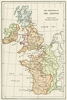
Angevin kings holdings in France and BritainBritish Isles and France under the Angevins, 1100s-1400s. Color lithograph reproduction of a 19th-century illustration
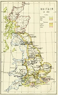
Map of Britain in 597 ADMap of territory controlled by Celts, Picts, Anglos, Saxons, and other tribes in Britain in 597 AD. Printed color lithograph of a 19th-century illustration
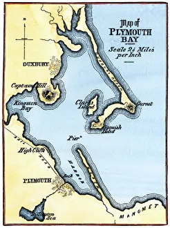
Map of Plymouth Bay, MassachusettsPlymouth Bay on the northern coast of Cape Cod, Massachusetts. Hand colored woodcut of a 19th-century illustration
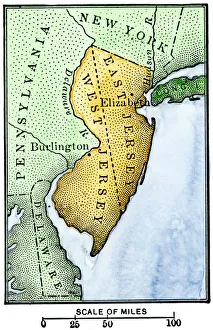
East Jersey and West JerseyMap of colonial East and West Jersey, late 1600s. Hand-colored woodcut of a 19th-century illustration
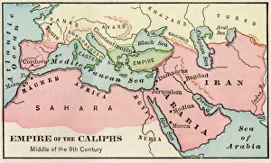
Arab empire, mid-700sEmpire of the Arab Caliphs, middle of the 8th century. Printed color lithograph
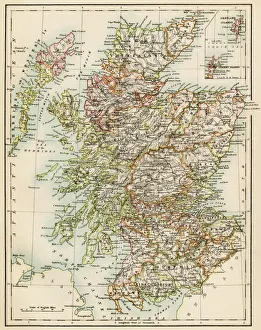
Scotland map, 1870sMap of Scotland, 1870s. Printed color lithograph
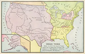
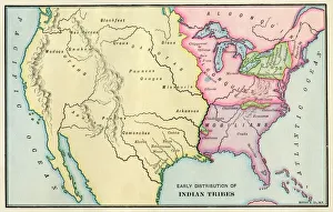
American Indian tribe locations in 1715Map of Native American tribe locations circa 1715, continental U.S. Printed color lithograph
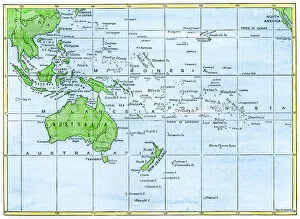
GPAC2A-00018Map of the Pacific island groups, 1800s. Hand-colored woodcut of a 19th-century illustration
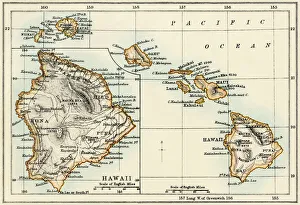
Map of Hawaii, 1870sMap of the Hawaiian islands, 1870s. Color lithograph reproduction of a 19th-century illustration
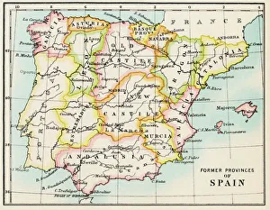
Traditional provinces of SpainMap of the former provinces of Spain. Printed color lithograph of a 19th-century illustration
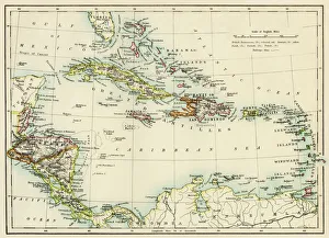
Caribbean islands, 1870sMap of West Indies and the Caribbean Sea, 1800s. Printed color lithograph
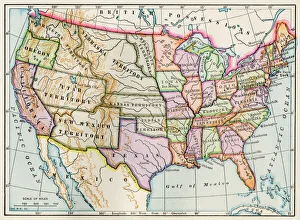
United States in 1860United States and territories at the beginning of the Civil War. Printed lithograph map
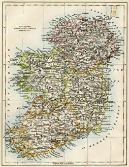
Ireland map, 1870sMap of Ireland, or Eire, 1870s. Printed color lithograph
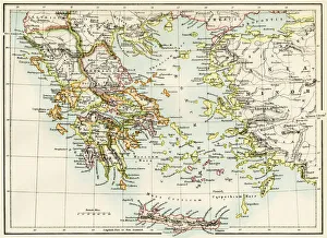
Ancient Greece and its colonies around the AegeanMap of the Aegean Sea in the time of ancient Greece. Printed color lithograph of a 19th-century illustration
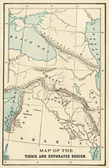
Ancient MesopotamiaMap of the ancient Tigris and Euphrates region. Printed color 19th-century illustration
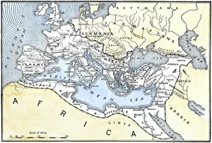
Map of the Roman EmpireMap showing the extent of the Roman Empire. Hand-colored woodcut of a 19th-century illustration
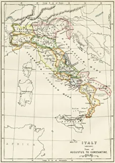
Regions of Italy in the Roman EmpireMap of Italy, during the time of Caesar Augustus to Emperor Constantine. Color lithograph of a 19th-century illustration
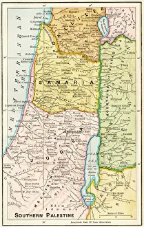
Southern Palestine in ancient timesMap of southern Palestine in ancient times. Printed color lithograph of a 19th-century illustration
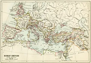
Roman Empire, circa 200 ADMap of the Roman Empire in the third century. Printed color lithograph of a 19th-century illustration
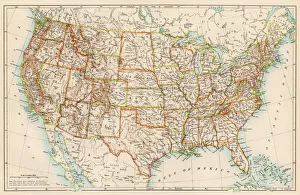
United States in the 1870sUnited States map, 1870s. Color lithograph
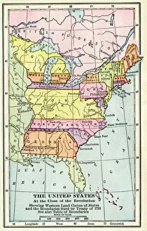
EXPL2A-00164Map of the United States at the close of the American Revolution, 1783. Printed color lithograph of a 19th-century illustration
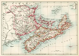
New Brunswick and Nova Scotia, 1870sMap of Nova Scotia, Prince Edward Island, and New Brunswick, 1870s. Printed color lithograph
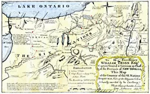
NATI2A-00044Map of the Six Iroquois Nations in Pennsylvania and New York, 1771. Hand-colored woodcut reproduction of an 18th-century document
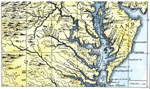
Virginia and Maryland settled in 1738Portions of Maryland and Virginia settled in 1738. Hand-colored 19th-century woodcut reproduction of a document
American Indian tribe locations about 1700Map of Native American locations, circa 1700. Printed lithograph
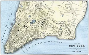
Manhattan map, 1780sJohn Hills map of New York City, surveyed in 1782, drawn in 1785. Hand-colored woodcut reproduction of an 18th-century illustration
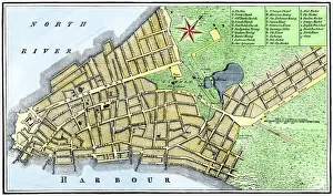
Manhattan map, 1789Map of the City of New York, 1789. Hand-colored woodcut reproduction of an 18th century illustration
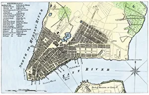
New York City map, 1767Map of New York City in 1767. Hand-colored woodcut of an 18th-century illustration
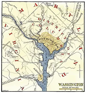
Washington DC during the Civil WarMap of the Washington DC vicinity at the outset of the Civil War. Hand-colored woodcut of a 19th century-illustration
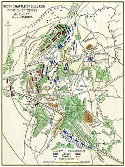
Map of the Second Battle of Bull Run, 1862Bull Run battlefield map showing troop positions on August 29, 1862. Hand-colored woodcut of a 19th-century illustration
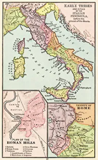
Maps of Italy in ancient timesMap of early tribes in Italy (top). of the Roman hills (lower left). and the vicinity of Rome (right) in the time of the Roman Empire. Printed color lithograph of a 19th-century illustration