
Home > Exploration

EXPL2A-00024

EXPL2A-00024


Poster Prints
Photo Prints
Jigsaw Puzzles
Cards
Canvas Prints
Fine Art Prints
Mounted Prints
Home Decor
Metal Prints


We accept all major credit cards

Wall Art and Photo Gifts from North Wind

EXPL2A-00024

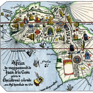
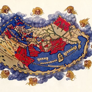
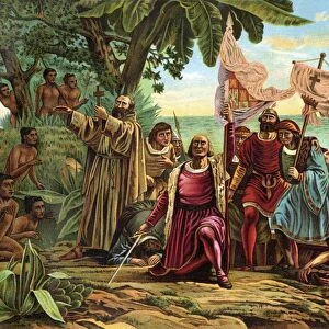
Map of the Atlantic with the New World coast, drawn in 1500 by Juan de la Cosa, Columbus pilot.
Hand colored 19th-century woodcut reproduction of the original chart

Media ID 5880423

© North Wind Picture Archives

1400s 15th Century 16th Century Africa Atlantic Caribbean Chart Christopher Columbus Columbus Discover Document Europe Expedition Exploration Explore Journey Maritime Navigate Navigation New World Ocean Sailing Ship Spanish Voyage West Indies


FEATURES IN THESE COLLECTIONS

> Exploration

> Maps


MADE IN THE UK
Safe Shipping with 30 Day Money Back Guarantee

FREE PERSONALISATION*
We are proud to offer a range of customisation features including Personalised Captions, Color Filters and Picture Zoom Tools

SECURE PAYMENTS
We happily accept a wide range of payment options so you can pay for the things you need in the way that is most convenient for you

* Options may vary by product and licensing agreement. Zoomed Pictures can be adjusted in the Basket.


redeem
Beautiful Photo Prints and Gifts
image
Professionally Printed
inventory
Photo Prints are in stock
thumb_up
Professional quality finish
diamond
Made with high-grade materials
inventory_2
Carefully packed to aid safe arrival


Related Images


Angevin kings holdings in France and Britain
Map of Britain in 597 AD
Captain Cook killed by Hawaiian natives, 1779
Vasco da Gamas route around Africa, 1400s
Surrender of a French town during the Hundred Years War
Scaling walls of a fort during the Hundred Years War
GGBR2A-00069
GGBR2A-00069
Map of England in 1066
EXPL2A-00061
EXPL2A-00061
EXPL2A-00066
EXPL2A-00066
Europe at the time of the Crusades
PART2A-00063
PART2A-00063

+

Shipping

+

Choices

+

Guaranteed