mail_outline sales@mediastorehouse.com
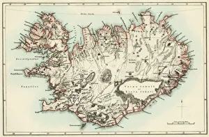
Iceland map, 1800sMap of Iceland, 1870s. Printed color lithograph reproduction of a 19th-century illustratioin
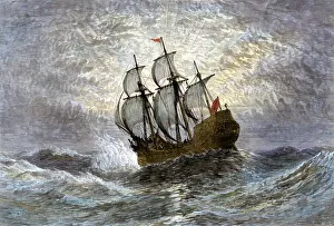
Pilgrims ship Mayflower at sea, 1620The " Mayflower" bringing the first colonists to Massachusetts, 1620. Hand-colored woodcut of a 19th-century illustration
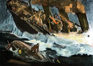
Sinking of the TitanicTitanics stern in the air as the ship sinks in the North Atlantic, 1912. Hand-colored halftone reproduction of an illustration from eyewitness reports
Lighthouse warning a clipper ship of dangerous shoresSailing ship passing a lighthouse marking the way to home port, 1800s. Hand-colored woodcut of a 19th-century illustration
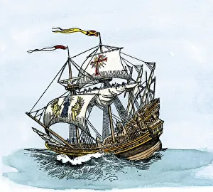
Spanish galleon at seaSpanish galleon, an improved caravel three times longer than wide, used in the 1500s and 1600s. Hand-colored woodcut of a 19th-century illustration
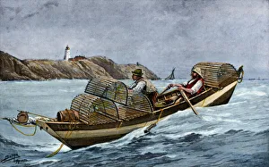
Lobster boat off the Atlantic coast of Maine and CanadaLobster fishermen in the Grand Manan Channel between Maine and New Brunswick, 1890s. Hand-colored halftone reproduction of a 19th-century illustration
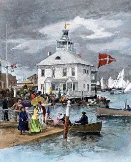
Yacht club in Newport, Rhode Island, 1880sClubhouse of the New York Yacht Club in Newport, Rhode Island, 1880s. Hand-colored woodcut of a 19th-century illustration
Crew of the USS Constitution in battle, War of 1812Deck of the US frigate " Constitution" engaging in battle with British " Guerriere, " War of 1812. Hand-colored woodcut of a 19th-century illustration
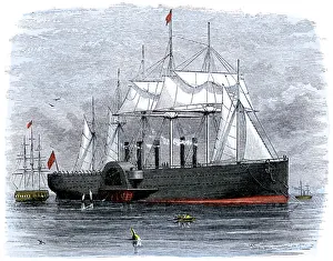
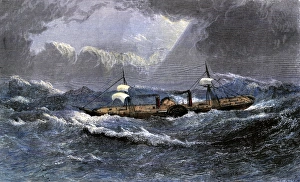
Great Eastern laying transatlantic telegraph cableSteamship " Great Eastern" attempting to lay telegraph cable across the Atlantic, 1850s. Hand-colored woodcut of a 19th-century illustration
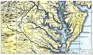
Virginia and Maryland settled in 1738Portions of Maryland and Virginia settled in 1738. Hand-colored 19th-century woodcut reproduction of a document
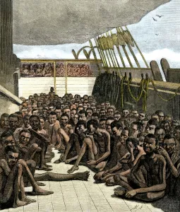
Captive Africans on a slave-ship off Key WestDeck of the captured slave-ship " Wildfire" brought into Key West, 1860. Hand-colored woodcut of a 19th-century illustration
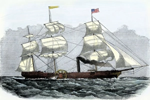
First Atlantic crossing by steamship, 1819American paddlewheeler " Savannah, " the first steamship to cross the Atlantic, 1819. Hand-colored woodcut of a 19th-century illustration
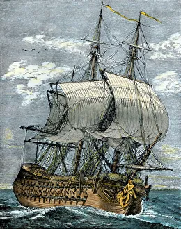
French frigate, 1700sArmed French frigate of the 18th century. Hand-colored woodcut of an illustration
Slave-ship hoisting sail, 1800sAfrican slave-ship hoisting sail upon sighting an English cruiser, 1800s. Hand-colored woodcut of a 19th-century illustration
Pirates capturing a shipPirates capturing a galleon on the high seas. Hand-colored woodcut of a 19th-century Howard Pyle illustration
Spanish pirates attacking English merchantmenSpanish ships capturing English ships with supplies for the colonies. Hand-colored woodcut of a 19th-century illustration
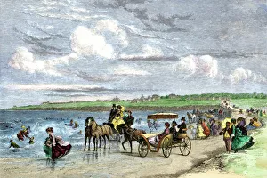
Newport, Rhode Island, beach scene, 1870sSummer residents enjoying the beach in Newport, Rhode Island, 1870s. Hand-colored woodcut of a 19th-century illustration
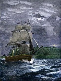
Steering a sailing-ship through stormy seasSailors at the wheel of a merchant ship in a gale, 1800s. Hand-colored engraving of a 19th-century illustration
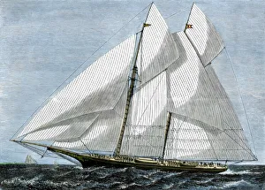
American yacht MohawkAmericas Cup contender " Mohawk" under full sail, 1870s. Hand-colored woodcut of a 19th-century illustration
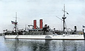
Battleship Maine, 1898US battleship Maine, just before sailing to Cuba, 1898. Hand-colored halftone reproduction of a photoograph
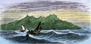
Cape Verde Islands in the Atlantic OceanSailboats along Washingtons Head, Saint Vincent, Cape Verde Islands. Hand-colored woodcut of a 19th-century illustration
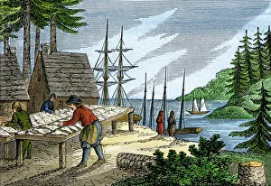
Drying and salting fish in colonial MaineFirst settlers of Maine drying and salting fish on the Atlantic shore. Hand-colored woodcut of a 19th-century illustration
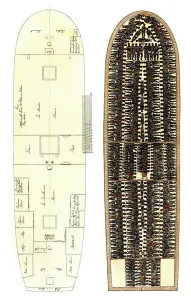
Slave-ship diagram showing Africans packed on deckDeck plan of a slave ship, showing how captured Africans were arranged as cargo, 1700s. Hand-colored 19th-century woodcut reproduction of an earlier illustration
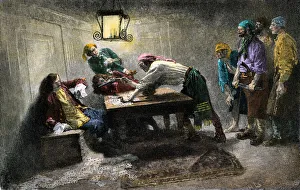
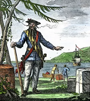
PPIR2A-00058Captain Edward Teach, commonly called Blackbeard. Hand-colored woodcut
EXPL2A-00184Part of the 1613 Samuel de Champlain map of New France. Hand-colored woodcut of a 19th-century reproduction of the original ma
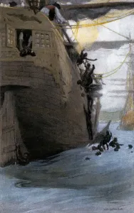
Hand-colored printed halftone illustrationJohn Paul Jones in command of the " Ranger" in battle with the British ship " Drake, " American Revolution. Hand-colored woodcut of a 19th-century illustratioin
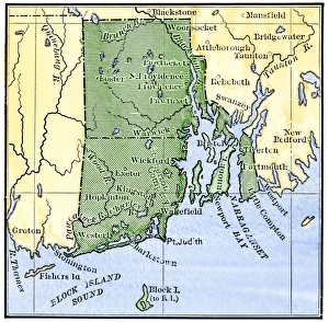
Map of colonial Rhode Island, 1660sMap of Rhode Island, showing the disputed colonial boundaries, 1660s. Hand-colored woodcut of a 19th-century illustration
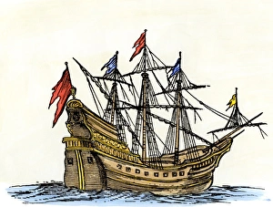
Ship in the 1600sSailing-ship of the seventeenth century. Hand-colored 19th-century woodcut reproduction of an earlier illustration
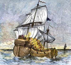
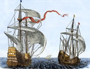
Dutch galleons, 1600sDutch traders galleons at sea in the 1600s. Hand colored 19th-century woodcut reproduction of an earlier illustration
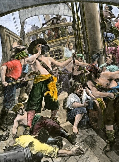
Pirates celebrating aboard shipDrunken pirates aboard their ship celebrating a successful raid. Hand-colored woodcut of a 19th-century illustration
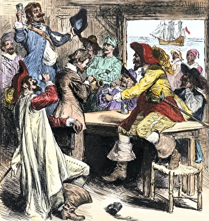
Pirates in Charleston, South Carolina, 1700sPirates celebrating in colonial Charleston, South Carolina. Hand-colored woodcut of a 19th-century illustration
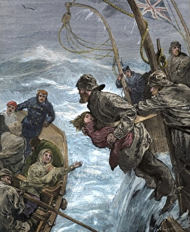
Passengers placed in lifeboats from a sinking shipSailor handing a child into a lifeboat during a storm at sea, 1880s. Hand-colored woodcut of a 19th-century illustration
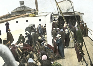
Titanic survivors on deck of a rescue shipDeck of the " Carpathia" crowded with " Titanic" survivors, 1912. Hand-colored halftone reproduction of a photograph
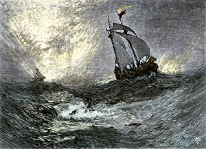
Sailing-ships at seaSailing ships on the high seas. Hand-colored woodcut of a 19th-century illustration
Paddlewheel steamship Scotia of the Cunard Line, 1800sThe " Scotia, " last of the Cunard Lines paddlewheel steamers. Hand-colored woodcut of a 19th-century illustration
Paddlewheel steamship Arabia of the Cunard LIneRoyal Mail steamship " Arabia" of the Cunard Line, 1850s. Hand-colored woodcut of a 19th-century illustration
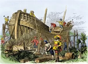
French colonists building a ship, South Carolina, 1560sShipbuilding at Archers Creek, South Carolina, by French colonists left behind by Ribault, 1562. Hand-colored woodcut of a 19th-century illustration
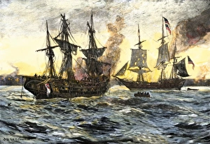
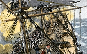
USS Constitution in battle against British ships, War of 1812Deckhands in action on the USS " Constitution" against the " Levant" and Cyane, " War of 1812. Hand-colored woodcut of a 19th-century illustration
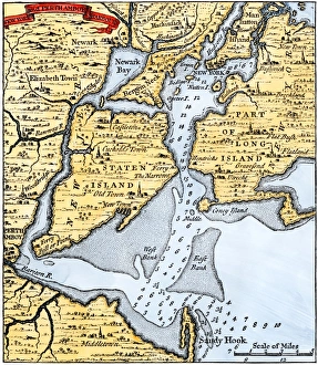
New York harbor chart, 1733Popples map of New York City and the surrounding area, 1733. Hand-colored woodcut reproduction of an 18th-century illustration
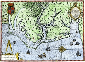
Virginia map, 1588Thomas Harriots map of Virginia, 1588. Hand-colored 19th-century woodcut reproduction of a document
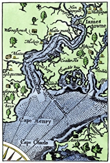
John Smiths map of JamestownMap of Jamestown settlement, Virginia. Hand-colored 19th-century woodcut reproduction from Smiths Historie of Virginia
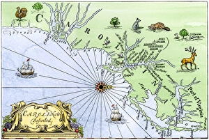
Carolina coast map, 1600sMap of the Carolinas, showing Charleston and the Outer Banks, north on the right. Hand-colored woodcut reproduction of a 17th-century map
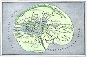
EXPL2A-00138Map of the flat earth according to Herodotus, ancient Greek historian. Hand-colored woodcut of a 19th-century illustration
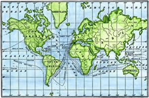
Great voyages of the age of explorationMap of great voyages from 1492 to 1580. Hand-colored woodcut of a 19th-century illustration
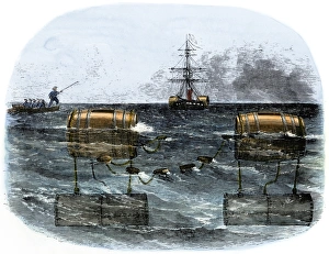
Confederate explosive mines blocking a river, Civil WarBarrel torpedo, or mine, used by Confederates to blockade a southern river mouth, 1860s. Hand-colored woodcut of a 19th-century illustration
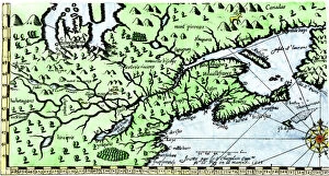
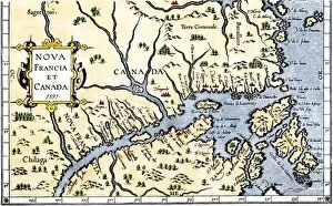
EXPL2A-00325Map of New France and Canada, 1597. Hand-colored 19th-century woodcut reproduction of a 16th-century map printed in Wytfliet
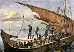
Africans jumping from a slave ship, 1700sAfrican captives leaping off a slave-ship near the coast of Africa, 1700s. Hand-colored halftone reproduction of a 19th-century illustration
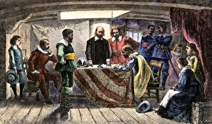
Mayflower Compact signed by the Plymouth colonists, 1620Pilgrims agreeing to govern themselves according to the Mayflower Compact, 1620. Hand-colored woodcut of a 19th-century illustration