Home > British history

GGBR2A-00069

GGBR2A-00069


We accept all major credit cards

North Wind Photo Prints and Wall Art

GGBR2A-00069

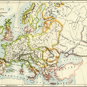
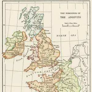
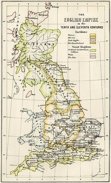
Map of English holdings in the 10th and 11th centuries, showing earldomes and vassal kingdoms.
Printed color lithograph, 19th-century

Media ID 5879212

© North Wind Picture Archives

10th Century 11th Century 900s British England English Europe Feudalism Great Britain Medieval Middle Ages Norman Conquest North Umberland Scot Land Wales William The Conqueror


FEATURES IN THESE COLLECTIONS

> British history

> Maps


MADE IN THE UK
Safe Shipping with 30 Day Money Back Guarantee

FREE PERSONALISATION*
We are proud to offer a range of customisation features including Personalised Captions, Color Filters and Picture Zoom Tools

SECURE PAYMENTS
We happily accept a wide range of payment options so you can pay for the things you need in the way that is most convenient for you

* Options may vary by product and licensing agreement. Zoomed Pictures can be adjusted in the Basket.

redeem
Beautiful Photo Prints and Gifts
image
Professionally Printed
inventory
Photo Prints are in stock
thumb_up
Professional quality finish
diamond
Made with high-grade materials
inventory_2
Carefully packed to aid safe arrival


Related Images


PROY2A-00017
PROY2A-00017
Turkish defeat in the Battle of Lepanto, 1571
GMED2A-00020
GMED2A-00020
Church of the Holy Sepulcher in Jerusalem
GMDE2A-00053
GMDE2A-00053
NATI2A-00076
NATI2A-00076
GEUR2A-00123
GEUR2A-00123
Medieval Europe at the start of the Crusades
Seljuk Turks defeated at Dorylaeum, First Crusade
St Bernard of Clairvaux
Saint Jerome
Saint Jerome
Nantucket in the 1850s

+

Shipping

+

Choices

+

Guarantee