mail_outline sales@mediastorehouse.com
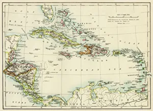
Caribbean islands, 1870sMap of West Indies and the Caribbean Sea, 1800s. Printed color lithograph
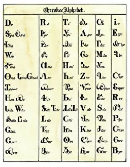
NATI2A-00094Cherokee alphabet developed by Sequoyah. Woodcut reproduction with a watercolor wash
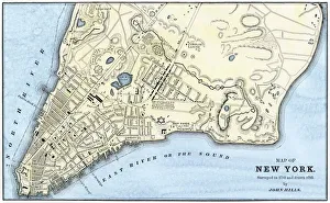
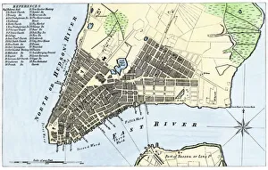
Manhattan map, 1780sJohn Hills map of New York City, surveyed in 1782, drawn in 1785. Hand-colored woodcut reproduction of an 18th-century illustration
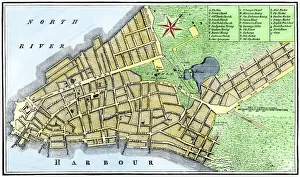
New York City map, 1767Map of New York City in 1767. Hand-colored woodcut of an 18th-century illustration
EXPL2A-00014Ptolemys map of the world, illustrating a concept of the flat earth. Hand-colored 19th-century woodcut reproduction
Manhattan map, 1789Map of the City of New York, 1789. Hand-colored woodcut reproduction of an 18th century illustration
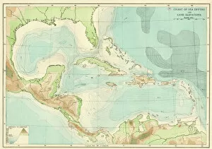
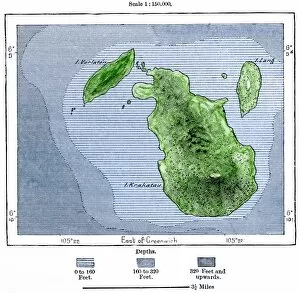
EXPL2A-00377Chart of the West Indies sea depths and land elevations. Printed color lithograph of a 19th-century illustration
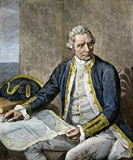
PEXP2A-00015Captain James Cook regarding a map. Hand-colored woodcut of a painting
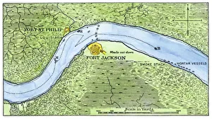
Lower Mississippi River defenses against Union ships, 1862Route of the USS " Brooklyn" past Fort Jackson, Civil War battle of New Orleans, 1862. Hand-colored woodcut of a 19th-century illustration
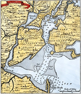
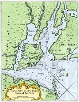
New York harbor chart, 1733Popples map of New York City and the surrounding area, 1733. Hand-colored woodcut reproduction of an 18th-century illustration
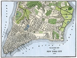
Manhattan in 1767Ratzer map of New York City, 1767. Hand-colored woodcut reproduction of an 18th-century illustration
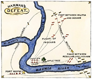
Harmars defeat at Fort Wayne, Indiana, 1791Map of General Harmars defeat by the Miami and Shawnee at Fort Wayne, Indiana, 1791 Hand-colored woodcut of a 19th-century illustration
EXPL2A-00138Map of the flat earth according to Herodotus, ancient Greek historian. Hand-colored woodcut of a 19th-century illustration
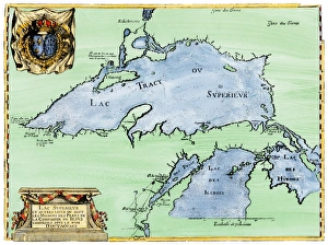
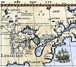
French settlement of the Great Lakes, 1600sFrench Jesuit map of Lake Superior, Upper Michigan, and Wisconsin, 1600s. Hand-colored woodcut of a 17th-century illustration
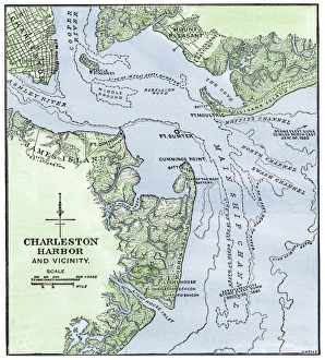
Map showing location of Fort Sumter, Civil WarChart of Charleston harbor, showing Fort Sumter and Fort Moultrie. Hand-colored woodcut of a 19th-century illustration
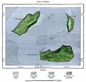
GPAC2A-00022Krakatoa and neighboring islets after the volcanic eruption of 1883. Hand-colored woodcut of a 19th-century illustration
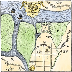
Swedish settlement at Fort Christina, DelawareFort Christina under siege by the Dutch in 1655 (now Wilmington, Delaware). Hand-colored woodcut reproduction of a contemporary illustration by Campanius
EXPL2A-00065World map of the flat earth printed by Beatus Rhenanus Bildaus Rheinau early 1500s - North is left, Mediterranean Sea middle Printed color lithograph reproduction 19th century
Spanish Armadas route in 1588Chart of the Spanish Armadas course, 1588. Hand-colored engraving
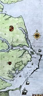
EXPL2A-00220John Whites map of the Virginia and Carolina coast where Roanoke Colony was located, 1500s. Hand-colored 19th-century reproduction engraving
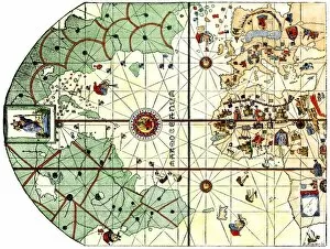
EXPL2A-00024Map of the Atlantic with the New World coast, drawn in 1500 by Juan de la Cosa, Columbus pilot. Hand colored 19th-century woodcut reproduction of the original chart
Dutch map of eastern North America, 1670Nova Belgh Tabula, map of New Netherland and New England, 1670. Hand-colored woodcut reproduction
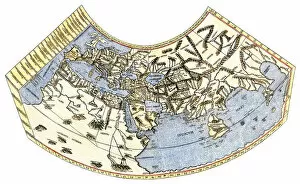
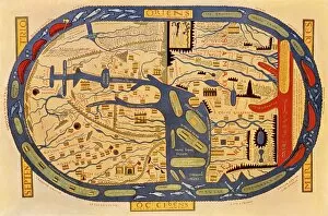
EXPL2A-00061Ptolemys world map, circa 150 AD, from the edition of 1472. Color halftone reproduction of the first printed edition of 1472
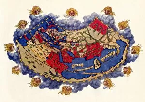
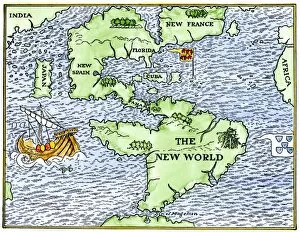
EXPL2A-00147World map after the disoveries of Columbus and Balboa, showing the prevalent idea that South America was attached to Asia. Hand-colored woodcut of a 19th-century illustration
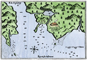
Champlains Tadoussac settlement, 1613Champlains map of Tadoussac settlement in New France, 1613. Hand-colored woodcut of a 17th-century illustration
Quebec and Tadoussac, 1609Lescarbots map of the St. Lawrence and the Saguenay showing Quebec (Kebec) in Canada, 1609. Hand-colored woodcut of a 19th-century illustration
GPAC2A-00021Krakatoa and neighboring islets before the volcanic eruption of 1883. Hand colored woodcut of a 19th-century illustration
USNY2A-00037Bellins map of the New York Bay, 1764. Hand-colored woodcut reproduction of an 18th-century illustration
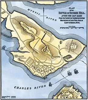
EVRV2A-00184Map of the Battle of Bunker Hill, drawn from a British map. Hand-colored woodcut reproduction
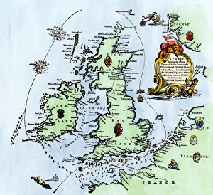
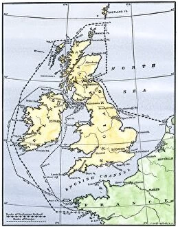
EVRV2A-00215Routes of the American ships Ranger and Bonhomme Richard raiding the British Isles during the American Revolution. Hand-colored woodcut of a 19th-century illustration
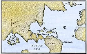
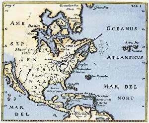
EXPL2A-00375Map of North America as known in the mid-1600s. Hand-colored woodcut reproduction of an illustration in Campanius, 1702
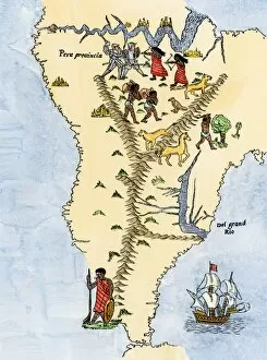
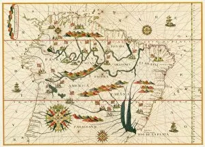
EXPL2A-00026Map of South America, from Sebastian Cabots map of the world, 1544. Hand colored 19th-century woodcut reproduction of the original map
EXPL2A-00021Map of South America from the Spanish atlas executed at Messina in 1582 by Joan Martines. Printed color lithograph reproduction 19th century
EXPL2A-00016Hennepins map of New France and Louisiana - La Carte de la Nouvelle France, 1683. Hand-colored 19th-century woodcut reproduction of the original map
EXPL2A-00032Christopher Columbus studying a map in his studio in Spain 1400s. Hand-colored woodcut of a 19th-century illustration
EXPL2A-00148New World geography according to a mapmaker of 1540. Hand-colored woodcut of a 19th-century illustration
EXPL2A-00183Samuel de Champlains fortified camp at Quebec on the St Lawrence River, 1600s Hand-colored 19th-century woodcut of a 17th-century map
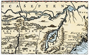
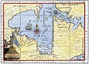
EXPL2A-00190Map of Hudsons Bay, Canada, showing Hudsons Strait, 1722. Hand-colored 19th-century woodcut reproduction of an 18th-century map
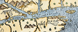
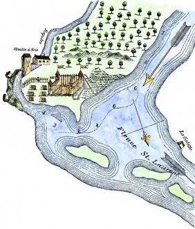
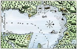
Champlains Quebec settlement, 1613Champlains settlement at Quebec in New France, 1613. Hand-colored woodcut of a 17th-century illustration
EXPL2A-00058Samuel de Champlains map of the Gaspee and Gulf of the Saint Lawrence River, 1632. Hand-colored woodcut reproduction of the original map
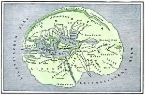
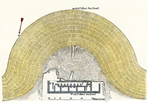
Trojan theater diagramGround-plan of the great theater of Troy, after archaeological excavations in the 1800s. Hand-colored woodcut of a 19th-century illustration