mail_outline sales@mediastorehouse.com
216 items
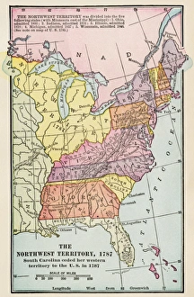
Northwest Territory mapMap of the old Northwest Territory, 1787. Printed color lithograph of a 19th-century illustration
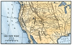
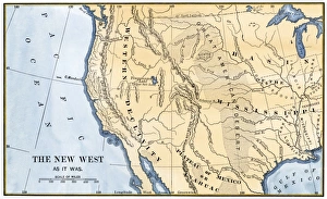
Western frontier in the 1880sMap of the American West in the 1880s. Hand-colored woodcut of a 19th century illustration
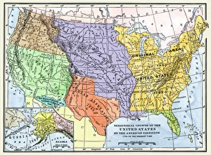
US territorial acquisition during the 1800sMap showiing the territorial growth of the continental US 1776 to 1899. Hand-colored woodcut of a 19th-century illustration
North American colonies in 1733European claims in North America in 1733, when the last English colony, Georgia, was founded. Color lithograph
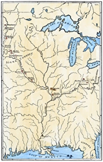
Western US frontier, early 1800sMap of the western frontier in the United States, 1800s. Hand-colored woodcut of a 19th-century illustration
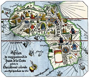
Vasco da Gamas route around Africa, 1400sAfrica as known after Vasco da Gamas discoveries, from map of Juan de la Cosa, 1500. Hand-colored woodcut reproduction
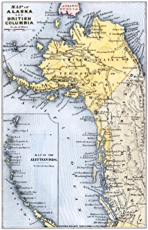
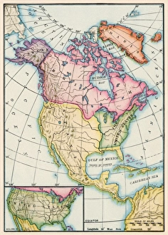
Alaska and British Columbia map, 1872Map of Alaska, the Aleutian Islands, and British Columbia, 1872. Hand-colored woodcut of a 19th-century illustration
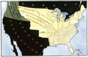
US after the Missouri Compromise, 1820Slave and free territories in the United States after the Missouri Compromise Act, 1820. Hand-colored woodcut of a 19th-century illustration
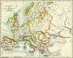
PROY2A-00017Map of Europe in the time of Charlemagne, 768-814 AD. Printed color lithograph, 19th century
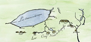
Iroquois Nations map, 1600sFrench map of the Five Iroquois Nations homeland and Fort Orange (Albany), 1660s. Hand-colored woodcut of a 17th-century illustration
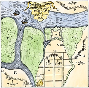
Swedish settlement at Fort Christina, DelawareFort Christina under siege by the Dutch in 1655 (now Wilmington, Delaware). Hand-colored woodcut reproduction of a contemporary illustration by Campanius
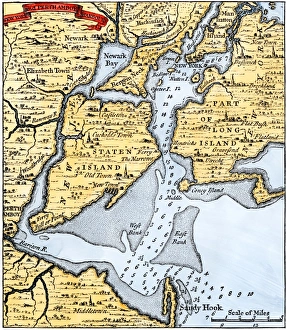
New York harbor chart, 1733Popples map of New York City and the surrounding area, 1733. Hand-colored woodcut reproduction of an 18th-century illustration
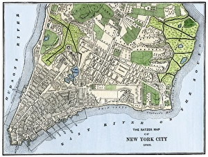
Manhattan in 1767Ratzer map of New York City, 1767. Hand-colored woodcut reproduction of an 18th-century illustration
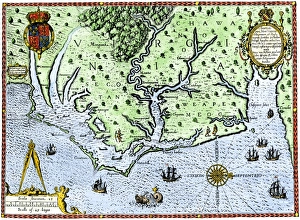
Virginia map, 1588Thomas Harriots map of Virginia, 1588. Hand-colored 19th-century woodcut reproduction of a document
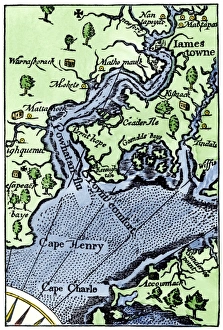
John Smiths map of JamestownMap of Jamestown settlement, Virginia. Hand-colored 19th-century woodcut reproduction from Smiths Historie of Virginia
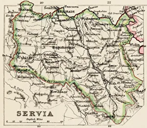
Serbia mapMap of Servia in the 1870s. Printed color lithograph reproduction of a 19th-century illustration
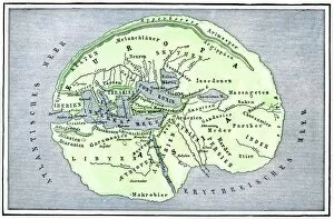
EXPL2A-00138Map of the flat earth according to Herodotus, ancient Greek historian. Hand-colored woodcut of a 19th-century illustration
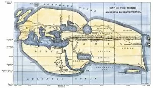
EXPL2A-00317Map of the world according to ancient Greek geographer Eratosthenes. Hand-colored 19th-century woodcut reproduction
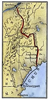
EVRV2A-00085Map of Benedict Arnolds route to invade Quebec during the American Revolution, 1775. Hand-colored woodcut of a 19th-century illustration
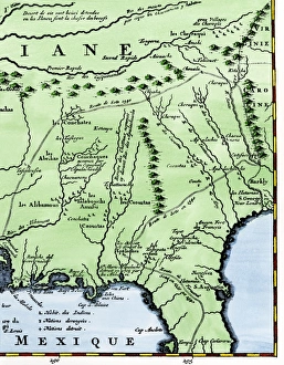
Map of part of DeSotos route, 1500sEastern portion of De Sotos route across southeastern North America, 1500s. Hand-colored woodcut reproduction of a 1593 illustration
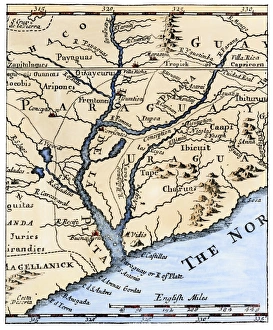
Rio de la Plata, 1698Mouth of the Rio de la Plata in South America, in a map of 1698. Hand-colored woodcut of a 19th-century illustration
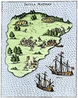
EXPL2A-00268Magellans ships at Mactan, an island in the Philippines, where Magellan was killed in a battle with natives, 1521. Hand-colored 19th-century halftone reproduction of a 16th-century engraving
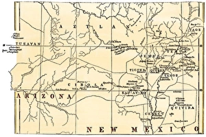
Pueblo Indian villages of the 1800sMap of the Pueblo region, showing inhabited pueblos and ruins, 1800s. Hand-colored woodcut of a 19th-century illustration
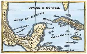
Mexico at the time of Cortes, 1500sMap of Cortes landing area in Mexico, 1519. Hand-colored woodcut of a 19th-century illustration
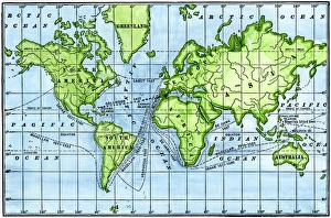
Great voyages of the age of explorationMap of great voyages from 1492 to 1580. Hand-colored woodcut of a 19th-century illustration
North American territories in 1783North America at the close of the Revolution - Treaty of Paris, 1783. Printed color lithograph
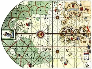
EXPL2A-00024Map of the Atlantic with the New World coast, drawn in 1500 by Juan de la Cosa, Columbus pilot. Hand colored 19th-century woodcut reproduction of the original chart
Dutch map of eastern North America, 1670Nova Belgh Tabula, map of New Netherland and New England, 1670. Hand-colored woodcut reproduction
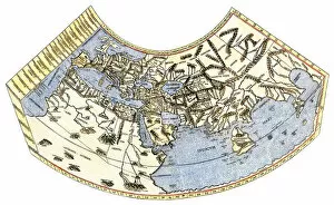
EXPL2A-00014Ptolemys map of the world, illustrating a concept of the flat earth. Hand-colored 19th-century woodcut reproduction
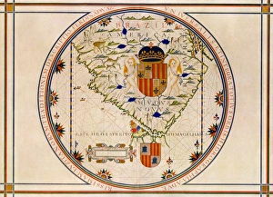
Portuguese map of the tip of South America, 1571Map of South America printed in Lisbon, 1571. Printed color halftone reproduction
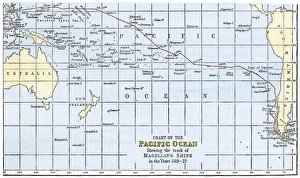
Magellans route across the PacificRoute of Magellans ships across the Pacific while circumnavigating the earth, 1519-1522. Hand-colored woodcut of a 19th-century illustration
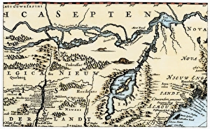
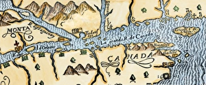
Quebec and Tadoussac, 1609Lescarbots map of the St. Lawrence and the Saguenay showing Quebec (Kebec) in Canada, 1609. Hand-colored woodcut of a 19th-century illustration
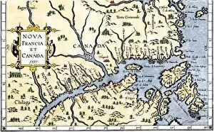
EXPL2A-00325Map of New France and Canada, 1597. Hand-colored 19th-century woodcut reproduction of a 16th-century map printed in Wytfliet
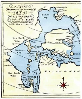
EXPL2A-00284Early map of Hudsons Strait and Hudsons Bay, 1662, in Arctic Canada. Hand-colored 19th-century woodcut reproduction
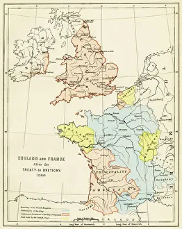
Treaty of Bretigny territory settlements, 1360England and France after the Treaty of Bretigny, Hundred Years War, 1360. Color lithograph reproduction of a 19th-century illustration
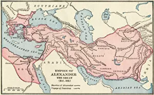
PANC2A-00003Map of the empire of Alexander the Great in 323 BC. Printed color lithograph of a 19th-century illustration
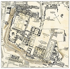
Ancient Romes center, Palatine HillMap of Palatine Hill, city center of ancient Rome. Hand-colored woodcut of a 19th-century illustration
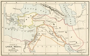
Babylonia, Lydia, and Medea in ancient timesMap of ancient Babylonia and of the kingdoms of Lydia and Medea, circa 550 BC. Printed color lithograph of a 19th-century illustration
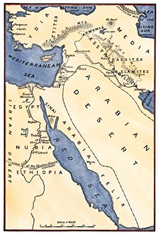
Map of the Mideast in ancient timesMap of the ancient Near East, birthplace of civilization. Hand-colored woodcut of a 19th-century illustration
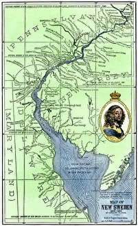
EXPL2A-00165Map of colonial New Sweden in America, 1638-1685. Hand-colored 19th-century woodcut reproduction of a 17th-century map
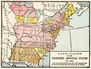
EXPL2A-00191Map showing land claims of the 13 original states in 1783. Printed color lithograph of a 19th-century illustration
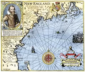
EXPL2A-00291John Smiths map of New England, with inset portrait, circa 1620. Hand-colored 19th-century woodcut reproduction of the original
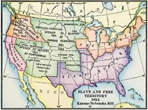
EXPL2A-00312Map of slave and free areas of the United States in 1854, at the time of the Kansas-Nebraska Bill. Printed color lithograph 19th century
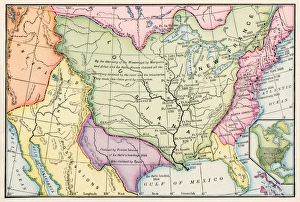
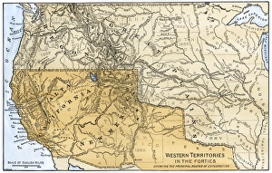
Western boundary with Mexico, 1840sMexican possessions and western US territories in the 1840s. Hand-colored woodcut of a 19th-century illustration
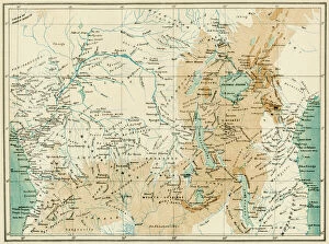
EXPL2A-00366Map of equatorial Africa as known in the 1870s. Printed color lithograph, 19th century
Map of Mandan migrationCaitlins map showing the moves of the Mandans and the place of their extinction, 1837. Hand-colored woodcut of a 19th-century illustration
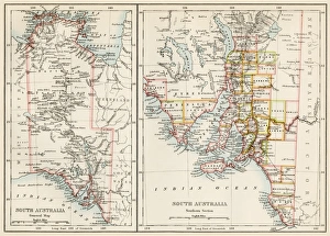
South Australia, 1800sMap of South Austrailia, 1870s. Color lithograph reproduction of a 19th-century illustration
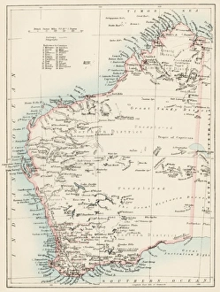
Western Australia province, 1800sMap of Western Australia, 1870s. Color lithograph reproduction of a 19th-century illustration