mail_outline sales@mediastorehouse.com
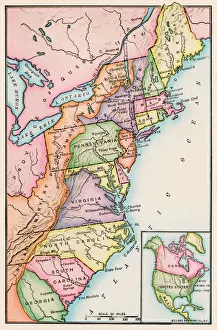
Thirteen original colonies in 1776American colonies at the outbreak of the Revolution. Printed color lithograph of a 19th-century illustration
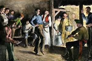
BUSN2A-00110Woodsman dancing to a fiddle in a logging camp at night, 1800s. Hand-colored woodcut of a 19th-century illustration
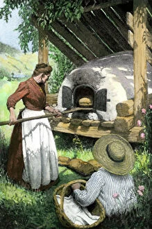
HOUS2A-00141French-Canadian woman baking bread in an outdoor oven, circa 1900. Hand-colored halftone reproduction of a turn-of-the-century illustration
EVNT2A-00048British capturing Quebec in the Battle of the Plains of Abraham, French and Indian War, 1759. Hand-colored woodcut
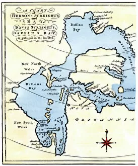
EXPL2A-00284Early map of Hudsons Strait and Hudsons Bay, 1662, in Arctic Canada. Hand-colored 19th-century woodcut reproduction
EXPL2A-00184Part of the 1613 Samuel de Champlain map of New France. Hand-colored woodcut of a 19th-century reproduction of the original ma
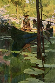
Canoeists on a slow-moving streamWoodsmen in canoes floating on a tranquil river, circa 1900. Printed color halftone reproduction of a Schoonover illustration
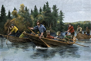
Racing heavy canoes on a northern river, 1800sA bateau (boat) race in the north woods, 1800s. Hand-colored woodcut of a 19th-century illustration
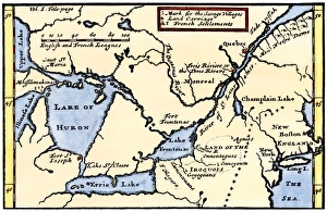
French map of the Great Lakes, 1703La Hontans map of the Great Lakes and Saint Lawrence valley, 1703. Hand-colored 19th-century woodcut reproduction of an 18th century illustration
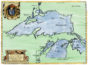
French settlement of the Great Lakes, 1600sFrench Jesuit map of Lake Superior, Upper Michigan, and Wisconsin, 1600s. Hand-colored woodcut of a 17th-century illustration
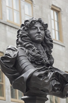
Statue of Louis XIV in old QuebecBust of French King Louis XIV in the historic district of Quebec City, Canada. Digital photograph
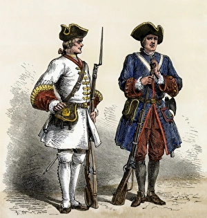
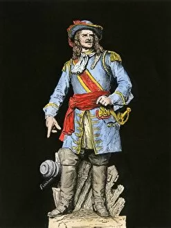
French soldiers in North America, early 1700sCanada and Louisiana defended by French soldiers in the early 1700s. Hand-colored woodcut of a 19th-century illustration
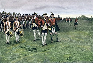
British army gathering to capture Quebec, 1759General Wolfe assembling the British army on the Plains of Abraham to take Quebec, 1759. Hand-colored halftone reproduction of a Frederic Remington illustration
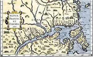
EXPL2A-00325Map of New France and Canada, 1597. Hand-colored 19th-century woodcut reproduction of a 16th-century map printed in Wytfliet
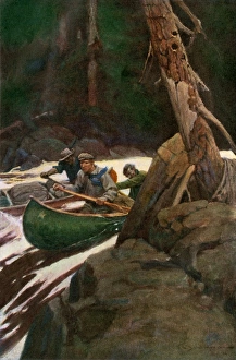
Canoeing a load of furs from the north woodsTrappers running rapids on a wilderness river, circa 1900. Printed color halftone reproduction of a Schoonover illustration
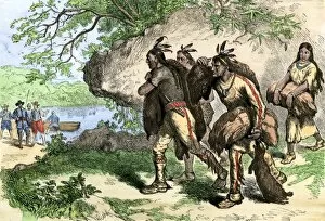
BUSN2A-00026Native Americans bringing beaver pelts to white traders. Hand-colored woodcut of a 19th-century illustration
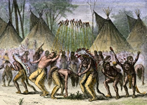
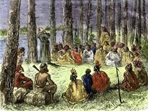
War danceNative American war dance near the St. Lawrence River during the French and Indian War. Hand-colored woodcut of a 19th-century illustration
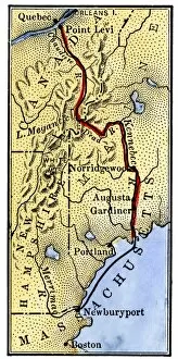
EVRV2A-00085Map of Benedict Arnolds route to invade Quebec during the American Revolution, 1775. Hand-colored woodcut of a 19th-century illustration
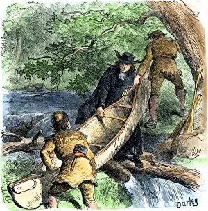
EXPL2A-00256French missionary and fur traders carrying a canoe at a portage in North America. Hand-colored woodcut of a 19th-century illustration
BUSN2A-00027Native Americans aboard ship to trade their furs to Europeans. Hand-colored woodcut of a 19th-century illustration
Dutch map of eastern North America, 1670Nova Belgh Tabula, map of New Netherland and New England, 1670. Hand-colored woodcut reproduction
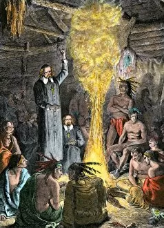
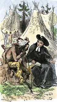
EXPL2A-00043French missionaries preaching to Native Americans. Hand-colored woodcut of a 19th-century illustration
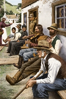
Neighborhood concert in a French-Canadian village, 1900French-Canadian villagers enjoying impromtu music, circa 1900. Digitally colored halftone reproduction of an illustration
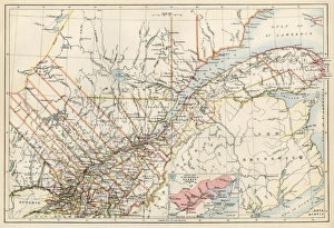
Quebec, 1870sMap of Quebec province, Canada, 1870s. Printed color lithograph
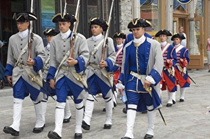
Colonial reenactors in QuebecColonial French army reenactors portraying 18th-century Quebec. Digital photograph
Home of Louis Joliet in old QuebecHome of Louis Joliet in the Petit Champlain district of old Quebec City. Digital photograph
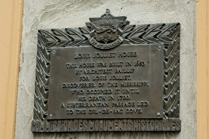
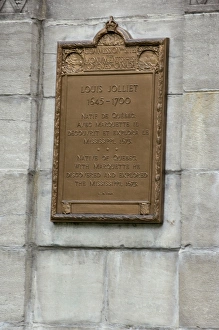
Memorial for Louis Joliets home in old QuebecMemorial plaque, in English, at Louis Joliets home in old Quebec City. Digital photograph
PCAN2A-00001Louis de Buade, Count Frontenac, Governor General of New France, 1600s. Hand-colored woodcut of a 19th-century illustration from a statue
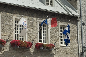
Stone building in the historic district of old QuebecStone building festooned with flags in the historic district of Quebec City. Digital photograph
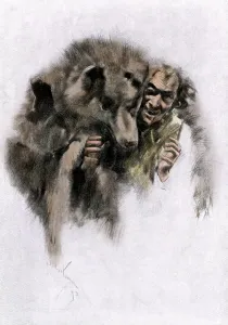
Werewolf of French CanadaLoup-garou, a French-Canadian werewolf legend, 1800s. Hand-colored woodcut of a 19th-century illustration
Louis Joliet memorial plaque in old QuebecMemorial ifor Louis Joliet in old Quebec City. Digital photograph
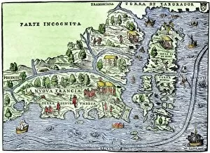
EXPL2A-00126Map of New France, 1550, showing the coast of Canada and the Gulf of Saint Lawrence Hand-colored woodcut
French fort at Quebec as a winter refuge, 1600sStarving Native Americans seeking refuge at the French fort at Quebec, Canada, 1600s. Hand-colored woodcut of a 19th-century illustration
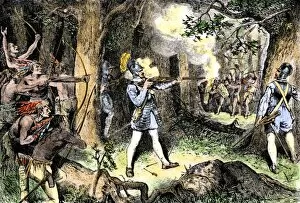
EXPL2A-00186Samuel de Champlain and his Huron Indian allies fighting the Iroquois near Lake Champlain, 1609. Hand-colored woodcut of a 19th-century illustration
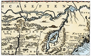
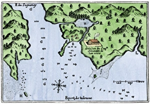
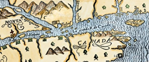
Champlains Tadoussac settlement, 1613Champlains map of Tadoussac settlement in New France, 1613. Hand-colored woodcut of a 17th-century illustration
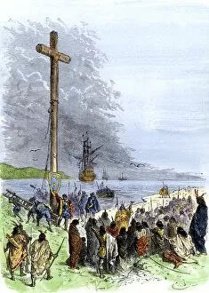
EXPL2A-00230Jacques Cartier erects a cross along the Saint Lawrence River, claiming Quebec for France, 1534. Hand-colored woodcut of a 19th-century illustration
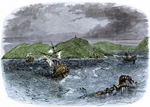
EXPL2A-00231Shipwrecks in the Strait of Belle Isle, Gulf of St Lawrence, Canada. Hand-colored woodcut of a 19th-century illustration
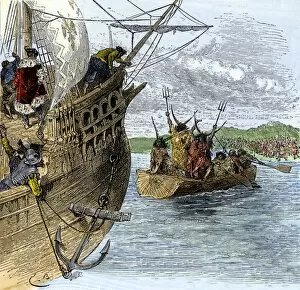
EXPL2A-00234Huron chief Donnacona warns Cartiers expedition not to sail up the St Lawrence River, 1535. Hand-colored woodcut of a 19th-century illustration
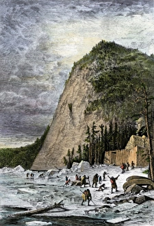
Ice-cutting in Quebec, 1850sSawing and harvesting ice on the St. Lawrence River, 1850s. Hand-colored woodcut of a 19th-century illustration
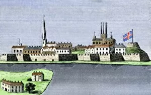
GCAN2A-00011Montreal, Canada, seen from the St. Lawrence River, 1760. Hand-colored woodcut
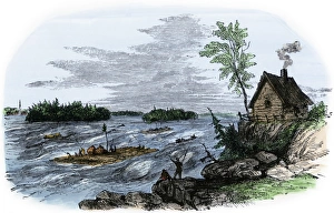
Raft transport on the St Lawrence RiverRafts on the rapids of the St Lawrence River, Canada. Hand-colored woodcut of a 19th-century illustration
Quebec and Tadoussac, 1609Lescarbots map of the St. Lawrence and the Saguenay showing Quebec (Kebec) in Canada, 1609. Hand-colored woodcut of a 19th-century illustration
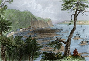
Timber ready to be shipped on the St Lawrence, 1850sTimber depot on the St Lawrence River near Quebec City, 1850s. Hand-colored engraving of a 19th-century illustration
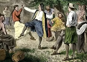
BUSN2A-00166French fur traders and Native Americans dancing at a rendezvous in the north woods. Hand-colored woodcut of a 19th-century illustration
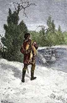
BUSN2A-00060Trapper making his winter rounds in the north wods. Hand-colored woodcut of a 19th-century illustration
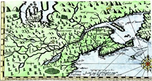
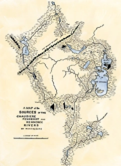
Maine map used in Arnolds invasion of Quebec, 1775Montresors map of inland Maine, used for Arnolds march to Quebec, 1775. Hand-colored woodcut of a 19th-century illustration
EXPL2A-00175Jesuit missionary preaching to Native Americans and fur traders in the wilderness. Hand-colored woodcut of a 19th-century illustration
EXPL2A-00253French Jesuit missionary in a Native American village. Hand-colored woodcut of a 19th-century illustration