mail_outline sales@mediastorehouse.com
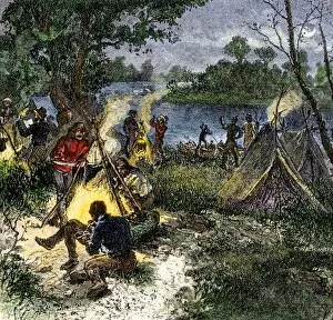
BUSN2A-00167Riverside camp of voyageurs, or French fur traders. Hand-colored woodcut of a 19th-century illustration
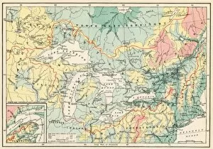
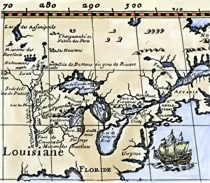
EXPL2A-00357Map of the Great Lakes and the St. Lawrence watershed. Printed color lithograph, 19th century
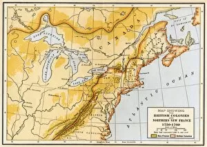
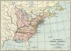
EVNT2A-00019Map showing British colonies and northern New France during the French and Indian War, 1750s. Printed color lithograph of a 19th century illustration
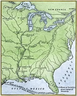
EXPL2A-00171Map showing the route of La Salles explorations in North America, late 1600s. Hand-colored woodcut of a 19th-century illustration
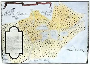
EXPL2A-00329Louis Joliets map of New France, 1673-1674, including the upper Mississippi River he and Jacques Marquette discovered. Hand-colored halftone reproduction
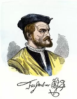
PEXP2A-00081Jacques Cartier portrait with his autograph. Hand-colored woodcut of a 19th-century illustration
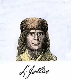
PEXP2A-00055Louis Joliet, with his autograph. Hand-colored 19th-century woodcut of an illustration
EXPL2A-00016Hennepins map of New France and Louisiana - La Carte de la Nouvelle France, 1683. Hand-colored 19th-century woodcut reproduction of the original map
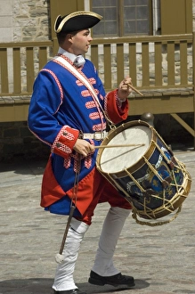
Drummer reenactor in olc QuebecColonial French army reenactor portraying a drummer in 18th-century Quebec. Digital photograph
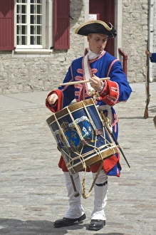
Drummer reenactor in old QuebecColonial French army reenactor portraying a drummer in 18th-century Quebec. Digital photograph
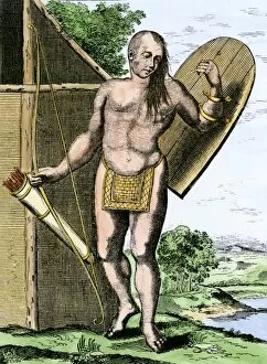
NATI2A-00149A Canadian Native American holding shield, bow, and arrows in a quiver. Hand-colored woodcut
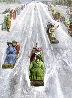
HREC2A-00035Toboggan slide in a park in Montreal, Canada, 1880s. Hand-colored woodcut of a 19th-century illustration
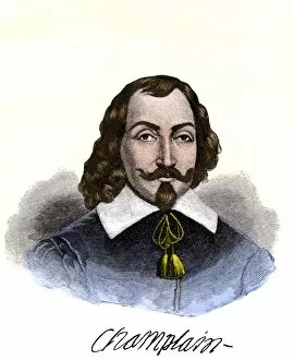
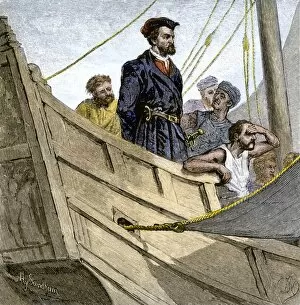
PEXP2A-00074Samuel de Champlain portrait, with his autograph. Hand-colored 19th-century engraving reproduction of the Moncornet portrait
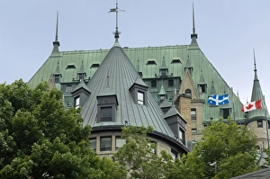
Chateau Frontenac in old QuebecChateau Frontenac in the historic district of Quebec City. Digital photograph
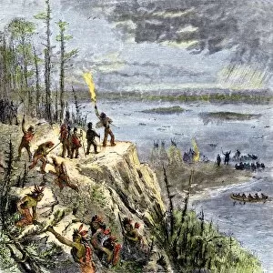
EXPL2A-00109Samuel de Champlain and his Huron allies going to fight the Iroquois, Lake Champlain, 1600s. Hand-colored woodcut of a 19th-century illustration
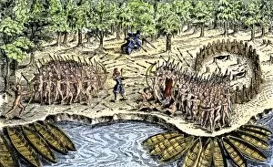
EXPL2A-00110Samuel de Champlains defeat of the Iroquois at Lake Champlain, opening the settlement of New France, 1600s. Hand-colored woodcut
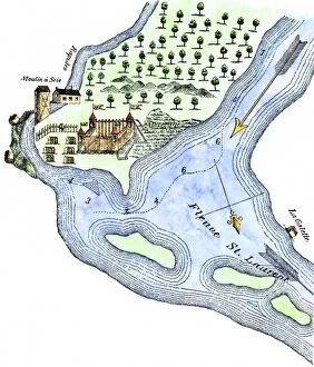
EXPL2A-00183Samuel de Champlains fortified camp at Quebec on the St Lawrence River, 1600s Hand-colored 19th-century woodcut of a 17th-century map
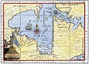
EXPL2A-00190Map of Hudsons Bay, Canada, showing Hudsons Strait, 1722. Hand-colored 19th-century woodcut reproduction of an 18th-century map
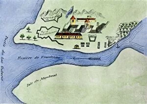
Champlains Quebec settlement, 1613Champlains settlement at Quebec in New France, 1613. Hand-colored woodcut of a 17th-century illustration
EXPL2A-00232Jacques Cartier aboard ship arriving on the shore of Canada, 1534. Hand-colored woodcut of a 19th-century illustration
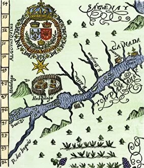
EXPL2A-00246Hochelaga, site of Montreal, shown as a Native American village in Lescarbots map, 1609. Hand-colored 19th-century woodcut reproduction of a 17th-century document
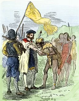
EXPL2A-00247Jacques Cartier embraced by Donnacona, a native Canadian Huron chief, Gaspee Peninsula, 1535. Hand-colored woodcut of a 19th-century illustration
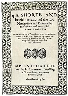
EXPL2A-00251Title page of the London edition of Jacques Cartiers book about his discoveries in Canada, printed in 1580. Watercolor wash over a 19th-century printed halftone reproduction
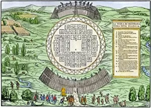
EXPL2A-00249French colonists building fort at Hochelaga, a native village and the site of Montreal, Canada, 1600s. Hand-colored halftone reproduction of a 17th-century illustration
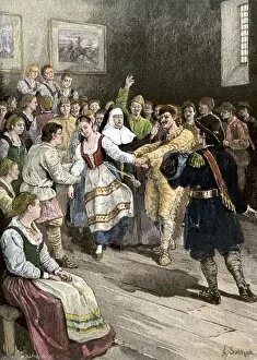
GCAN2A-00012French-Canadians enjoying a dance in early Quebec. Hand-colored woodcut of a 19th-century illustration
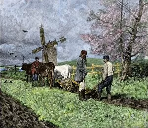
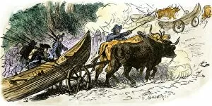
GCAN2A-00008French-Canadian farmers plowing in the Saint Lawrence valley of Quebec, 1800s. Hand colored woodcut of a 19th-century illustration
GCAN2A-00006Catholic clergyman of the Order of St. Sulpice, Quebec, Canada, circa 1700. Hand-colored woodcut of a 19th-century illustration
EXPL2A-00087Jacques Cartier on the summit of Mont Real, now Montreal, Canada, 1535. Hand-colored woodcut of a 19th-century illustration
EXPL2A-00080Capture of French Quebec by the English, 1629. Hand-colored woodcut reproduction from Hennepin 1698
EXPL2A-00058Samuel de Champlains map of the Gaspee and Gulf of the Saint Lawrence River, 1632. Hand-colored woodcut reproduction of the original map
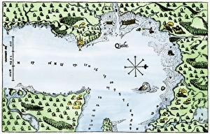
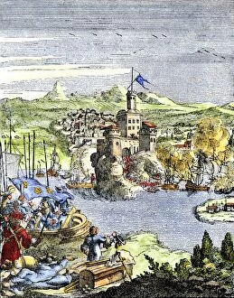
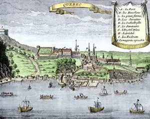
EXPL2A-00025Quebec City and the Saint Lawrence River, 1722. Hand-colored 18th-century woodcut from La Potherie
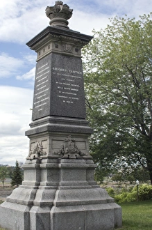
Cartier monument on the St Lawrence, QuebecMonument marking Jacques Cartiers landing place on the St Lawrence River in Quebec. Digital photograph
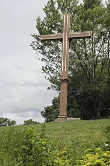
Cartiers landing place on the St Lawrence, QuebecReplica cross marking Jacques Cartiers landing place on the St Lawrence River in Quebec. Digital photograph
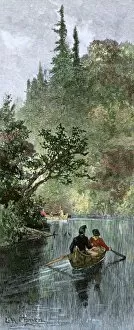
BUSN2A-00204French traders canoeing on a river in the forests of North America. Hand-colored woodcut of a 19th century illustration
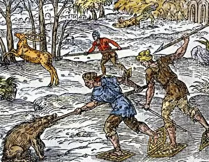
BUSN2A-00152Early settlers hunting on snowshoes in Canada. Hand-colored woodcut
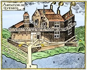
EXPL2A-00295Champlains Quebec fort, 1613, showing the dwellings (C, D), drawbridge (I), Moat (M), cannon (N), garden (O). Hand-colored 19th-century woodcut reproduction of Champlains drawing
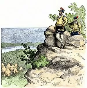
EXPL2A-00267Fort Frontenac on Lake Ontario, 1600s, at the head of the St Lawrence River, now Kingston, Ontario. Hand-colored 19th century halftone reproduction of the original map
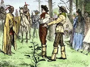
BUSN2A-00096Fur traders and Native Americans conversing in pantomine. Hand-colored woodcut of a 19th-century illustration
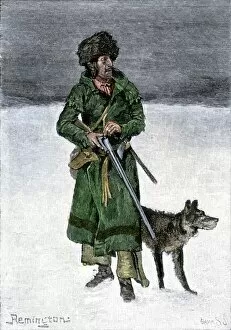
BUSN2A-00020French-Canadian trapper in the snow. Hand-colored 19th-century woodcut of a Frederic Remington illustration
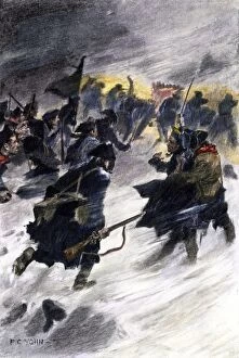
EVRV2A-00087Benedict Arnolds attack on the British in Quebec in the winter of 1775. Hand-colored halftone of a 19th-century illustration by F.C. Yohn
EVRV2A-00109Benedict Arnolds expedition through the Maine wilderness to attack Quebec, 1775. Hand-colored woodcut of a 19th-century illustration
EVRV2A-00230British North American colonies in 1776. Printed color lithograph of a 19th-century illustration