mail_outline sales@mediastorehouse.com
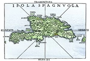
EXPL2A-00227Map of Hispaniola in 1534, from cartography of Peter Martyr and Oviedo. Hand-colored 19th-century woodcut reproduction of a 16th-century map
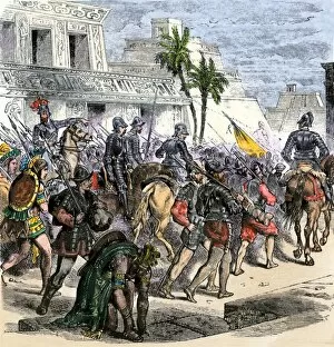
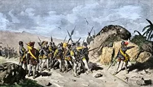
EXPL2A-00368Cortes marches out of Aztec Tenochtitlan to battle the army of Narvaez, 1519. Hand-colored woodcut of a 19th century illustration
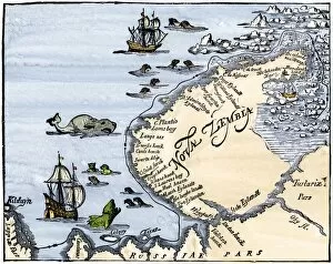
EXPL2A-00346Early map showing Nova Zembla off the Arctic coast of Russia, probably 1600s. Hand-colored 19th-century woodcut reproduction
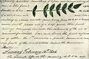
EXPL2A-00168William Clarks sketch of an evergreen shrub leaf in the Lewis and Clark expedition diary, 1806. Hand-colored halftone reproduction of a 19th-century photograph of Clarks handwritten page
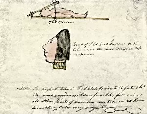
EXPL2A-00167William Clarks sketch of Flathead Indians in his diary of the Lewis and Clark expedition, 1804-1806 Hand-colored halftone reproduction of a 19th-century photograph of Clarks handwritten page
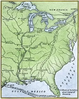
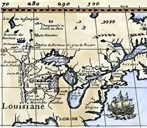
EXPL2A-00171Map showing the route of La Salles explorations in North America, late 1600s. Hand-colored woodcut of a 19th-century illustration
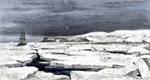
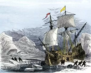
Barents Sea ice around the Eira on its first voyage, 1880Leigh Smiths " Eira" locked in ice during the ships first Arctic voyage off Spitsbergen, 1880. Hand-colored woodcut of a 19th-century illustration
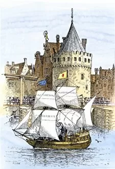
EXPL2A-00189Hudsons ship " Half-Moon" leaving Amsterdam for the New World, 1609. Hand-colored woodcut of a 19th-century illustration
EXPL2A-00197Hudsons map of his voyages in the Arctic, published in 1612. Hand-colored 19th-century reproduction of a woodcut from Hudsons " Voyages" published in 1612
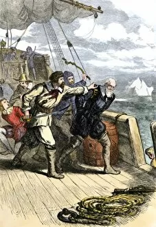
EXPL2A-00198Mutineers send Henry Hudson and his son overboard to die adrift in a small boat in the Arctic 1611. Hand-colored woodcut of a 19th-century illustration
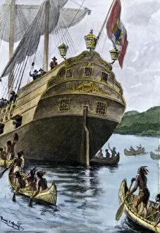
EXPL2A-00209Henry Hudsons ship " Half Moon" arriving at Manhattan Island, 1609. Hand-colored halftone of a 19th-century illustration
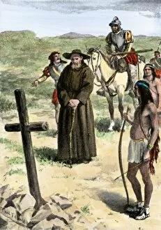
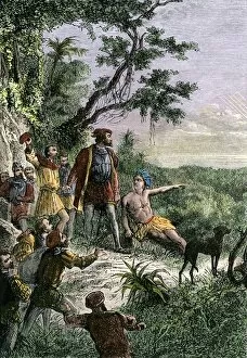
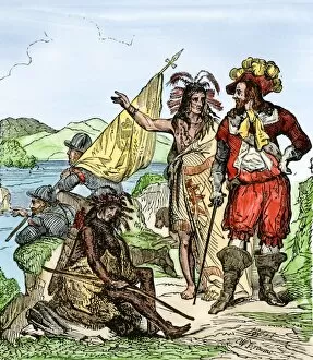
EXPL2A-00211Father Juan de Padilla finds the cross set by Coronado, 1540s. Hand-colored halftone of a 19th-century illustration
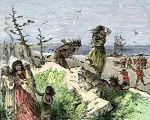
EXPL2A-00213Henry Hudsons attack on a Native American village on the Atlantic coast, 1609. Hand colored woodcut of a 19th-century illustration
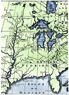
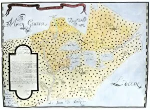
EXPL2A-00218French missionary Louis Hennepins map of the Mississippi River valley, Gulf Coast, and Great Lakes after LaSalle expeditions 1697
Virginia and North Carolina coast, 1500sJohn Whites map of the Atlantic coast of North Carolina and Virginia, 1500s. Hand-colored 19th-century woodcut reproduction
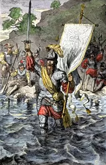
EXPL2A-00222Vasco Nunez de Balboa discovering the Pacific Ocean, 1513. Hand-colored woodcut of a 19th century illustration
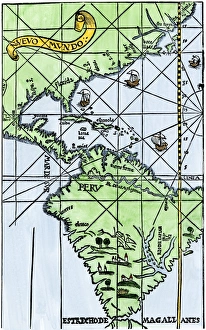
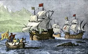
South America mapped after Magellans voyage, 1519New World map after Magellans passage around Cape Horn in 1519. Hand-colored woodcut of a 19th century illustration
EXPL2A-00235Balboa raising his sword to claim the Pacific Ocean for Spain, 1513. Hand-colored woodcut of a 19th-century illustration
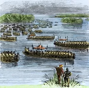
EXPL2A-00258De Sotos expedition met by Chief Aquixos Native Americans in canoes on the Mississippi River, 1542. Hand-colored woodcut of a 19th-century illustration
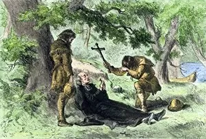
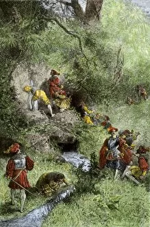
EXPL2A-00257Death of Father Marquette in Michigan, returning from a mission to the Ilinois Indians, 1675. Hand-colored woodcut of a 19th-century illustration
EXPL2A-00260De Soto discovering the Mississippi River after an overland journey, 1540. Hand-colored woodcut of a 19th century illustration
EXPL2A-00263Juan Ponce de Leons expedition searching for the Fountain of Youth in Florida, 1500s. Hand-colored woodcut of a 19th-century illustration
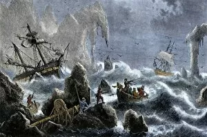
EXPL2A-00271Vitus Berings Russian expedition ships wrecked upon the Aleutian Isles. 1741. Hand-colored woodcut of a 19th-century illustration
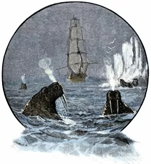
EXPL2A-00285Walrus in Arctic waters near a tall sailing ship. Hand-colored woodcut of a 19th-century illustration
EXPL2A-00286Willem Barents expedition in Arctic ice at Nova Zembla searching for a northeast passage, 1500s. Hand-colored woodcut of a 19th-century illustration
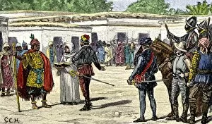
EXPL2A-00293Francisco Pizarro draws a line in the sand in Panama daring his men to follow him to Peru, 1530. Hand-colored woodcut of a 19th-century illustration
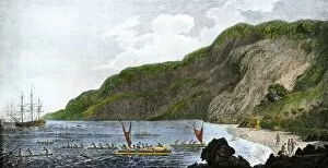
EXPL2A-00316Captain James Cook, discoverer of the Sandwich Islands, with his ships in Kealakekua Bay, where he was killed by natives in 1779. Hand-colored halftone reproduction of a painting
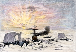
Borchgrevink in the Antarctic, 1894Carsten Borchgrevinks ship in the midnight sun on Christmas Eve in Antarctica, 1894. Hand-colored woodcut of a 19th-century illustration
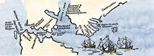
EXPL2A-00329Louis Joliets map of New France, 1673-1674, including the upper Mississippi River he and Jacques Marquette discovered. Hand-colored halftone reproduction
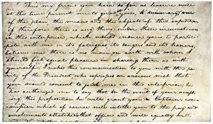
William Clarks invitation from Meriwether Lewis, 1804Meriwether Lewiss letter inviting William Clark to join the expedition to explore the Louisiana Territory. Printed halftone reproduction with a watercolor wash
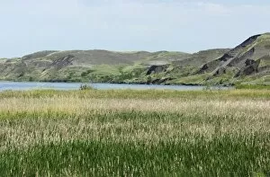
EXPL2D-00028Missouri River where Lewis and Clark had their first meeting with the Sioux Nation, near Pierre, South Dakota, 1804. Digital photograph
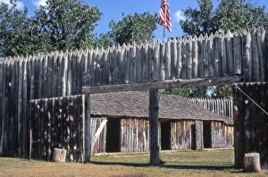
EXPL2P-00037Fort Mandan, reconstructed Lewis and Clark campsite on Missouri River, North Dakota. Photograph
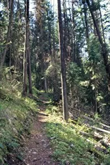
EXPL2P-00061Lewis and Clark trail over Lolo Pass, Bitterroot Mountains, Montana. Photograph
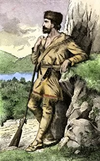
PEXP2A-00004Daniel Boone in the Kentucky wilderness. Hand-colored woodcut of a 19th-century illustration
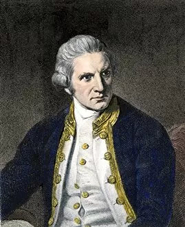
PEXP2A-00113Captain James Cook. Hand-colored woodcut of a painting
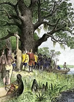
EXPL2A-00118LaSalle at the mouth of the Mississippi River claims Louisiana for France 1682. Hand-colored woodcut of a 19th-century illustration
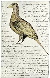
EXPL2A-00117Sketch by William Clark of Cock of the Plains in the Lewis and Clark expedition diary. Hand-colored halftone of a 19th-century reproduction of the diary
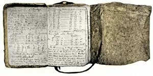
EXPL2A-00116Diary kept by William Clark of the Lewis and Clark expedition 1804 - 1806. Hand-colored halftone of a 19th-century reproduction of the diary
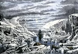
EXPL2A-00106Arctic icebergs surrounding a sailing ship. Hand-colored woodcut of a 19th-century illustration
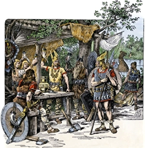
Vikings in the New WorldNorsemen celebrating their discovery of the New World. Hand-colored woodcut of a 19th-century illustration
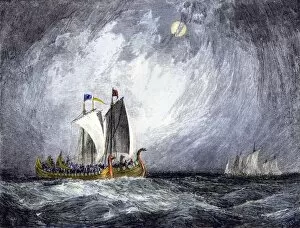
EXPL2A-00103Fleet of Viking ships at sea. Hand colored woodcut of a 19th-century illustration
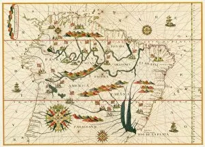
EXPL2A-00026Map of South America, from Sebastian Cabots map of the world, 1544. Hand colored 19th-century woodcut reproduction of the original map
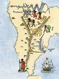
EXPL2A-00021Map of South America from the Spanish atlas executed at Messina in 1582 by Joan Martines. Printed color lithograph reproduction 19th century
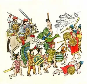
EXPL2A-00019Battles of the Spanish conquistadors in Mexico, 1500s. Hand-colored woodcut from an Aztec drawing
EXPL2A-00016Hennepins map of New France and Louisiana - La Carte de la Nouvelle France, 1683. Hand-colored 19th-century woodcut reproduction of the original map
EXPL2A-00015Meeting between Spanish conqueror Pizarro and Inca leader Atahualpa. Hand-colored woodcut of a 19th-century illustration
EXPL2A-00010Columbus expedition coasting along the northern shore of Cuba. Hand-colored woodcut of a 19th-century illustration
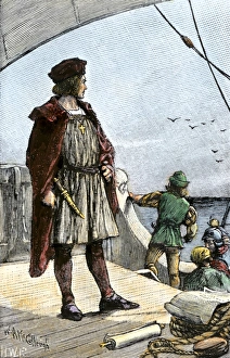
EXPL3A-00008Columbus watching for land from the deck of the caravel Santa Maria, 1492. Hand-colored woodcut of a 19th-century illustration