mail_outline sales@mediastorehouse.com
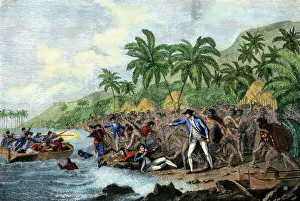
Captain Cook killed by Hawaiian natives, 1779Death of English explorer Captain James Cook in the Sandwich Islands (Hawaii), 1779. Hand-colored woodcut reproduction of a painting
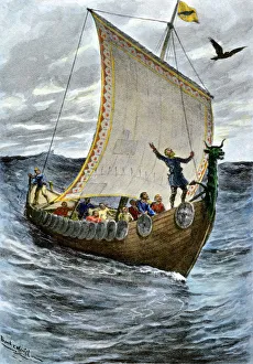
Viking ship at seaNorsemen at sea following their raven pilot. Hand-colored halftone reproduction of a 19th-century illustration
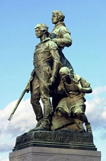
PEXP2D-00013Explorers Meriwether Lewis and William Clark with their Native American guide Sacagawea. Digital photograph of a bronze statue in Charlottesville Virginia
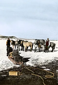
Shackletons Manchurian ponies, Antarctica, 1908Manchurian ponies used by Shackleton in the Antarctic, 1908-09. Hand-colored halftone reproduction of a photograph
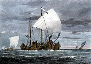
Fleet of Viking raiders in the Middle AgesViking ships at sea with warriors on board. Hand-colored woodcut of a 19th-century illustration
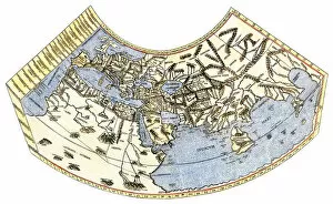
EXPL2A-00014Ptolemys map of the world, illustrating a concept of the flat earth. Hand-colored 19th-century woodcut reproduction
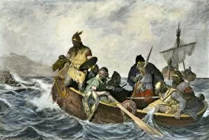
EXPL2A-00034Leif Erikssen off the coast of Vineland in a Viking landing boat. Hand-colored photogravure of a 19th-century illustration
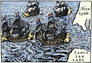
Dutch ships in the Arctic, 1600sDutch ships of Henry Hudsons time near Novaya Zemlya, early 1600s. Hand-colored 19th-century woodcut reproduction of an earlier illustration
Schwatkas discovery of Franklin expedition grave, 1880Grave of Franklin Expedition member Lt. John Irving found by Schwatkas American search party in Greenland, 1880. Hand-colored woodcut of a 19th century illustration
EXPL2A-00128Landing of Jean Nicolet on the Wisconsin shore of Lake Michigan, 1634, the first European to reach that region. Hand-colored halftone of a 19th-century illustration
Native Americans meet Lewis and Clark at Council BluffsLewis and Clark meeting with Native Americans at Council Bluffs, Iowa. Hand-colored woodcut by Patrick Goss, a member of the expedition
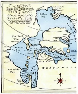
EXPL2A-00284Early map of Hudsons Strait and Hudsons Bay, 1662, in Arctic Canada. Hand-colored 19th-century woodcut reproduction
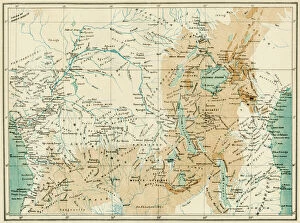
EXPL2A-00366Map of equatorial Africa as known in the 1870s. Printed color lithograph, 19th century
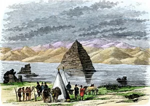
EXPL2A-00169John C. Fremonts second western expedition at Pyramid Lake, Nevada, 1842-1843. Hand-colored woodcut of a 19th-century illustration
EXPL2A-00184Part of the 1613 Samuel de Champlain map of New France. Hand-colored woodcut of a 19th-century reproduction of the original ma
Florida explored by De Soto, 1539Bivouac of De Sotos expedition in the Florida wilderness, 1539. Hand-colored woodcut of a 19th-century illustration
Archaeological excavation on the Acropolis, 1890sArchaeologists excavating ancient ruins on the Acropolis, Athens, 1890s. Hand-colored woodcut of a 19th-century illustration
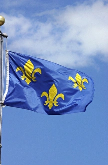
Flag of France, 1700sFrench flag marking La Verendrye expeditions claim of the northern Great Plains for France in 1743, Pierre, South Dakota. Digital photograph
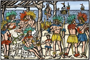
Brazilian cannibalism, 1500sNatives eating and cooking human flesh, northern Brazil, circa 1500. Hand-colored woodcut reproduction of a 16th-century illustration
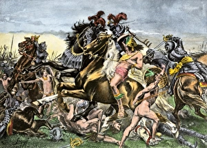
Incas battling Spanish conquistadors in PeruManco Inca Yupanqui leads attack on the Spanish in Cusco, Peru, 1536. Hand-colored halftone reproduction of a 19th-century illustration
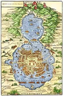
EXPL2A-00294Tenochtitlan, capital city of Aztec Mexico, an Island connected by causeways to land, 1520s. Hand-colored 19th-century woodcut reproduction of an early Spanish colonial map
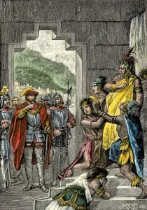
Inca leader Atahualpa sentenced to execution, 1533Spanish conqueror Pizarro orders the Inca ruler Atahualpa to be led instantly to execution in Peru, 1533. Hand-colored woodcut of a 19th-century illustration
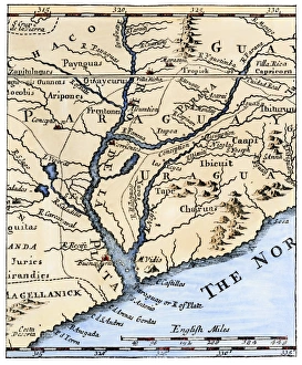
Rio de la Plata, 1698Mouth of the Rio de la Plata in South America, in a map of 1698. Hand-colored woodcut of a 19th-century illustration
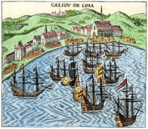
Callao, Peru, under Spanish rule, 1620Spanish colonial port of Callao, Peru, circa 1620. Hand-colored woodcut reproduction of a 17th-century illustration
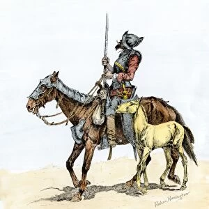
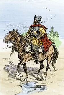
EXPL2A-00173Spanish conquistador on a horse with foal - the origin of the horse in colonial America. Hand-colored woodcut of a 19th-century Frederic Remington illustration
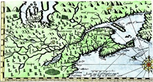
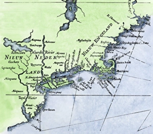
Dutch map of New Netherland and New EnglandNew Netherland and New England, circa 1630. Hand-colored 19th-century woodcut reproduction of DeLaets map
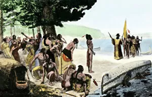
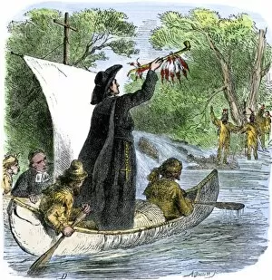
EXPL2A-00194Father Jacques Marquette holding a peace pipe to greet Native Americans during his journey to the upper Mississippi River, 1673. Hand-colored woodcut of a 19th-century illustration
DeSoto expedition retreating down the Mississippi, 1542Spaniards descending Mississippi River after De Sotos death, 1542. Hand-colored woodcut of a 19th-century illustration
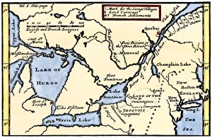
French map of the Great Lakes, 1703La Hontans map of the Great Lakes and Saint Lawrence valley, 1703. Hand-colored 19th-century woodcut reproduction of an 18th century illustration
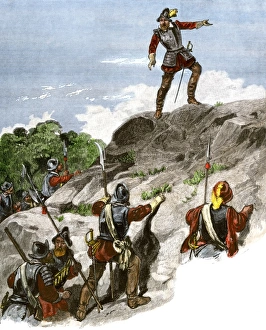
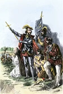
Balboa discovering the Pacific, 1513Spanish expedition under Balboa discovering the Pacific Ocean, 1513. Hand-colored woodcut of a 19th-century illustration
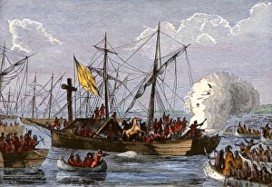
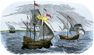
EXPL2A-00226Spanish ships of Hernando Cortes sailing to Mexico, 1519. Hand-colored woodcut of a 19th-century illustration
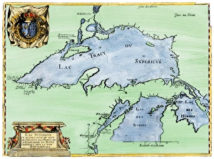
French settlement of the Great Lakes, 1600sFrench Jesuit map of Lake Superior, Upper Michigan, and Wisconsin, 1600s. Hand-colored woodcut of a 17th-century illustration
EXPL2A-00245Spanish conquistador in armor on horseback, New Spain, 1500s. Hand-colored woodcut of a 19th-century illustration
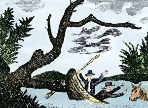
EXPL2A-00269Meriwether Lewis and William Clark expedition losing notes and specimens in a canoe accident on the upper Missouri River. Hand-colored woodcut reproduction of sketch by Patrick Goss
EXPL2A-00268Magellans ships at Mactan, an island in the Philippines, where Magellan was killed in a battle with natives, 1521. Hand-colored 19th-century halftone reproduction of a 16th-century engraving
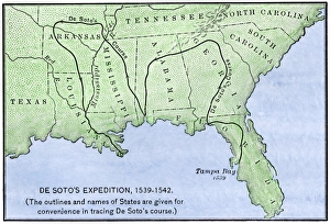
Map of DeSotos route, 1540sDe Soto expeditions route across southeast North America, 1539-1542. Hand-colored woodcut of a 19th-century illustration
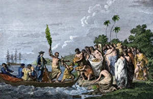
Captain Cook landing on a South Pacific island, 1770sJames Cook landing in the Friendly Islands, greeted by Tonga natives bearing fruit, 1770s. Hand-colored engraving of a 19th-century illustration
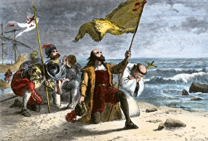
Columbus landing in the New World, 1492First landing of Columbus in the New World, 1492. Hand-colored woodcut of a 19th-century illustration
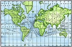
Great voyages of the age of explorationMap of great voyages from 1492 to 1580. Hand-colored woodcut of a 19th-century illustration
Borchgrevink expedition landing on Antarctica, 1894Carsten Borchgrevink making the first landing on Victoria Land, Antarctica, 1894. Hand-colored halftone reproduction of a 19th-century illustration
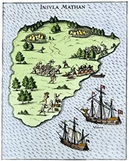
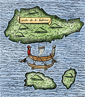
Mariana Islands in the Pacific discovered by Magellan, 1521The Ladrones, later called the Marianas, and a native outrigger drawn by Pigafetta on the Magellan expedition, 1521. Hand-colored woodcut reproduction of a 16th-century illustration
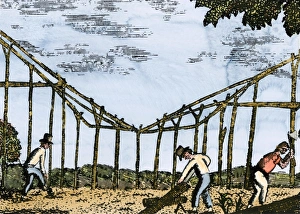
Fort Mandan constructed by Lewis and Clark, 1803Lewis and Clark expedition overwintering along the Missouri River near a Mandan village, 1803-1804. Hand-colored woodcut of a Patrick Goss drawing, a member of the expedition
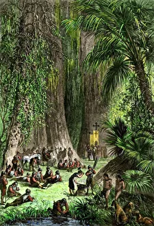
St. Augustine, Florida, founded by Menendez de AvilesPedro Menendez de Aviles laying out Saint Augustine, Florida, 1565. Hand-colored woodcut of a 19th-century illustration
EXPL2A-00123Spanish explorer Hernando De Soto discovering the Mississippi River, 1540. Hand-colored engraving of a 19th-century illustration
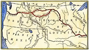
EXPL2A-00035Map of the Lewis and Clark route across Louisiana Territory, 1804-1806. Hand-colored woodcut of a 19th-century illustration
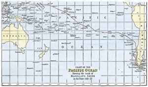
Magellans route across the PacificRoute of Magellans ships across the Pacific while circumnavigating the earth, 1519-1522. Hand-colored woodcut of a 19th-century illustration
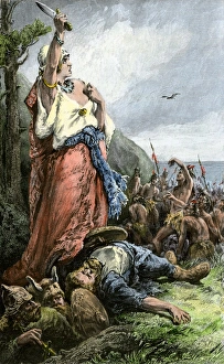
Vikings battling natives on the coast of VinlandFreydis defends her fellow Norse settlers from Native Americans, or Skraelings, 1009. Hand-colored woodcut of a 19th-century illustration
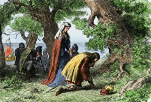
Vikings discovering VinlandNorse settlers Thorfin and Gudrida landing on Vinland. Hand-colored woodcut of a 19th-century illustration