mail_outline sales@mediastorehouse.com
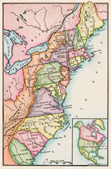
Thirteen original colonies in 1776American colonies at the outbreak of the Revolution. Printed color lithograph of a 19th-century illustration
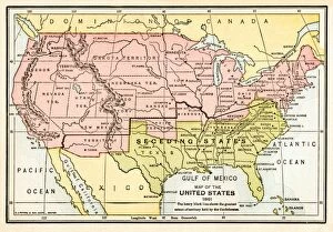
EVCW2A-00100US map showing seceding states by date, American Civil War, 1860 and 1861. Printed color lithograph 19th century
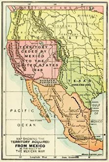
U. S. territory gained from MexicoMap of territory acquired by the U.S. from Mexico. Color lithograph of a 19th-century illustration
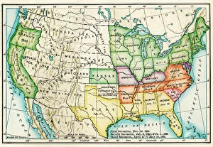
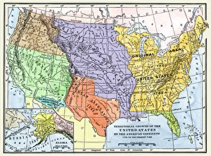
Growth of the United States to 1853U.S. map, showing territorial growth to 1853. Printed color lithograph of a 19th-century illustration
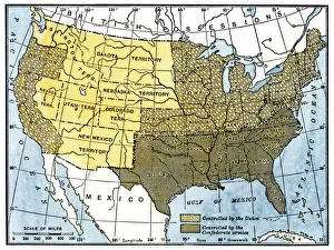
Civil War territory map, 1861Map showing Confederate-held territory at the end of 1861. Hand-colored woodcut of a 19th-century illustration
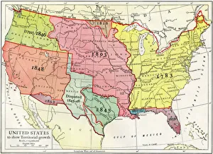
US territorial acquisition during the 1800sMap showiing the territorial growth of the continental US 1776 to 1899. Hand-colored woodcut of a 19th-century illustration
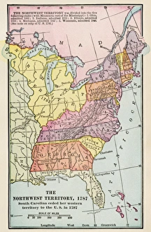
Northwest Territory mapMap of the old Northwest Territory, 1787. Printed color lithograph of a 19th-century illustration
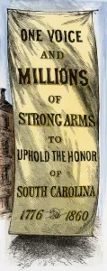
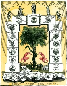
Secession banner in Charleston, 1860Street banner in Charleston, South Carolina, during the session convention, 1860. Hand-colored woodcut of a 19th-century illustration
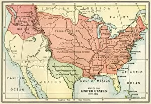
EXPL2A-00038Map of the U.S. boundary disputes with Spain and Great Britain, 1810-1812. Printed color lithograph of a 19th-century illustration
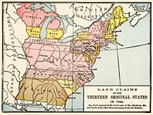
EXPL2A-00191Map showing land claims of the 13 original states in 1783. Printed color lithograph of a 19th-century illustration
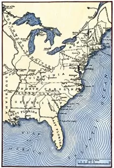
EVRV2A-00174Map showing the thirteen colonies which joined together as the original thirteen states in 1776. Hand-colored woodcut of a 19th-century illustration
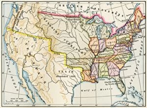
EXPL2A-00022Map of the United States in 1819, showing territory under Spanish and British control. Printed color halftone of a 19th-century illustration
EVCW2A-000116Banner of the Secession Convention in Charleston, South Carolina, 1860. Hand-colored woodcut of a 19th century illustration
EVCW2A-00009Map of the United States in 1861, at the start of the Civil War. Printed color lithograph 19th century