mail_outline sales@mediastorehouse.com
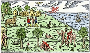
Early depiction of Brazil in the Age of DiscoveryBrazil coast, natives, and New World flora and fauna as known in 1586. Hand-colored woodcut from De Lery
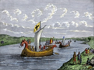
Viking explorers on the North American coastViking settlers exploring the North American coast. Hand-colored woodcut of a 19th-century illustration
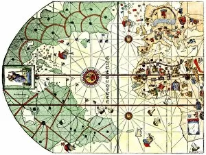
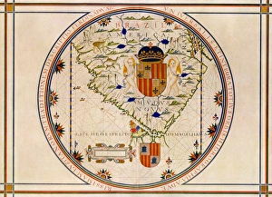
EXPL2A-00024Map of the Atlantic with the New World coast, drawn in 1500 by Juan de la Cosa, Columbus pilot. Hand colored 19th-century woodcut reproduction of the original chart
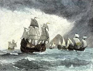
EXPL2A-00020Ships of Ferdinand Magellan rounding Tierra del Fuego to circumnavigate the earth 1519 to 1521. Hand-colored woodcut of a 19th-century illustration
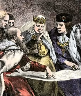
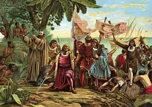
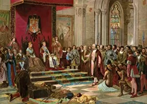
EXPL2A-00018Columbus showing a map to Ferdinand and Isabella of Spain. Hand-colored woodcut of a 19th-century illustration
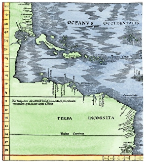
Early map of the New World, 1513Tabula Terre Nove 1513: the Admirals Map of the Caribbean and Terra Incognita (unknown lands). Hand-colored woodcut reproduction
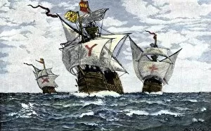
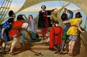
EXPL2A-00009Three ships of Columbus approaching the New World, 1492. Hand-colored woodcut of a 19th-century illustration
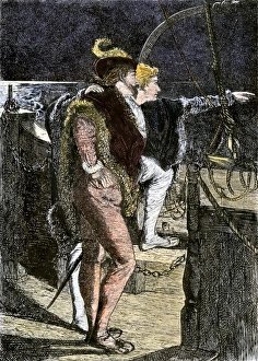
Columbus first sighting the New WorldColumbus getting his first sight of the New World from the deck of the Santa Maria, 1492. Hand-colored woodcut of a 19th-century illustration
EXPL2A-00006Columbuss hospitable reception by Guacanagari, Caribbean chief, after shipwreck of Santa Maria, 1492. Hand-colored woodcut of a 19th-century illustration
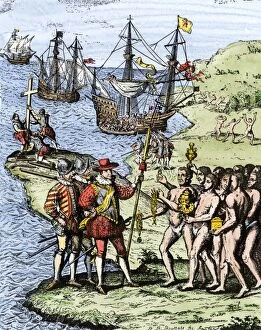
EXPL2A-00004Expedition of Christopher Columbus landing at Hispaniola, 1492. Hand-colored woodcut of a 19th-century illustration
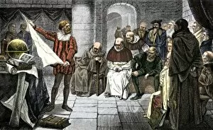
EXPL2A-00001Christopher Columbus promoting his ideas before the Council at Salamanca. Hand-colored woodcut of a 19th-century illustration
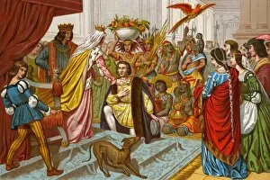
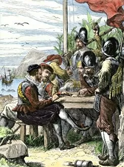
EXPL2A-00057Columbus bringing gifts from the New World to Queen Isabella of Spain 1492. Printed color lithograph of a 19th-century illustration
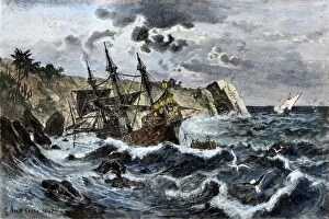
EXPL2A-00036Wreck of Columbuss flagship Santa Maria on the coast of Hispaniola, 1492. Hand-colored woodcut of a 19th-century illustration
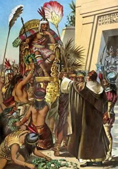
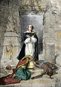
EXPL2A-00030Missionary Father Valverde addresses the Inca king Atahualpa during the Spanish conquest of Peru, 1532. Printed color lithograph of a 19th-century illustration
EXPL2A-00066Landing of Columbus expedition on the island of Guanahane in 1492. Printed color lithograph of a 19th-century painting by Dioscoro Puebla
Portuguese map of the tip of South America, 1571Map of South America printed in Lisbon, 1571. Printed color halftone reproduction
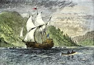
EXPL2A-00091Henry Hudsons ship " Half-Moon" ascending the Hudson River, 1609. Hand-colored woodcut of a 19th-century illustration
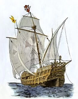
EXPL2A-00089Caravel " Santa Maria, " the flagship of Columbus first voyage and which sank off Hispaniola in 1492. Hand-colored woodcut of a 19th-century illustration
EXPL2A-00070Columbus greeted by King Ferdinand and Queen Isabella upon his return to Spain from the New World. Color lithograph of a 19th-century painting by Ricardo Balaca
EXPL2A-00084Bartholomew Columbuss cruel destruction of native villages on Hispaniola. Hand-colored woodcut of a 19th-century illustration
EXPL2A-00055First view of the New World by Columbus and his crew aboard the " Santa Maria, " 1492. Printed color lithograph of a 19th-century illustration
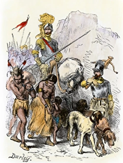
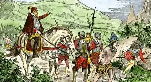
DeSoto with Native American captives, 1539De Soto expedition traveling with captive Native Americans, 1539. Hand-colored woodcut reproduction of a 19th-century Darley illustration
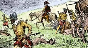
EXPL2A-00153Spanish conquistadors using Native American captives to carry burdens. Hand-colored woodcut of a 19th-century illustration
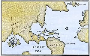
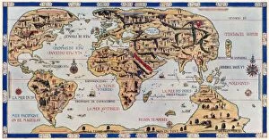
EXPL2A-00147World map after the disoveries of Columbus and Balboa, showing the prevalent idea that South America was attached to Asia. Hand-colored woodcut of a 19th-century illustration
Columbus encountering an iguana when he was ashore in the New World. Hand-colored woodcut of a 19th-century illustration
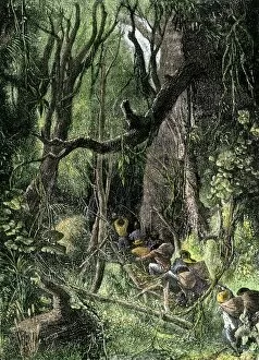
EXPL2A-00130Exploring a tropical rain forest, such as in Central or South America. Hand-colored woodcut of a 19th-century illustration
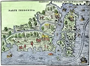
EXPL2A-00126Map of New France, 1550, showing the coast of Canada and the Gulf of Saint Lawrence Hand-colored woodcut
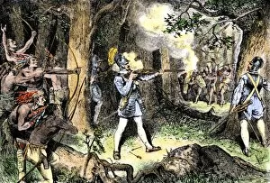
EXPL2A-00186Samuel de Champlain and his Huron Indian allies fighting the Iroquois near Lake Champlain, 1609. Hand-colored woodcut of a 19th-century illustration
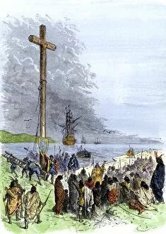
EXPL2A-00230Jacques Cartier erects a cross along the Saint Lawrence River, claiming Quebec for France, 1534. Hand-colored woodcut of a 19th-century illustration
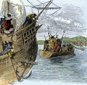
EXPL2A-00234Huron chief Donnacona warns Cartiers expedition not to sail up the St Lawrence River, 1535. Hand-colored woodcut of a 19th-century illustration
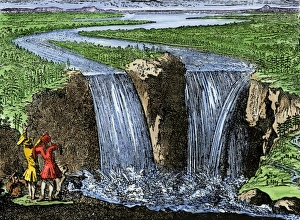
La Salle at Niagara Falls, 1669French explorer La Salle at Niagara Falls, 1669. Hand-colored woodcut of a 19th-century illustration
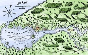
EXPL2A-00297Champlains 1613 map of his settlement at Port Royal, now Annapolis Royal, Nova Scotia, Canada. Hand-colored 19th-century woodcut reproduction of Champlains drawing
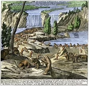
EXPL2A-00356Beavers at work below Niagara Falls, early 1700s. Hand-colored woodcut from Molls New and Exact Map
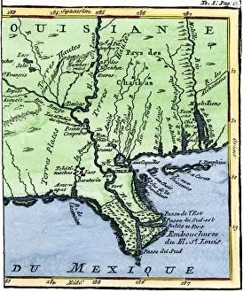
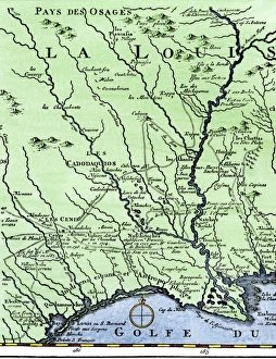
EXPL2A-00302Map of Louisiana, 1744, showing the mouths of the Mississippi River while part of New France. Hand-colored woodcut reproduction of the map
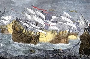
EXPL2A-00075Seizure of Spanish treasure ships by the English fleet of Sir Francis Drake. Hand-colored woodcut of a 19th-century illustration
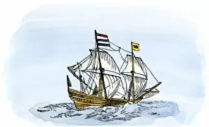
EXPL2A-00188One of Henry Hudsons ships, early 1600s. Hand-colored 19th-century reproduction of a woodcut from Hudsons " Voyages" published in 1612
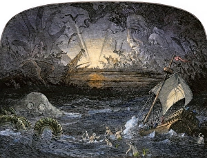
Sea of DarknessTerrors in the Sea of Darkness. Hand-colored woodcut of a 19th-century illustration
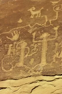
NATI2D-00218Anasazi / Ancestral Puebloan petroglyphs of " whipping kachinas" at Mesa Verde National Park, Colorado. Digital photograph
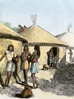
Moundbuilder village lifeLife among the Moundbuilders. Hand-colored woodcut of a 19th-century illustration
DeSotos route in LouisianaWestern part of De Sotos route, from Desisles map published in 1707. Hand-colored woodcut reproduction of an 18th-century illustration
EXPL2A-00354Dauphin Map by Pierre Desceliers made for Prince Henry (who became Henri II) by order of the French King Francis I, 1546. Printed color halftone reproduction 19th century
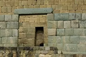
NATL2D-00007Doorways leading to Inca Temple of the Sun at Ingapirca in the Andes Mountains, Ecuador. Digital photograph
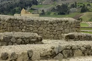
NATL2D-00009Ruins of Inca city and Temple of the Sun at Ingapirca in the Andes Mountains, Ecuador. Digital photograph
PEXP2A-00023Walter Raleigh and his expedition at Trinidad, off South America, 1595. Hand-colored woodcut of a 19th-century illustration
PEXP2A-00047Bartolome de Las Casas protecting the Aztecs from Spanish conquerors. Hand-colored woodcut of a 19th-century illustration
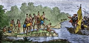
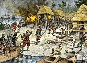
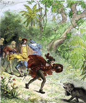
PEXP2A-00069Nicolas de Ovandos army on Hispaniola setting out for Xaragua, 1500s. Hand-colored woodcut of a 19th-century illustration
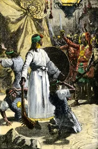
Inca king Huascar overthrown by AtahualpaMurder of Inca ruler Huascar by order of Inca Atahualpa. Hand-colored woodcut of a 19th-century illustration
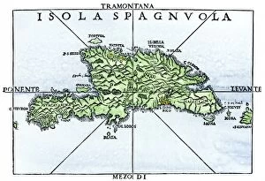
EXPL2A-00227Map of Hispaniola in 1534, from cartography of Peter Martyr and Oviedo. Hand-colored 19th-century woodcut reproduction of a 16th-century map