mail_outline sales@mediastorehouse.com
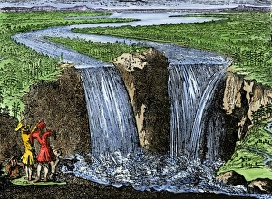
La Salle at Niagara Falls, 1669French explorer La Salle at Niagara Falls, 1669. Hand-colored woodcut of a 19th-century illustration
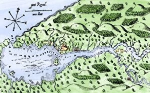
EXPL2A-00297Champlains 1613 map of his settlement at Port Royal, now Annapolis Royal, Nova Scotia, Canada. Hand-colored 19th-century woodcut reproduction of Champlains drawing
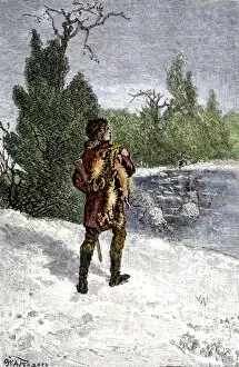
BUSN2A-00060Trapper making his winter rounds in the north wods. Hand-colored woodcut of a 19th-century illustration
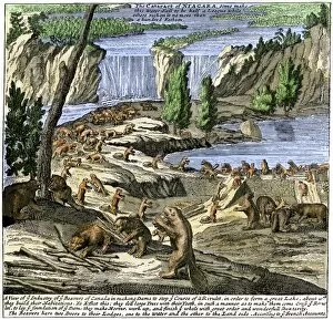
EXPL2A-00356Beavers at work below Niagara Falls, early 1700s. Hand-colored woodcut from Molls New and Exact Map
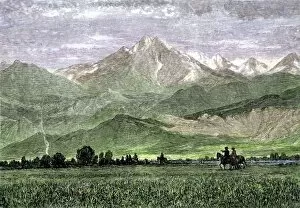
EXPL2A-00250Rocky Mountains with horseback riders in a valley, titled " Kingdom of the West Wind." Hand-colored woodcut of a 19th-century painting
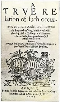
EXPL2A-00237Title page of John Smiths book, " A True Relation... in Virginia... " 1608. Hand-colored 19th-century reproduction of the original document
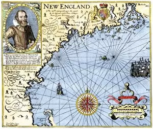
EXPL2A-00291John Smiths map of New England, with inset portrait, circa 1620. Hand-colored 19th-century woodcut reproduction of the original
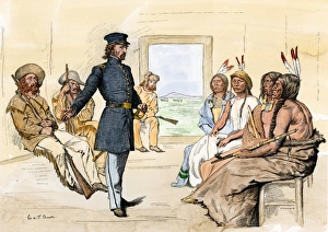
John C. Fremont meeting Plains chiefs at Fort Laramie, 1840sJohn C. Fremont meeting with Native Americans at Fort Laramie, 1840s. Hand-colored woodcut of a 19th-century illustration
EXPL2A-00292Destruction of John Smiths ship by the Spanish, ending his New England venture. Hand-colored woodcut of a 19th-century illustration
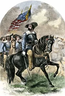
PEXP2A-00043General John C. Fremont in his prairie uniform leading an expedition into western territory. Hand-colored woodcut of a 19th-century illustration
Sir Richard Burton exploring Lake Tanganika, 1858Sir Richard Burton exploring Lake Tanganika, east Africa, 1858. Hand-colored woodcut of a 19th-century illustration
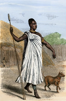
Mutesa I, King of Uganda, as described by John Henning Speke. Hand-colored woodcut from Spekes Journal, 1864
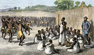
Speke entertained by the King of Uganda, 1861King Mutesa I of Uganda reviewing his troops, a woodcut from Spekes journal, 1864. Hand-colored woodcut of a 19th-century illustration
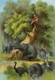
Henry Stanley in AfricaAfrican explorer Henry Stanley attacked by elephants, 1870s. Color lithograph of a 19th-century illustration from Stanleys book, " In Darkest Africa"
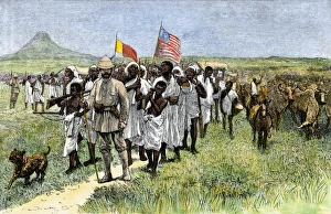
Henry Stanley leading an African expedition, 1870sStanleys expedition marching toward Muta Nzege near Mount Ruwenzori, 1870s. Hand-colored woodcut of a 19th-century illustration
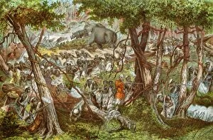
EXPL2A-00204Henry Stanleys expedition dragging a boat around rapids on the Congo river in Africa 1870s. Printed color lithograph of a 19th-century illustration
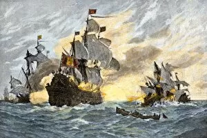
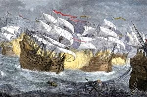
EXPL2A-00075Seizure of Spanish treasure ships by the English fleet of Sir Francis Drake. Hand-colored woodcut of a 19th-century illustration
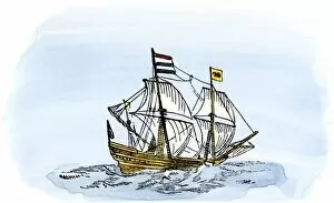
EXPL2A-00188One of Henry Hudsons ships, early 1600s. Hand-colored 19th-century reproduction of a woodcut from Hudsons " Voyages" published in 1612
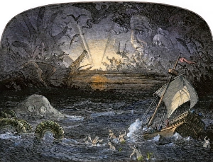
Sea of DarknessTerrors in the Sea of Darkness. Hand-colored woodcut of a 19th-century illustration
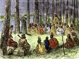
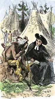
EXPL2A-00175Jesuit missionary preaching to Native Americans and fur traders in the wilderness. Hand-colored woodcut of a 19th-century illustration
EXPL2A-00253French Jesuit missionary in a Native American village. Hand-colored woodcut of a 19th-century illustration
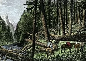
BUSN2A-00066Pack train of traders in the Rocky Mountains, 1800s. Hand-colored woodcut of a 19th-century illustration
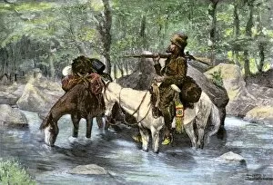
BUSN2A-00036A white trapper crossing a mountain stream. Hand-colored 19th-century woodcut of a Frederic Remington Illustration
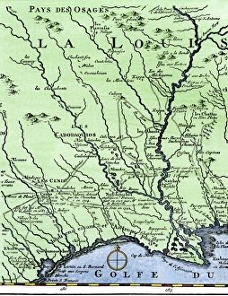
DeSotos route in LouisianaWestern part of De Sotos route, from Desisles map published in 1707. Hand-colored woodcut reproduction of an 18th-century illustration
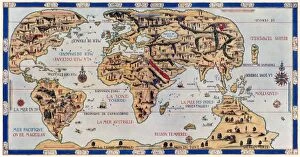
EXPL2A-00354Dauphin Map by Pierre Desceliers made for Prince Henry (who became Henri II) by order of the French King Francis I, 1546. Printed color halftone reproduction 19th century
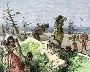
PEXP2A-00069Nicolas de Ovandos army on Hispaniola setting out for Xaragua, 1500s. Hand-colored woodcut of a 19th-century illustration
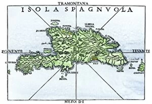
EXPL2A-00227Map of Hispaniola in 1534, from cartography of Peter Martyr and Oviedo. Hand-colored 19th-century woodcut reproduction of a 16th-century map
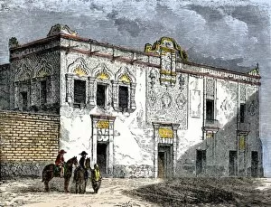
EXPL2A-00276House of Hernando Cortes in Mexico City, built by native labor in the 1500s. Hand-colored woodcut of a 19th-century illustration
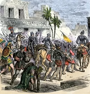
EXPL2A-00368Cortes marches out of Aztec Tenochtitlan to battle the army of Narvaez, 1519. Hand-colored woodcut of a 19th century illustration
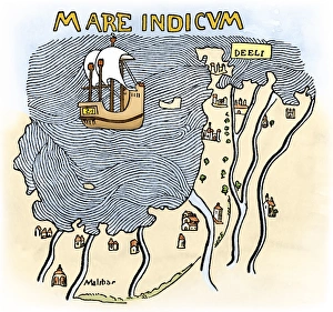
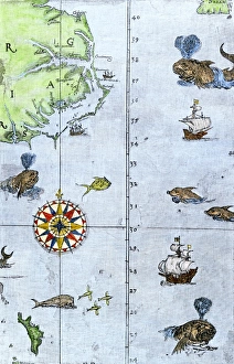
India coast, 1459The Malabar coast of India, from Fra Mauros map, 1459 (south is at the top). Digitally colored woodcut reproduction
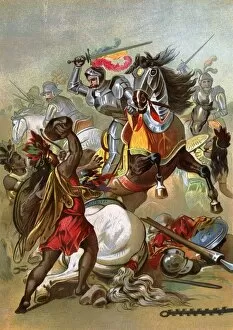
EXPL2A-00076Hernando Cortes loses two horses in battle with Tlaxcalan natives in conquering Mexico, 1519. Printed color lithograph of a 19th century illustration
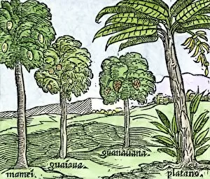
EXPL2A-00100Bananas and other fruit trees of Hispaniola, from a sketch published in 1572. Hand-colored woodcut of a 19th-century reproduction of an illustration from Benzoni 1572
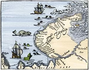
EXPL2A-00346Early map showing Nova Zembla off the Arctic coast of Russia, probably 1600s. Hand-colored 19th-century woodcut reproduction
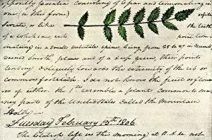
EXPL2A-00168William Clarks sketch of an evergreen shrub leaf in the Lewis and Clark expedition diary, 1806. Hand-colored halftone reproduction of a 19th-century photograph of Clarks handwritten page
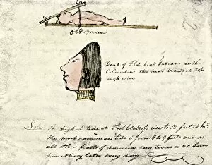
EXPL2A-00167William Clarks sketch of Flathead Indians in his diary of the Lewis and Clark expedition, 1804-1806 Hand-colored halftone reproduction of a 19th-century photograph of Clarks handwritten page
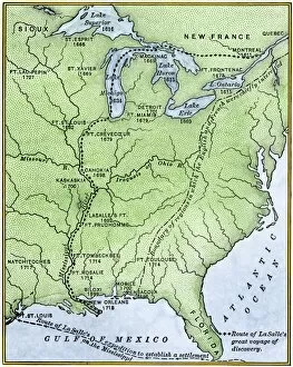
EXPL2A-00171Map showing the route of La Salles explorations in North America, late 1600s. Hand-colored woodcut of a 19th-century illustration
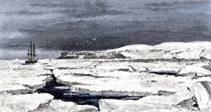
Barents Sea ice around the Eira on its first voyage, 1880Leigh Smiths " Eira" locked in ice during the ships first Arctic voyage off Spitsbergen, 1880. Hand-colored woodcut of a 19th-century illustration
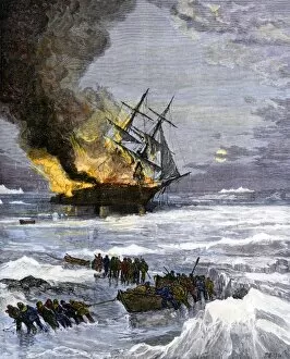
Arctic rescue ship disaster off Siberia, 1882Burning of the US Navy ship " Rodgers" in Arctic waters, hunting for the DeLong expedition after disappearance of the " Jeannette, " 1882
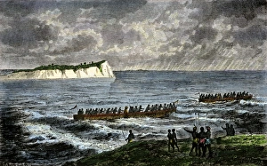
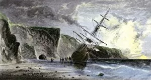
EXPL2A-00180Henry Grinnells ship aground during the search led by Elisha Kent Kane for the lost Sir John Franklin expedition, under the midnight sun, 1853
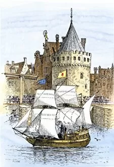
EXPL2A-00189Hudsons ship " Half-Moon" leaving Amsterdam for the New World, 1609. Hand-colored woodcut of a 19th-century illustration
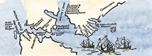
EXPL2A-00197Hudsons map of his voyages in the Arctic, published in 1612. Hand-colored 19th-century reproduction of a woodcut from Hudsons " Voyages" published in 1612
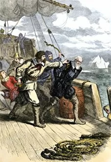
EXPL2A-00198Mutineers send Henry Hudson and his son overboard to die adrift in a small boat in the Arctic 1611. Hand-colored woodcut of a 19th-century illustration
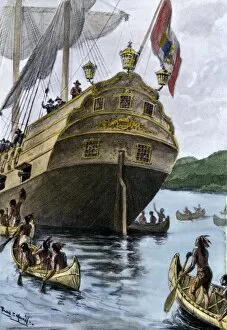
EXPL2A-00209Henry Hudsons ship " Half Moon" arriving at Manhattan Island, 1609. Hand-colored halftone of a 19th-century illustration
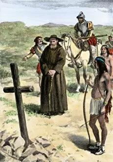
EXPL2A-00211Father Juan de Padilla finds the cross set by Coronado, 1540s. Hand-colored halftone of a 19th-century illustration
EXPL2A-00213Henry Hudsons attack on a Native American village on the Atlantic coast, 1609. Hand colored woodcut of a 19th-century illustration
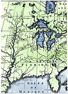
EXPL2A-00218French missionary Louis Hennepins map of the Mississippi River valley, Gulf Coast, and Great Lakes after LaSalle expeditions 1697
Virginia and North Carolina coast, 1500sJohn Whites map of the Atlantic coast of North Carolina and Virginia, 1500s. Hand-colored 19th-century woodcut reproduction
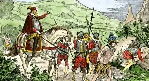
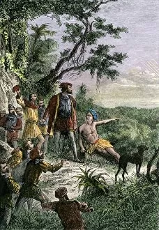
EXPL2A-00222Vasco Nunez de Balboa discovering the Pacific Ocean, 1513. Hand-colored woodcut of a 19th century illustration