mail_outline sales@mediastorehouse.com
293 items
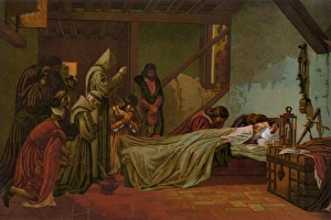
Death of ColumbusDeath of Christopher Columbus in Spain, 1506. Color lithograph reproduction of a 19th-century illustration
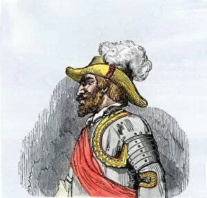
PEXP2A-00083Juan Ponce de Leon portrait. Hand-colored woodcut of a 19th-century illustration
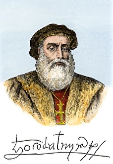
Vasco da Gama portrait, with his autograph. Hand-colored woodcut of a 19th-century illustration
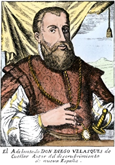
Diego Velazquez de Cuellar, Spanish conqueror of Cuba. Hand-colored 19th-century woodcut reproduction of an earlier illustration
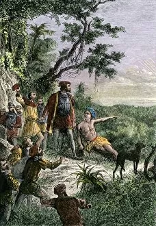
EXPL2A-00123Spanish explorer Hernando De Soto discovering the Mississippi River, 1540. Hand-colored engraving of a 19th-century illustration
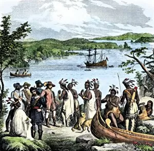
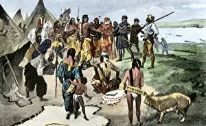
EXPL2A-00115Henry Hudson meeting with Native Americans along the Hudson River, 1609. Hand-colored woodcut of a 19th-century illustration
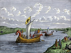
Viking explorers on the North American coastViking settlers exploring the North American coast. Hand-colored woodcut of a 19th-century illustration
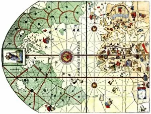
EXPL2A-00024Map of the Atlantic with the New World coast, drawn in 1500 by Juan de la Cosa, Columbus pilot. Hand colored 19th-century woodcut reproduction of the original chart
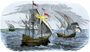
EXPL2A-00020Ships of Ferdinand Magellan rounding Tierra del Fuego to circumnavigate the earth 1519 to 1521. Hand-colored woodcut of a 19th-century illustration
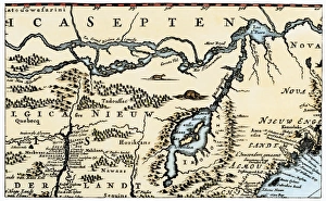
Dutch map of eastern North America, 1670Nova Belgh Tabula, map of New Netherland and New England, 1670. Hand-colored woodcut reproduction
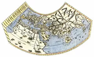
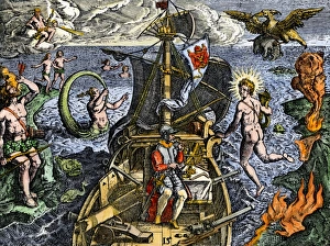
EXPL2A-00014Ptolemys map of the world, illustrating a concept of the flat earth. Hand-colored 19th-century woodcut reproduction
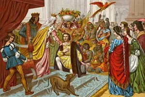
EXPL2A-00057Columbus bringing gifts from the New World to Queen Isabella of Spain 1492. Printed color lithograph of a 19th-century illustration
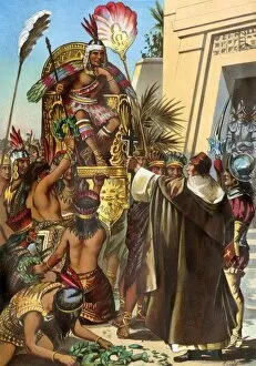
EXPL2A-00030Missionary Father Valverde addresses the Inca king Atahualpa during the Spanish conquest of Peru, 1532. Printed color lithograph of a 19th-century illustration
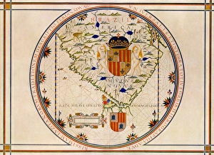
Portuguese map of the tip of South America, 1571Map of South America printed in Lisbon, 1571. Printed color halftone reproduction
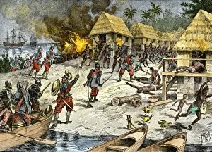
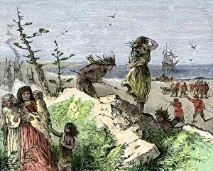
EXPL2A-00084Bartholomew Columbuss cruel destruction of native villages on Hispaniola. Hand-colored woodcut of a 19th-century illustration
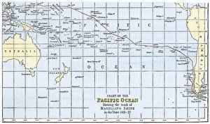
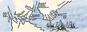
Magellans route across the PacificRoute of Magellans ships across the Pacific while circumnavigating the earth, 1519-1522. Hand-colored woodcut of a 19th-century illustration
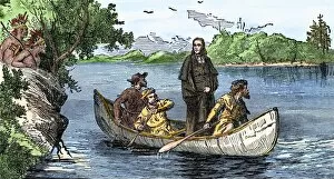
EXPL2A-00133Lewis and Clark expedition trying to make friends with Native Americans during their exploration of Louisiana Territory. Hand-colored halftone of a 19th-century illustration
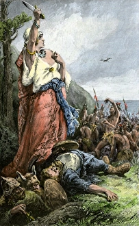
Vikings battling natives on the coast of VinlandFreydis defends her fellow Norse settlers from Native Americans, or Skraelings, 1009. Hand-colored woodcut of a 19th-century illustration
Vikings discovering VinlandNorse settlers Thorfin and Gudrida landing on Vinland. Hand-colored woodcut of a 19th-century illustration
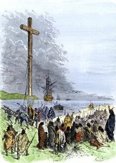
EXPL2A-00230Jacques Cartier erects a cross along the Saint Lawrence River, claiming Quebec for France, 1534. Hand-colored woodcut of a 19th-century illustration
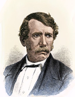
Dr. David LivingstonePortrait of missionary and explorer David Livingstone. Hand-colored woodcut reproduction of a 19th-century portrait
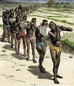
Sir Richard Burton exploring central Africa, 1850sEnglish explorer Richard Burtons march towards central Africa, 1850s. Hand-colored woodcut of a 19th-century illustration
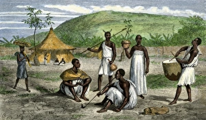
Uganda natives, as described by John H. Speke, 1860sNatives near the residence of Ugandas King Mtesas uncle. Hand-colored woodcut from Spekes Journal, 1864
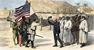
Dr. Livingstone, I presume? 1871Stanley finding Dr. Livingstone at Ujiji, Tanganyika, 1871. Hand-colored woodcut of a 19th-century illustration
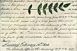
EXPL2A-00168William Clarks sketch of an evergreen shrub leaf in the Lewis and Clark expedition diary, 1806. Hand-colored halftone reproduction of a 19th-century photograph of Clarks handwritten page
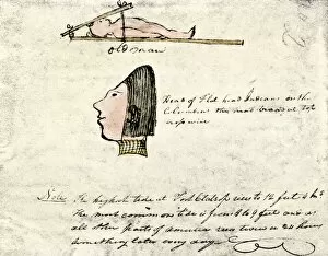
EXPL2A-00167William Clarks sketch of Flathead Indians in his diary of the Lewis and Clark expedition, 1804-1806 Hand-colored halftone reproduction of a 19th-century photograph of Clarks handwritten page
EXPL2A-00170La Salle and his companions exploring the lower Mississippi River for France, 1682. Hand-colored woodcut of a 19th-century illustration
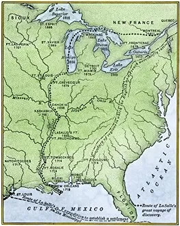
EXPL2A-00171Map showing the route of La Salles explorations in North America, late 1600s. Hand-colored woodcut of a 19th-century illustration
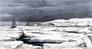
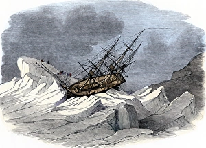
Barents Sea ice around the Eira on its first voyage, 1880Leigh Smiths " Eira" locked in ice during the ships first Arctic voyage off Spitsbergen, 1880. Hand-colored woodcut of a 19th-century illustration
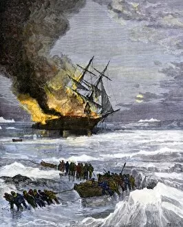
Arctic rescue ship disaster off Siberia, 1882Burning of the US Navy ship " Rodgers" in Arctic waters, hunting for the DeLong expedition after disappearance of the " Jeannette, " 1882
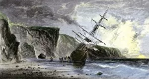
EXPL2A-00180Henry Grinnells ship aground during the search led by Elisha Kent Kane for the lost Sir John Franklin expedition, under the midnight sun, 1853
Magellan sails around South America to circumnavigate the earthMagellan passing through his Strait to sail around South America on his circumnavigation of the earth, 1519-1522. Hand-colored woodcut reproduction
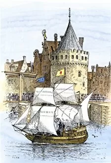
EXPL2A-00189Hudsons ship " Half-Moon" leaving Amsterdam for the New World, 1609. Hand-colored woodcut of a 19th-century illustration
EXPL2A-00197Hudsons map of his voyages in the Arctic, published in 1612. Hand-colored 19th-century reproduction of a woodcut from Hudsons " Voyages" published in 1612
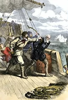
EXPL2A-00198Mutineers send Henry Hudson and his son overboard to die adrift in a small boat in the Arctic 1611. Hand-colored woodcut of a 19th-century illustration
McClure discovers the Northwest Passage, 1850British ship " Investigator" in Arctic ice during McClures discovery of the Northwest Passage while searching for the lost Franklin expedition, 1850
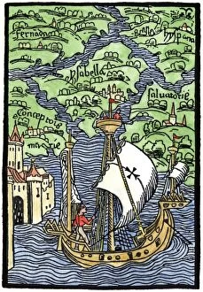
EXPL2A-00203Isabella, the settlement founded by Columbus on Hispaniola, 1493. Hand-colored woodcut reproduction
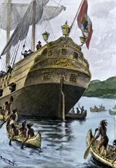
EXPL2A-00209Henry Hudsons ship " Half Moon" arriving at Manhattan Island, 1609. Hand-colored halftone of a 19th-century illustration
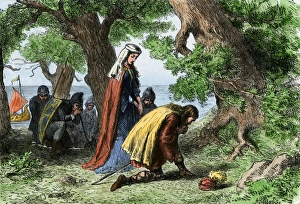
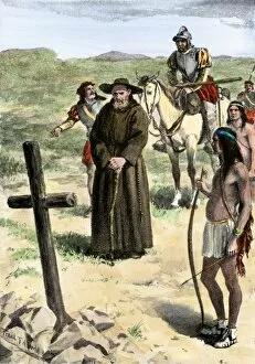
EXPL2A-00211Father Juan de Padilla finds the cross set by Coronado, 1540s. Hand-colored halftone of a 19th-century illustration
EXPL2A-00213Henry Hudsons attack on a Native American village on the Atlantic coast, 1609. Hand colored woodcut of a 19th-century illustration
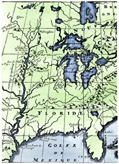
EXPL2A-00218French missionary Louis Hennepins map of the Mississippi River valley, Gulf Coast, and Great Lakes after LaSalle expeditions 1697
EXPL2A-00220John Whites map of the Virginia and Carolina coast where Roanoke Colony was located, 1500s. Hand-colored 19th-century reproduction engraving
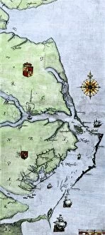
Virginia and North Carolina coast, 1500sJohn Whites map of the Atlantic coast of North Carolina and Virginia, 1500s. Hand-colored 19th-century woodcut reproduction
EXPL2A-00222Vasco Nunez de Balboa discovering the Pacific Ocean, 1513. Hand-colored woodcut of a 19th century illustration
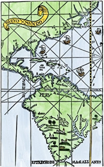
South America mapped after Magellans voyage, 1519New World map after Magellans passage around Cape Horn in 1519. Hand-colored woodcut of a 19th century illustration
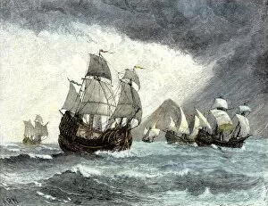
EXPL2A-00226Spanish ships of Hernando Cortes sailing to Mexico, 1519. Hand-colored woodcut of a 19th-century illustration
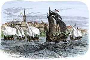
EXPL2A-00233Cartiers ships leaving St. Malo, France, to sail for North America, 1530s. Hand-colored woodcut of a 19th-century illustration
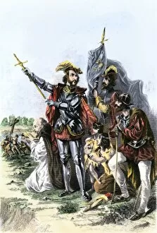
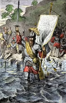
EXPL2A-00235Balboa raising his sword to claim the Pacific Ocean for Spain, 1513. Hand-colored woodcut of a 19th-century illustration