mail_outline sales@mediastorehouse.com
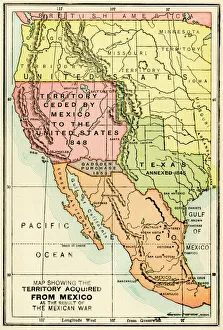
U. S. territory gained from MexicoMap of territory acquired by the U.S. from Mexico. Color lithograph of a 19th-century illustration
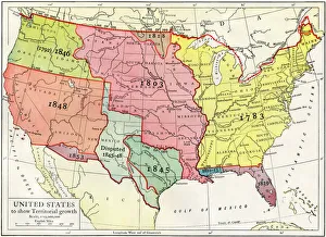
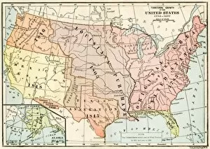
Growth of the United States to 1853U.S. map, showing territorial growth to 1853. Printed color lithograph of a 19th-century illustration
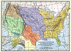
US territorial acquisition during the 1800sMap showiing the territorial growth of the continental US 1776 to 1899. Hand-colored woodcut of a 19th-century illustration
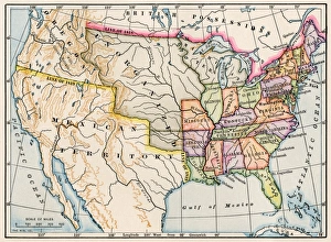
United States map in 1830Territories of the United States in 1830. Printed color lithograph
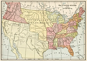
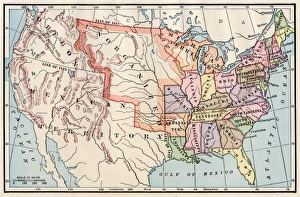
United States in 1825Map of the United States and Unorganized Public Lands in 1825. Printed color lithograph
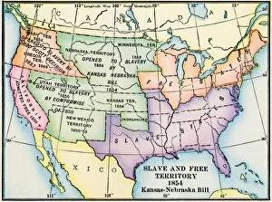
EXPL2A-00312Map of slave and free areas of the United States in 1854, at the time of the Kansas-Nebraska Bill. Printed color lithograph 19th century
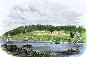
Oregon City, terminus of the Oregon Trail, 1850sOregon City on the Willamette River, first capital of Oregon Territory, 1850s. Hand-colored woodcut of a 19th-century illustration
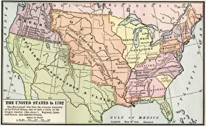
EXPL2A-00039Map of the US in 1792, showing colonial claims on Oregon Territory. Printed color halftone of a 19th century illustration
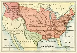
EXPL2A-00038Map of the U.S. boundary disputes with Spain and Great Britain, 1810-1812. Printed color lithograph of a 19th-century illustration
United States territory in 1830Map of the United States in 1830. Printed color lithograph
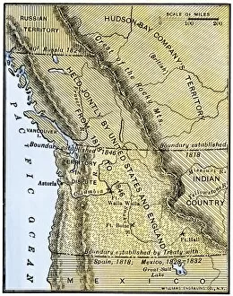
EXPL2A-00210Map of Oregon Territory showing boundary of US with English Canada under dispute until 1846. Hand-colored woodcut of a 19th-century illustration
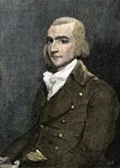
PBUS2A-00002Fur trader John Jacob Astor, founder of Astoria on the Columbia River, 1811. Hand colored woodcut of a painting
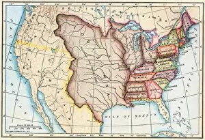
EXPL2A-00041Map of territorial growth of the United States from 1783-1867. Printed color lithograph of a 19th-century illustration
EXPL2A-00062Map of the Louisiana Purchase as understood in 1803, later modified by treaty. Printed color lithograph of a 19th-century illustration