mail_outline sales@mediastorehouse.com
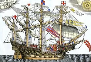
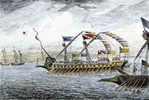
EVNT2A-00035Ark Royal, the flagship which led the English fleet against the Spanish Armada, 1588. Hand-colored woodcut reproducing a 16th century illustration
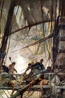
War of 1812 sea fight on the USS ChesapeakeFighting at the mizzentop of the frigate Chesapeake during a naval battle, War of 1812. Printed halftone reproduction of a W. J. Aylward painting
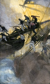
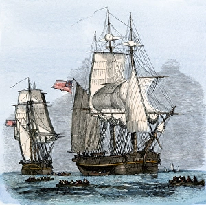
War of 1812 naval battleAmerican sailors from the " Frolic" boarding the British ship " Wasp, " War of 1812. Hand-colored halftone reproduction of a 19th-century illustration
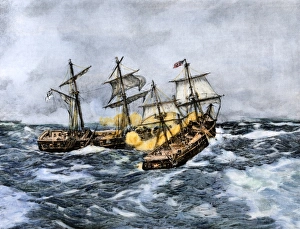
Sea battle of the Wasp and Frolic, War of 1812USS " Wasp" crosses " Frolic s" bow and fires at close range, War of 1812. Hand-colored halftone reproduction of a 19th-century illustration
EXPL2A-00095Marco Polo leading the Venetian ships at Korcula in the Adriatic Sea. Hand-colored woodcut
EXPL2A-00094Ships of Marco Polo on the Mediterranean Sea, 1300s. Hand-colored woodcut
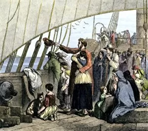
HUSG2A-00044Emigrants aboard ship from Europe, bound for America, mid-1800s. Hand-colored woodcut of a 19th-century illustration
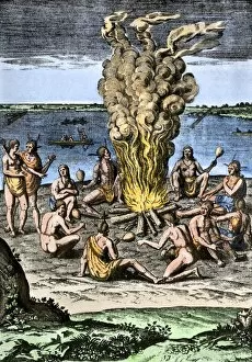
NATI2A-00151Native Americans around a fire on the Virginia/North Carolina coast, 1500s. Hand-colored woodcut reproduction of an illustration from Hariot
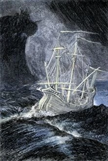
PMYT2A-00060Ghost-ship in a storm. Hand-colored woodcut of a 19th-century illustration
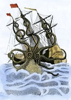
PMYT2A-00008Giant octopus attacking a sailing-ship. Hand-colored woodcut reproduction of art in the Church of St Malo, France
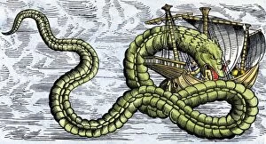
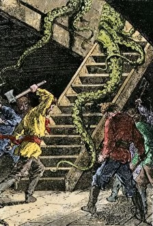
PMYT2A-00023Ship attacked by a sea serpent in the Sea of Darkness. Hand-colored woodcut reproduction from Olaus Magnus, 1555
GPAC2A-00011Native village of Warus-Warus, Ceram, in the Moluccas (Spice Islands). Hand-colored woodcut of a 19th-century illustration
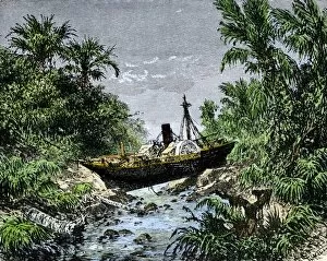
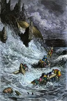
GPAC2A-00008Ocean steamship carried inland in Sumatra by tsunami from the Krakatoa eruption, 1883. Hand-colored woodcut of a 19th-century illustration
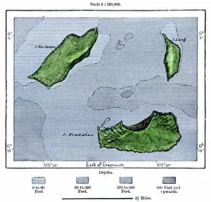
GPAC2A-00022Krakatoa and neighboring islets after the volcanic eruption of 1883. Hand-colored woodcut of a 19th-century illustration
PMYT2A-00035Sinbad and his companions shipwrecked, from the 1001 Arabian Nights. Hand-colored woodcut of a 19th-century Gustave Dore illustration
PMYT2A-00065Giant octopus attacking the submarine " Nautilus" in Jules Vernes book, " 10, 000 Leagues under the Sea, " edition of 1873, Paris
EXPL2A-00065World map of the flat earth printed by Beatus Rhenanus Bildaus Rheinau early 1500s - North is left, Mediterranean Sea middle Printed color lithograph reproduction 19th century
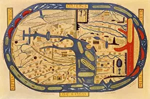
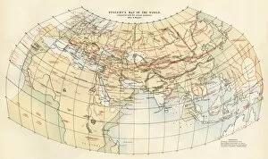
EXPL2A-00353Ptolemys map of the world shown in red, true locations in black. Printed color lithograph 19th century
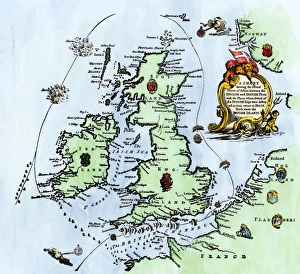
Spanish Armadas route in 1588Chart of the Spanish Armadas course, 1588. Hand-colored engraving
EXPL2A-00136Native canoe in the Strait of Magellan, Tierra del Fuego, southern tip of South America. Hand-colored woodcut of a 19th-century illustration
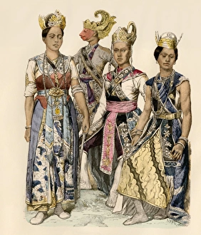
Java dancers and actorsPerformers of Java in traditional costumes. Antique hand-colored print
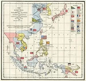
EVNT2A-00313Map of the China Seas, Philippines, and European colonies in the region, 1898. Printed color lithograph 19th century
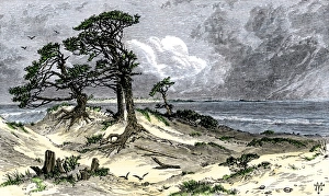
Chesapeake Bay entrance before settlers arrivedEntrance to Chesapeake Bay, as it appeared to early explorers and colonists. Hand-colored woodcut of a 19th-century illustration
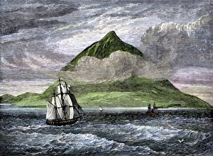
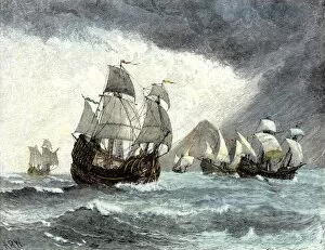
Peak of Tenerife, Canary IslandsSailing ships passing the Peak of Tenerife, or Teyde, Canary Islands, 1800s. Hand-colored woodcut of a 19th-century illustration
Magellan sails around South America to circumnavigate the earthMagellan passing through his Strait to sail around South America on his circumnavigation of the earth, 1519-1522. Hand-colored woodcut reproduction
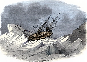
McClure discovers the Northwest Passage, 1850British ship " Investigator" in Arctic ice during McClures discovery of the Northwest Passage while searching for the lost Franklin expedition, 1850
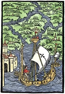
EXPL2A-00203Isabella, the settlement founded by Columbus on Hispaniola, 1493. Hand-colored woodcut reproduction
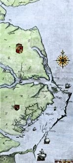
EXPL2A-00220John Whites map of the Virginia and Carolina coast where Roanoke Colony was located, 1500s. Hand-colored 19th-century reproduction engraving
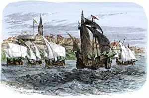
EXPL2A-00233Cartiers ships leaving St. Malo, France, to sail for North America, 1530s. Hand-colored woodcut of a 19th-century illustration
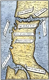
EXPL2A-00239First map of the Strait of Magellan from Magellans circumnavigation of the earth in 1519 showing north at the bottom. Hand-colored 19th-century woodcut reproduction of Pigafettas 16th century map
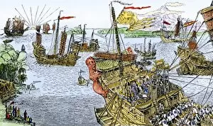
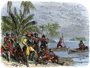
Balboa expeditions canoes on the Pacific, 1513Balboas first embarkation on the Pacific Ocean (South Sea), 1513. Hand-colored woodcut of a 19th-century illustration
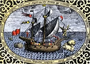
EXPL2A-00240Ship " Victoria, " one of Magellans fleet which circumnavigated the earth, 1519-1520. Hand-colored 19th-century woodcut reproduction of an earlier illustration
Portuguese traders in India and Ceylon, 1500Calcutta and the southern coast of India, from Juan de la Cosas map, 1500. Hand-colored woodcut reproduction of a 16th-century illustration
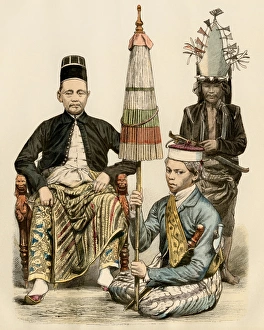
Java official and his attendants, 1800sRegent of Java, his bodyguard, and an attendant, 1800s. Antique hand colored print
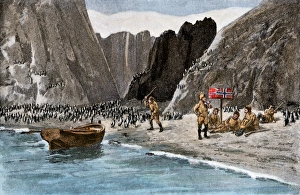
Borchgrevink marking the Antarctic mainland for Norway, 1894Borchgrevinks expedition planting the Norwegian flag amidst penguins on the Antarctic mainland, 1894. Hand-colored halftone reproduction of a 19th-century illustration
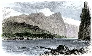
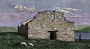
Norse settlement ruins in GreenlandRuins of a Viking church at Katortok, Greenland, view in 1800s. Hand-colored woodcut of a 19th century illustration
EXPL2A-00308Arctic explorer Robert Peary meeting the Relief Expedition on the Greenland Ice-cap, August 5, 1892. Hand-colored woodcut of a 19th-century illustration
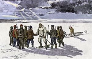
The search for Sir John Franklins Arctic expedition, 1850s" Resolute" and four other ships leaving England to search for Franklins lost Arctic expedition, 1852. Hand-colored woodcut of a 19th-century illustration
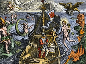
Sailing unknown seas in the Age of DiscoveryNavigating the Sea of Darkness. Hand-colored woodcut reproduction
PEXP2A-00078Captain Adrian Block buildng a ship in Narragansett Bay, 1613-14. Hand-colored woodcut of a 19th-century illustration
EXPL2A-00107Ships in busy Lisbon harbor, circa 1600. Hand-colored woodcut of a 19th-century reproduction of the original illustration from DeBry
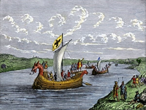
Viking explorers on the North American coastViking settlers exploring the North American coast. Hand-colored woodcut of a 19th-century illustration
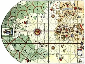
EXPL2A-00024Map of the Atlantic with the New World coast, drawn in 1500 by Juan de la Cosa, Columbus pilot. Hand colored 19th-century woodcut reproduction of the original chart
EXPL2A-00020Ships of Ferdinand Magellan rounding Tierra del Fuego to circumnavigate the earth 1519 to 1521. Hand-colored woodcut of a 19th-century illustration
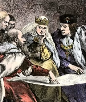
EXPL2A-00018Columbus showing a map to Ferdinand and Isabella of Spain. Hand-colored woodcut of a 19th-century illustration
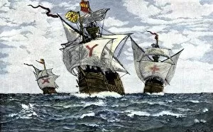
EXPL2A-00009Three ships of Columbus approaching the New World, 1492. Hand-colored woodcut of a 19th-century illustration
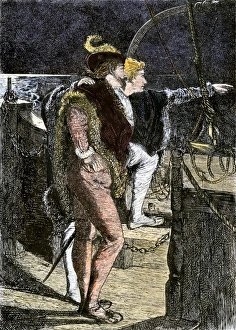
Columbus first sighting the New WorldColumbus getting his first sight of the New World from the deck of the Santa Maria, 1492. Hand-colored woodcut of a 19th-century illustration
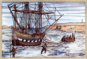
Arctic voyage of Willem Barents, 1500sWillem Barents ship in the Artic ice, 1590s. Printed color woodcut by Gerard de Veer, 1598