mail_outline sales@mediastorehouse.com
EXPL2A-00058Samuel de Champlains map of the Gaspee and Gulf of the Saint Lawrence River, 1632. Hand-colored woodcut reproduction of the original map
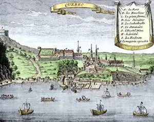
EXPL2A-00025Quebec City and the Saint Lawrence River, 1722. Hand-colored 18th-century woodcut from La Potherie
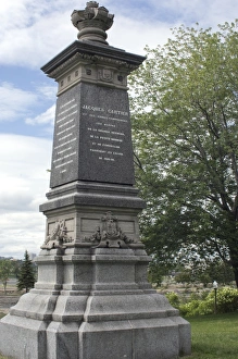
Cartier monument on the St Lawrence, QuebecMonument marking Jacques Cartiers landing place on the St Lawrence River in Quebec. Digital photograph
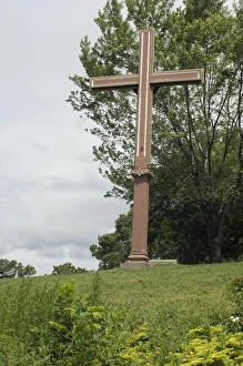
Cartiers landing place on the St Lawrence, QuebecReplica cross marking Jacques Cartiers landing place on the St Lawrence River in Quebec. Digital photograph
BUSN2A-00204French traders canoeing on a river in the forests of North America. Hand-colored woodcut of a 19th century illustration
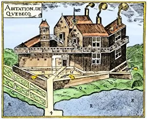
EXPL2A-00295Champlains Quebec fort, 1613, showing the dwellings (C, D), drawbridge (I), Moat (M), cannon (N), garden (O). Hand-colored 19th-century woodcut reproduction of Champlains drawing
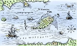
EXPL2A-00296Map of Champlains settlement on the Isle de Sainte Croix, Canada, 1613. Hand-colored 19th-century woodcut reproduction of the original map
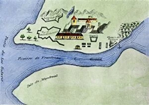
EXPL2A-00267Fort Frontenac on Lake Ontario, 1600s, at the head of the St Lawrence River, now Kingston, Ontario. Hand-colored 19th century halftone reproduction of the original map
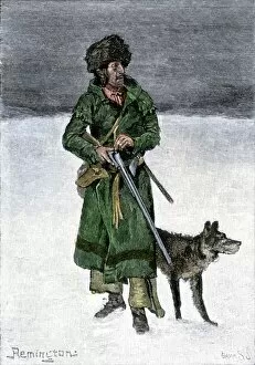
BUSN2A-00020French-Canadian trapper in the snow. Hand-colored 19th-century woodcut of a Frederic Remington illustration
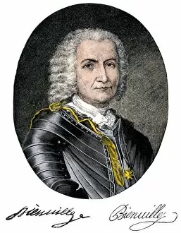
PEXP2A-00031Jean-Baptiste Le Moyne, Sieur de Bienville, portrait with autograph. Hand-colored 19th-century engraving
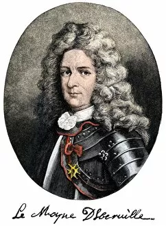
PEXP2A-00030Pierre Le Moyne, Sieur d Iberville, portrait with autograph. Hand-colored 19th-century engraving
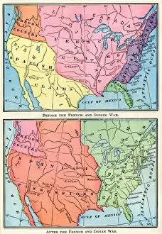
EXPL2A-00151Maps of North American colonies before and after the French and Indian War, 1700s. Printed color lithograph of a 19th century illustration