mail_outline sales@mediastorehouse.com
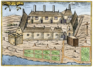
Champlains settlement in Nova Scotia, 1600sSamuel de Champlains fort at Port Royal, now Annapolis Royal, Nova Scotia, 1600s. Hand-colored woodcut of a 19th century illustration
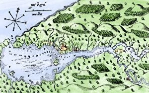
EXPL2A-00297Champlains 1613 map of his settlement at Port Royal, now Annapolis Royal, Nova Scotia, Canada. Hand-colored 19th-century woodcut reproduction of Champlains drawing
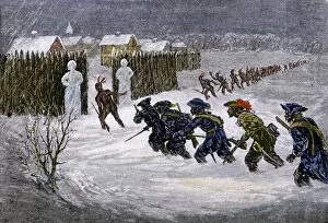
EVNT2A-00182French and Indian attack on Schenectady, New York, during the winter of 1689-1690. Hand-colored woodcut of a 19th-century illustration
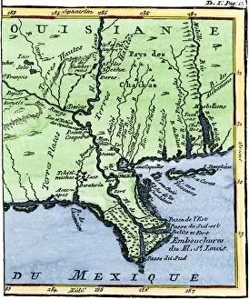
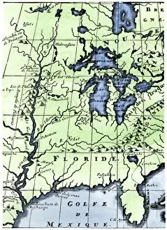
EXPL2A-00302Map of Louisiana, 1744, showing the mouths of the Mississippi River while part of New France. Hand-colored woodcut reproduction of the map
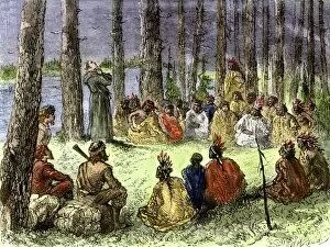
EXPL2A-00175Jesuit missionary preaching to Native Americans and fur traders in the wilderness. Hand-colored woodcut of a 19th-century illustration
EXPL2A-00253French Jesuit missionary in a Native American village. Hand-colored woodcut of a 19th-century illustration
French missionaries arriving in Maine, 1600sFrench missionaries landing on Mount Desert Island, Maine. Hand-colored woodcut of a 19th-century illustration
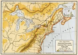
EVNT2A-00019Map showing British colonies and northern New France during the French and Indian War, 1750s. Printed color lithograph of a 19th century illustration
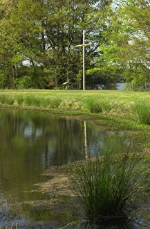
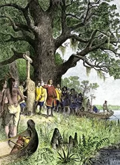
Site of Henri de Tontis French settlement, 1686Replica of cross marking Henri de Tontis 1686 French trading settlement, Arkansas Post National Memorial, Arkansas. Digital photograph
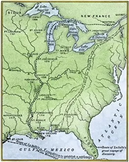
EXPL2A-00171Map showing the route of La Salles explorations in North America, late 1600s. Hand-colored woodcut of a 19th-century illustration
EXPL2A-00218French missionary Louis Hennepins map of the Mississippi River valley, Gulf Coast, and Great Lakes after LaSalle expeditions 1697
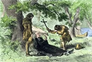
EXPL2A-00257Death of Father Marquette in Michigan, returning from a mission to the Ilinois Indians, 1675. Hand-colored woodcut of a 19th-century illustration
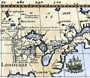
EXPL2A-00329Louis Joliets map of New France, 1673-1674, including the upper Mississippi River he and Jacques Marquette discovered. Hand-colored halftone reproduction
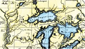
EXPL2A-00350French map of the Great Lakes and upper Mississippi River region, circa 1700. Hand-colored 19th-century woodcut reproduction
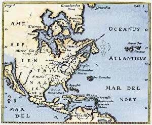
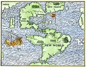
EXPL2A-00375Map of North America as known in the mid-1600s. Hand-colored woodcut reproduction of an illustration in Campanius, 1702
PEXP2A-00026Antoine de La Mothe, Sieur de Cadillac landing on the shore of Lake Saint Clair where he founded Fort Detroit, 1701. Hand colored woodcut of a 19th-century illustration by Howard Pyle
PEXP2A-00081Jacques Cartier portrait with his autograph. Hand-colored woodcut of a 19th-century illustration
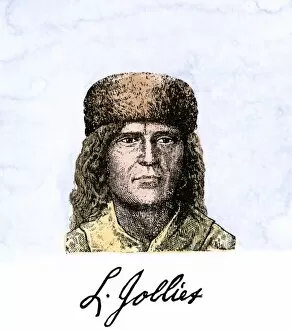
PEXP2A-00055Louis Joliet, with his autograph. Hand-colored 19th-century woodcut of an illustration
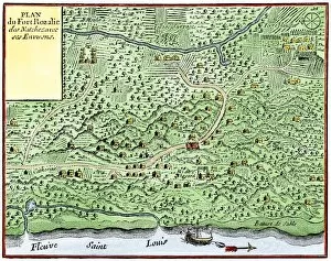
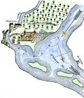
EXPL2A-00124Fort Rozalie des Natchez on the Mississippi River 1700s - North is to the right. Hand-colored woodcut of a map published in 1770. Fleuve Saint Louis was the French name for the Mississippi River
EXPL2A-00118LaSalle at the mouth of the Mississippi River claims Louisiana for France 1682. Hand-colored woodcut of a 19th-century illustration
EXPL2A-00016Hennepins map of New France and Louisiana - La Carte de la Nouvelle France, 1683. Hand-colored 19th-century woodcut reproduction of the original map
EXPL2A-00148New World geography according to a mapmaker of 1540. Hand-colored woodcut of a 19th-century illustration
EXPL2A-00143La Salle landing in Matagorda Bay Texas to colonize Louisiana Terrritory and the Mississippi valley area, 1685. Hand-colored 19th-century woodcut reproduction of an earlier illustration
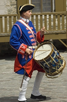
Drummer reenactor in olc QuebecColonial French army reenactor portraying a drummer in 18th-century Quebec. Digital photograph
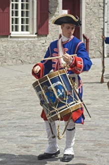
Drummer reenactor in old QuebecColonial French army reenactor portraying a drummer in 18th-century Quebec. Digital photograph
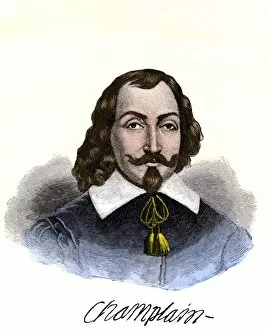
PEXP2A-00074Samuel de Champlain portrait, with his autograph. Hand-colored 19th-century engraving reproduction of the Moncornet portrait
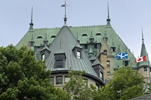
Chateau Frontenac in old QuebecChateau Frontenac in the historic district of Quebec City. Digital photograph
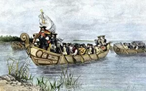
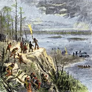
EXPL2A-00109Samuel de Champlain and his Huron allies going to fight the Iroquois, Lake Champlain, 1600s. Hand-colored woodcut of a 19th-century illustration
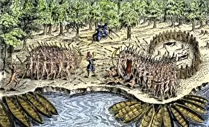
EXPL2A-00110Samuel de Champlains defeat of the Iroquois at Lake Champlain, opening the settlement of New France, 1600s. Hand-colored woodcut
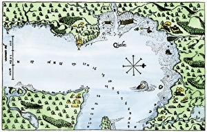
EXPL2A-00183Samuel de Champlains fortified camp at Quebec on the St Lawrence River, 1600s Hand-colored 19th-century woodcut of a 17th-century map
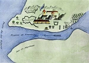
Champlains Quebec settlement, 1613Champlains settlement at Quebec in New France, 1613. Hand-colored woodcut of a 17th-century illustration
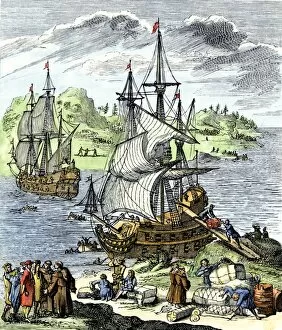
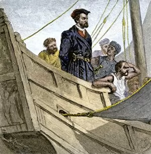
EXPL2A-00232Jacques Cartier aboard ship arriving on the shore of Canada, 1534. Hand-colored woodcut of a 19th-century illustration
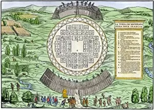
EXPL2A-00246Hochelaga, site of Montreal, shown as a Native American village in Lescarbots map, 1609. Hand-colored 19th-century woodcut reproduction of a 17th-century document
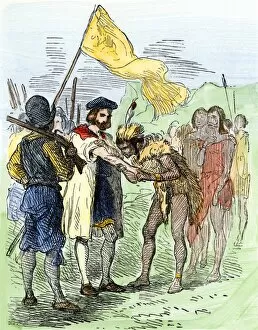
EXPL2A-00247Jacques Cartier embraced by Donnacona, a native Canadian Huron chief, Gaspee Peninsula, 1535. Hand-colored woodcut of a 19th-century illustration
EXPL2A-00251Title page of the London edition of Jacques Cartiers book about his discoveries in Canada, printed in 1580. Watercolor wash over a 19th-century printed halftone reproduction
EXPL2A-00249French colonists building fort at Hochelaga, a native village and the site of Montreal, Canada, 1600s. Hand-colored halftone reproduction of a 17th-century illustration
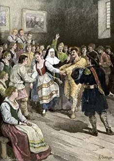
GCAN2A-00012French-Canadians enjoying a dance in early Quebec. Hand-colored woodcut of a 19th-century illustration
GCAN2A-00006Catholic clergyman of the Order of St. Sulpice, Quebec, Canada, circa 1700. Hand-colored woodcut of a 19th-century illustration
EXPL2A-00087Jacques Cartier on the summit of Mont Real, now Montreal, Canada, 1535. Hand-colored woodcut of a 19th-century illustration
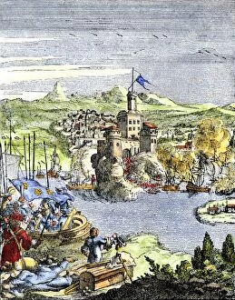
EXPL2A-00080Capture of French Quebec by the English, 1629. Hand-colored woodcut reproduction from Hennepin 1698
EXPL2A-00058Samuel de Champlains map of the Gaspee and Gulf of the Saint Lawrence River, 1632. Hand-colored woodcut reproduction of the original map
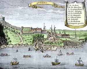
EXPL2A-00025Quebec City and the Saint Lawrence River, 1722. Hand-colored 18th-century woodcut from La Potherie
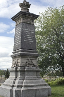
Cartier monument on the St Lawrence, QuebecMonument marking Jacques Cartiers landing place on the St Lawrence River in Quebec. Digital photograph
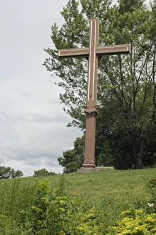
Cartiers landing place on the St Lawrence, QuebecReplica cross marking Jacques Cartiers landing place on the St Lawrence River in Quebec. Digital photograph
BUSN2A-00204French traders canoeing on a river in the forests of North America. Hand-colored woodcut of a 19th century illustration
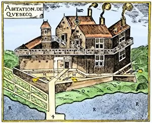
EXPL2A-00295Champlains Quebec fort, 1613, showing the dwellings (C, D), drawbridge (I), Moat (M), cannon (N), garden (O). Hand-colored 19th-century woodcut reproduction of Champlains drawing
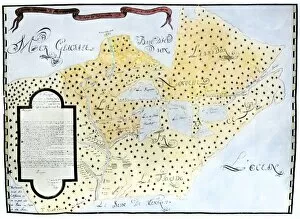
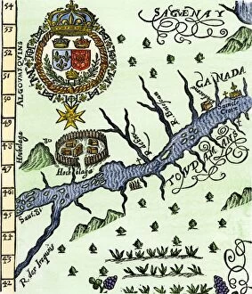
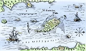
EXPL2A-00296Map of Champlains settlement on the Isle de Sainte Croix, Canada, 1613. Hand-colored 19th-century woodcut reproduction of the original map
EXPL2A-00267Fort Frontenac on Lake Ontario, 1600s, at the head of the St Lawrence River, now Kingston, Ontario. Hand-colored 19th century halftone reproduction of the original map