mail_outline sales@mediastorehouse.com
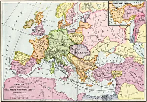
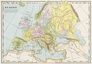
Medieval Europe at the start of the CrusadesMap of Europe at the time of the First Crusade, 1097 AD. Printed color lithograph of a 19th-century illustration
Map of ancient Palestine kingdoms of Judah and IsraelMap of Phoenicia and Judea in the time of King Solomon, 10th century BC. Hand-colored woodcut of a 19th-century illustration
Map of the Roman EmpireMap showing the extent of the Roman Empire. Hand-colored woodcut of a 19th-century illustration
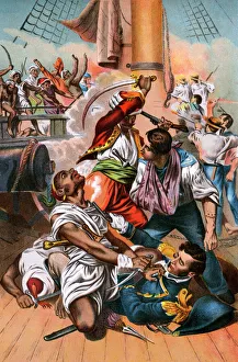
Barbary Pirates threatening US commander Stephen DecaturCommodore Stephen Decaturs life saved in a shipboard battle off Algeria. Color lithograph
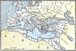
PROY2A-00017Map of Europe in the time of Charlemagne, 768-814 AD. Printed color lithograph, 19th century
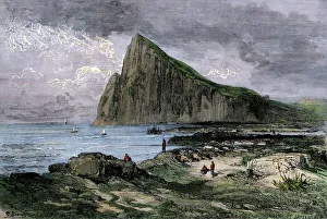
Rock of Gibraltar in the British EmpireBritish troops occupying Gibraltar, 1800s. Hand-colored woodcut of a 19th-century illustration
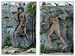
Undersea exploration in 16th-century EuropeUnderwater diver and man-at-arms, France, 1532. Hand-colored woodcut of a 19th century illustration
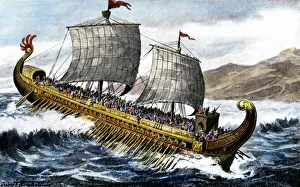
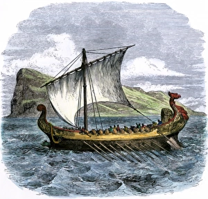
A trireme, used by the ancient Greeks and RomansA trireme, with three banks of oars, used by the ancient Greeks and Romans. Hand-colored halftone reproduction of a 19th-century illustration
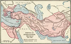
PANC2A-00003Map of the empire of Alexander the Great in 323 BC. Printed color lithograph of a 19th-century illustration
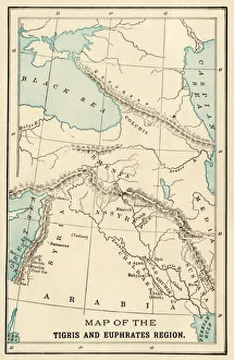
Ancient MesopotamiaMap of the ancient Tigris and Euphrates region. Printed color 19th-century illustration
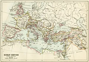
Roman Empire, circa 200 ADMap of the Roman Empire in the third century. Printed color lithograph of a 19th-century illustration
Phoenician ship in the MediterraneanPhoenician galley passing the Rock of Gibraltar. Hand-colored woodcut of a 19th-century illustration
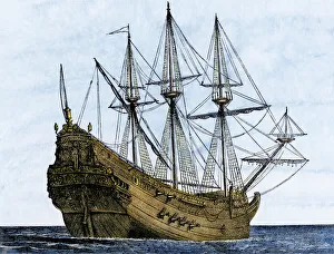
Carrack, a merchant ship of the late 1400sArmed Genoese carrack, a merchant ship of the 1400s and 1500s. Hand-colored woodcut of a 19th-century illustration
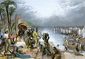
Ancient Phoenician traders in portPhoenician sailors trading goods in an ancient Mediterranean seaport. Hand-colored woodcut of a 19th-century illustration
EXPL2A-00014Ptolemys map of the world, illustrating a concept of the flat earth. Hand-colored 19th-century woodcut reproduction
Battle of Actium, 31 BCSea battle of Actium, in which Octavius defeated Antony and Cleopatra, 31 BC. Hand colored wodcut of a 19th-century illustration
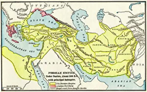
Persian Empire about 500 BCMap of the Persian Empire under Darius I, with principal satrapies, about 500 BC. Color lithograph reproduction of a 19th-century illustration
Roman ship with a rudderAncient Roman trading ship with an early rudder. Hand-colored 19th-century woodcut reproduction of an earlier illustration
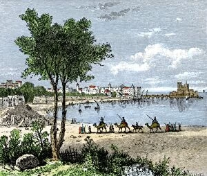
Seaport of Sidon, LebanonSidon, a chief seaport of ancient Phoenicia on the Mediterranean. Hand-colored woodcut of a 19th-century illustration
Europe in the mid-1500sMap of Europe during the early Protestant Reformation. Printed color lithograph of a 19th-century illustration
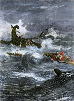
Pauls shipwreck while on a missionary journeyShipwreck of Apostle Paul off Malta in the Mediterranean Sea. Hand-colored woodcut of a 19th-century illustration
Alexandria, Egypt, in the 1500sMap of Alexandria, showing the lighthouse Pharos at the harbor entrance in the 1500s. Hand-colored 19th-century woodcut reproduction of a medieval illustration
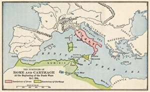
Rome and Carthage, 264 BCTerritories of Rome and Carthage at the outset of the Punic Wars, 264 BC. Color lithograph
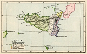
Sicily during the First Punic War, 264 BC. Color lithograph
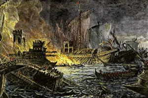
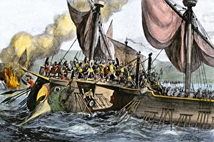
Roman defeat of the Carthaginians at Mylae, 260 BCRoman naval victory over the Carthaginians at Mylae during the First Punic War, 260 BC. Hand-colored halftone reproduction of a 19th-century illustration
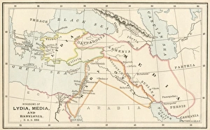
Babylonia, Lydia, and Medea in ancient timesMap of ancient Babylonia and of the kingdoms of Lydia and Medea, circa 550 BC. Printed color lithograph of a 19th-century illustration
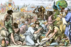
Hebrew traders in a Phoenician seaportKing Solomons ships unloading goods to trade with Phoenicians. Hand-colored woodcut of a 19th-century illustration
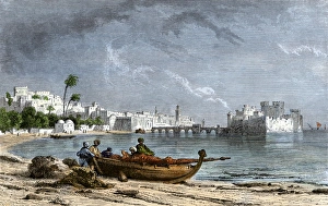
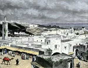
GAFR2A-00012Tangier, Morocco, overlooking the Strait of Gibraltar. Hand-colored woodcut of a 19th-century illustration
Barbary Pirates attacked in Algiers, 1541Emperor Charles Vs attempt to capture Algiers, home of the Barbary Pirates, 1541. Hand-colored woodcut reproduction of an earlier illustration
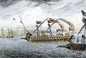
EXPL2A-00095Marco Polo leading the Venetian ships at Korcula in the Adriatic Sea. Hand-colored woodcut
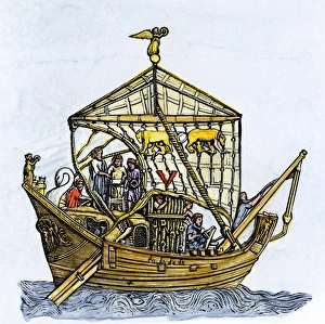
EXPL2A-00094Ships of Marco Polo on the Mediterranean Sea, 1300s. Hand-colored woodcut
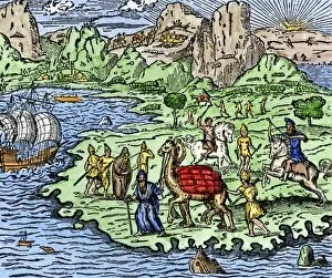
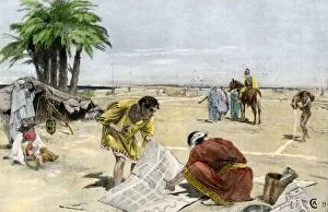
Traders approaching Sidon, a seaport of ancient PhoeniciaCamel caravan approaching Sidon, a seaport of ancient Phoenicia. Hand-colored woodcut of a 19th-century illustration
EXPL2A-00065World map of the flat earth printed by Beatus Rhenanus Bildaus Rheinau early 1500s - North is left, Mediterranean Sea middle Printed color lithograph reproduction 19th century
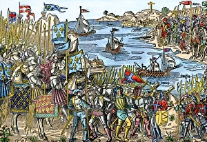
Crusaders sailing for the Holy LandCrusaders setting sail for Jerusalem from Damietta in northern Egypt, 1200s. Hand-colored 19th-century engraving of an earlier illustration
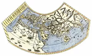
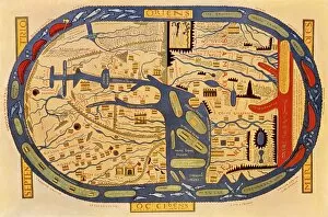
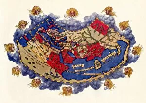
EXPL2A-00061Ptolemys world map, circa 150 AD, from the edition of 1472. Color halftone reproduction of the first printed edition of 1472
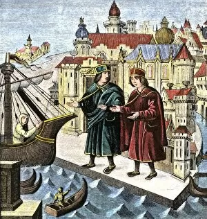
BUSN2A-00049Transporting merchandise on the great Silk Road in the Middle Ages. Hand-colored woodcut reproduction of a medieval illustration
PBIB2A-00067King Hirams fleet brings gifts to Solomon. Hand-colored engraving of a 19th-century illustration
PANC2A-00059Alexander the Great laying out the city of Alexandria in ancient Egypt, 332 BC. Hand-colored halftone reproduction of a 19th-century illustration
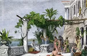
PANC2A-00092Roman Emperor Tiberius enjoying his villa on Capri. Hand-colored woodcut of a 19th-century illustration
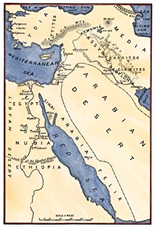
Map of the Mideast in ancient timesMap of the ancient Near East, birthplace of civilization. Hand-colored woodcut of a 19th-century illustration
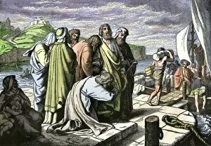
PBIB2A-00061Apostle Paul leaving his friends to spread Christianity in Asia Minor. Hand-colored woodcut of a 19th-century illustration
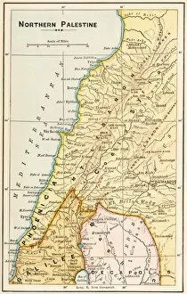
GMDE2A-00055Map of northern Palestine in ancient times. Printed color lithograph of a 19th-century illustration
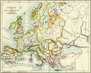
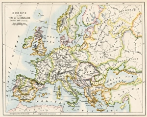
Europe at the time of the CrusadesMap of Europe during the Crusades, 1000 to 1200 AD. Printed color lithograph reproduction of a 19th-century illustration
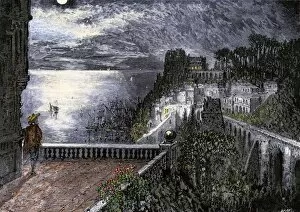
GEUR2A-00002Moonlight on Genoa harbor, circa 1400s. Hand-colored woodcut of a 19th-century illustration
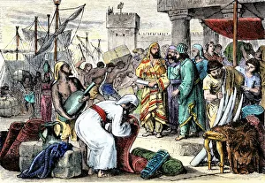
EXPL2A-00096Trade in a seaport of the Mediterranean about the time of Marco Polo. Hand-colored woodcut of a 19th-century reproduction of a miniature in a 15th-century manuscript of the Travels of Marco Polo
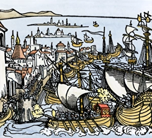
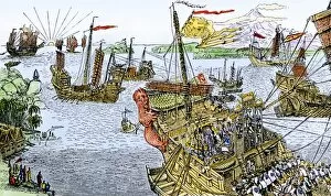
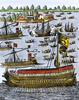
Ceremony marrying Venice to the sea, 1609Doge of Venice carried in the galley Bucentaur, to espouse the sea, 1609. Hand-colored woodcut reproduction of a 17th-century illustration
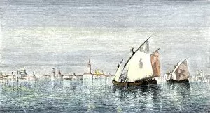
GEUR2A-00090Sailboats on the lagoon of Venice. Hand-colored woodcut of a 19th-century illustration