mail_outline sales@mediastorehouse.com
Bozeman Trail over the Bridger Mountains, MontanaBridger Mountains, named for Jim Bridger, along the Bozeman Pass on the Bozeman Trail, Montana. Photograph
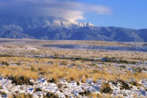
Snow on the Sandia Mountains, New MexicoSnow on the Sandia Mountains and high plains near Albuquerque, New Mexico. Photograph
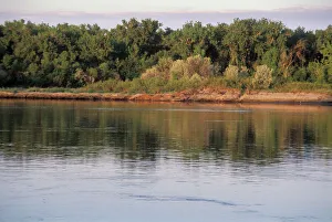
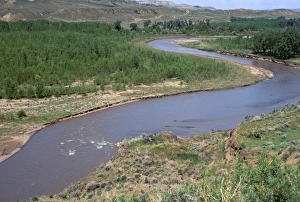
Missouri River near Mandan, North DakotaMissouri River between Pierre and Mandan, North Dakota, explored by Lewis and Clark. Photograph
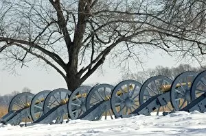
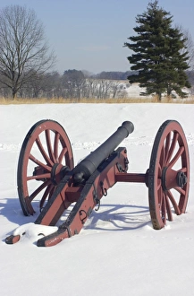
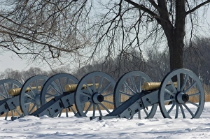
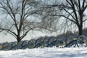
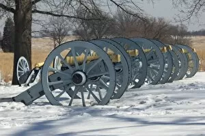
EVRV2D-00199Artillery defending the Continental Army winter camp at Valley Forge, Pennsylvania. Digital photograph
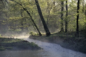
Colbert Creek in AlabamaColbert Creek in morning mist, Natchez Trace, northwestern Alabama. Photograph
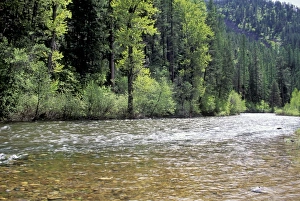
Lolo Creek in the Bitterroot Range, MontanaLolo Creek on Lewis and Clarks trail over the Bitterroot Mountains in Montana. Photograph
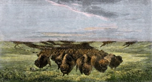
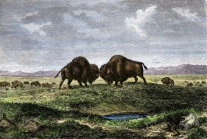
Buffalo herd on the American prairieHerd of bison crossing a river bottom on the Great Plains. Hand-colored woodcut reproduction of a 19th-century painting by Hays
Revolutionary War cannon at Valley ForgeField artillery in snow on a Continental Army redoubt at Valley Forge winter camp, Pennsylvania. Digital photograph
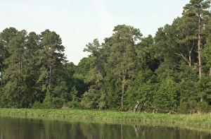
Jamestown forest, VirginiaJamestown Island viewed from Powhatan Creek, Colonial National Historical Park, Virginia. Digital photograph
HSET2D-00108Fort Laramie, Wyoming, seen from the Oregon Trail, also the route to California and Utah. Digital photograph
HSET2D-00106Oregon Trail tracks heading west from Fort Laramie, Wyoming, also the route to California. Digital photograph
Oregon Trail in WyomingWagon ruts of the Oregon Trail near Guernsey, Wyoming. Digital photograph
Santa Fe Trail wagon tracks in New MexicoSanta Fe Trail ruts on the Cimarron Cutoff route, New Mexico. Photograph
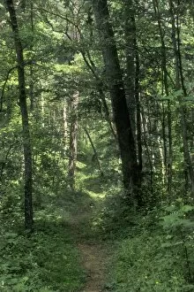
HSET2P-00551Pathway of the Wilderness Road, Levi Jackson Wilderness Road State Park, Kentucky. Photograph
Cow pasture, AlabamaCows in morning mist along the Natchez Trace, Alabama. Photograph
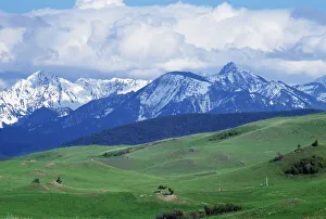
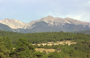
Sangre de Cristo range of the Rockies, New MexicoTruchas Peaks, over 13, 000 feet high in the Sangre de Cristo Mountains, New Mexico. Digital photograph
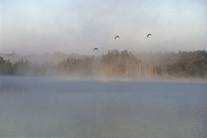
Mallards over the Wolf River, WisconsinWild ducks in morning fog flying over Post Lake on the Wolf River, Wisconsin. Photograph
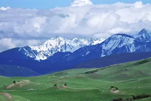
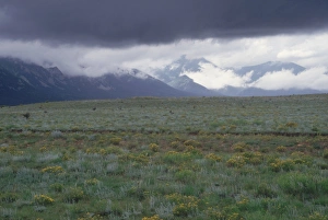
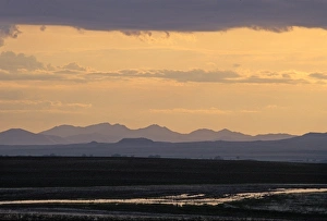
Bears Paw Mountains, MontanaSunset after rainstorm, Bears Paw Mountains, Montana. Photograph
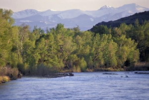
Tobacco Root Mountains and the Jefferson River, MontanaJefferson River, named for Thomas Jefferson by Lewis and Clark. Photograph
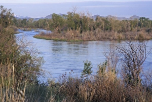
Judith River near its junction with the Missouri River, MontanaJudith River, named by Lewis and Clark, Montana. Photograph
Buffalo bulls fighting on the Great PlainsConfrontation between bulls in a buffalo herd, Great Plains. Hand-colored woodcut of a 19th century illustration
Missouri River headwaters, Three Forks, MontanaMissouri River headwaters, discovered by Lewis and Clark, Three Forks, Montana. Photograph
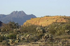
Four Peaks Wilderness in the mountains of central ArizonaFour Peaks Wilderness, viewed from the Dutchmans Trail in the Superstition Mountains Wilderness Area, Arizona. Digital photograph
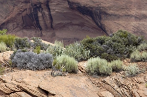
Plants of Canyon de Chelly, ArizonaNative plants on the arid rim of Canyon de Chelly, on the Navajo Nation Reservation, Arizona. Digital photograph
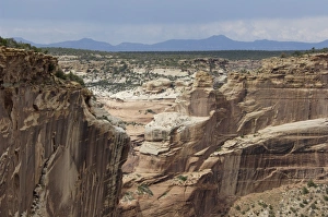
Chuska Mountains and Canyon de Chelly, ArizonaChuska Mountains on the New Mexico border seen from Canyon de Chelly, Navajo Nation Reservation, Arizona. Digital photograph
Valley Forge artilleryArtillery defending the Continental Army winter camp at Valley Forge, Pennsylvania. Digital photograph
EVRV2D-00198Artillery defending the Continental Army winter camp at Valley Forge, Pennsylvania. Digital photograph
EVRV2D-00204Artillery defending the Continental Army winter camp at Valley Forge, Pennsylvania. Digital photograph
EVRV2D-00200Artillery defending the Continental Army winter camp at Valley Forge, Pennsylvania. Digital photograph
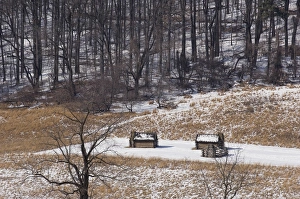
Valley Forge cabins in the snowContinental Army cabins reconstructed at Valley Forge, Pennsylvania. Digital photograph
Fort Ticonderoga about 1850Ruins of Fort Ticonderoga on Lake Champlain, about 1850. Hand-colored engraving of a 19th-century illustration
Oregon Trail in western NebraskaOregon Trail, Scotts Bluff National Monument, Nebraska. Digital photograph
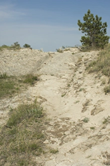
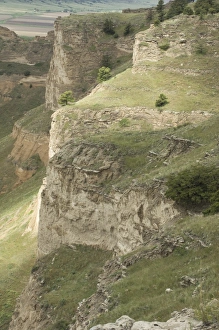
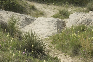
Erosion in western NebraskaErosion in the hills overlooking the Oregon Trail, Scotts Bluff National Monument, Nebraska. Digital photograph
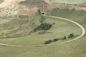
Road ascending Scotts Bluff, NebraskaRoad and tunnel to the top of Scotts Bluff overlooking the Oregon Trail, Scotts Bluff National Monument, Nebraska. Digital photograph
Scotts Bluff, NebraskaCliffs of Scotts Bluff overlooking the Oregon Trail, Scotts Bluff National Monument, Nebraska. Digital photograph
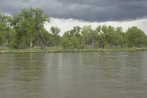
North Platte River in NebraskaStormy sky over the North Platte River along the Oregon and Mormon Trails, Nebraska. Digital photograph
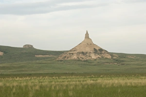
Chimney Rock, NebraskaChimney Rock, a landmark on the Oregon Trail, Nebraska. Digital photograph
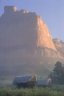
HSET2P-00104Covered wagons on the Oregon Trail at sunrise, Scotts Bluff, Nebraska. Photograph
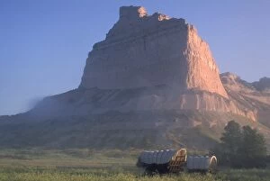
HSET2P-00108Covered wagons on the Oregon Trail at sunrise, Scotts Bluff, Nebraska. Photograph
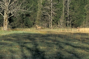
White-tailed deer in AlabamaWild whitetail deer running near the Natchez Trace in northwestern Alabama. Photograph
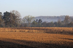
Field of red clay soil in AlabamaTilled field along the Natchez Trace in northwestern Alabama. Photograph
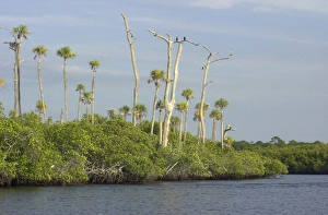
Loxahatchee River, Floridas only wild and scenic riverCormorants watching for fish from a dead tree over the wild and scenic Loxahatchee River, Florida. Digital photograph
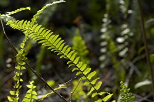
Ferns in the Florida EvergladesTropical understory in a woodland of Everglades National Park, Florida. Digital photograph
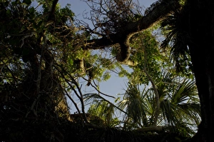
Mahogany tree in the Florida EvergladesAncient mohogany tree in Everglades National Park, Florida. Digital photograph
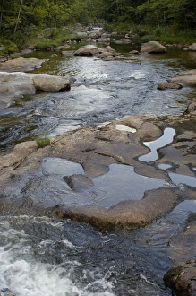
Stream in the White Mountains of New Hampshire and MaineCold River in Evans Notch of the White Mountains, Maine and New Hampshire border area. Digital photograph
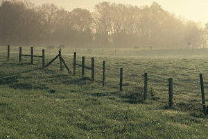
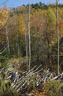
Beaver dam in MainePond created by a beaver dam in Albany Notch, part of the White Mountains National Forest in Maine. Digital photograph