mail_outline sales@mediastorehouse.com
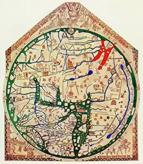
EXPL2A-00352The Hereford Mappa Mundi of 1280 - Jerusalem is at the center, Europe lower left, Africa lower right. Printed color halftone reproduction 19th century
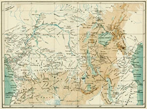
EXPL2A-00366Map of equatorial Africa as known in the 1870s. Printed color lithograph, 19th century
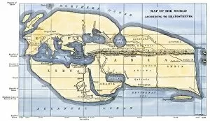
EXPL2A-00317Map of the world according to ancient Greek geographer Eratosthenes. Hand-colored 19th-century woodcut reproduction
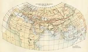
EXPL2A-00353Ptolemys map of the world shown in red, true locations in black. Printed color lithograph 19th century
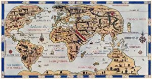
EXPL2A-00354Dauphin Map by Pierre Desceliers made for Prince Henry (who became Henri II) by order of the French King Francis I, 1546. Printed color halftone reproduction 19th century
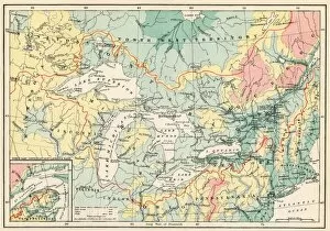
EXPL2A-00357Map of the Great Lakes and the St. Lawrence watershed. Printed color lithograph, 19th century