mail_outline sales@mediastorehouse.com
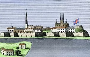
GCAN2A-00011Montreal, Canada, seen from the St. Lawrence River, 1760. Hand-colored woodcut
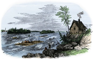
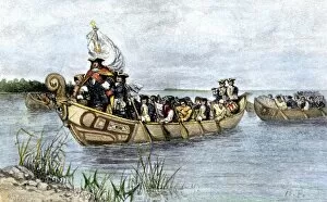
Raft transport on the St Lawrence RiverRafts on the rapids of the St Lawrence River, Canada. Hand-colored woodcut of a 19th-century illustration
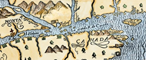
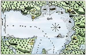
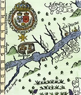
Quebec and Tadoussac, 1609Lescarbots map of the St. Lawrence and the Saguenay showing Quebec (Kebec) in Canada, 1609. Hand-colored woodcut of a 19th-century illustration
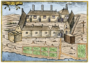
Champlains settlement in Nova Scotia, 1600sSamuel de Champlains fort at Port Royal, now Annapolis Royal, Nova Scotia, 1600s. Hand-colored woodcut of a 19th century illustration
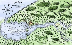
EXPL2A-00297Champlains 1613 map of his settlement at Port Royal, now Annapolis Royal, Nova Scotia, Canada. Hand-colored 19th-century woodcut reproduction of Champlains drawing
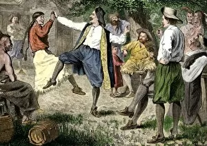
BUSN2A-00166French fur traders and Native Americans dancing at a rendezvous in the north woods. Hand-colored woodcut of a 19th-century illustration
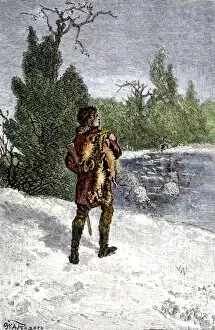
BUSN2A-00060Trapper making his winter rounds in the north wods. Hand-colored woodcut of a 19th-century illustration
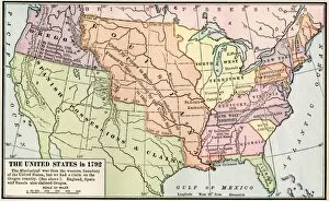
EXPL2A-00039Map of the US in 1792, showing colonial claims on Oregon Territory. Printed color halftone of a 19th century illustration
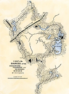
Maine map used in Arnolds invasion of Quebec, 1775Montresors map of inland Maine, used for Arnolds march to Quebec, 1775. Hand-colored woodcut of a 19th-century illustration
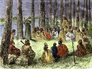
EXPL2A-00175Jesuit missionary preaching to Native Americans and fur traders in the wilderness. Hand-colored woodcut of a 19th-century illustration
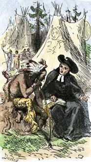
EXPL2A-00253French Jesuit missionary in a Native American village. Hand-colored woodcut of a 19th-century illustration
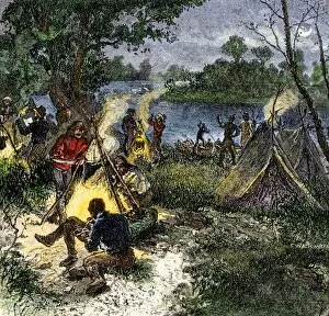
BUSN2A-00167Riverside camp of voyageurs, or French fur traders. Hand-colored woodcut of a 19th-century illustration
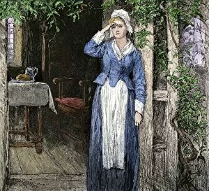
PLIT2A-00112Evangeline, an illustration from the poem by Henry Wadsworth Longfellow. Hand-colored woodcut of a 19th-century illustration
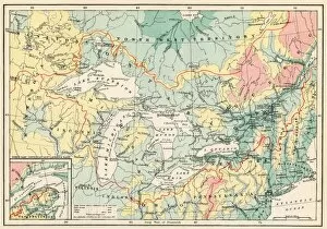
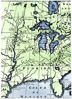
EXPL2A-00357Map of the Great Lakes and the St. Lawrence watershed. Printed color lithograph, 19th century
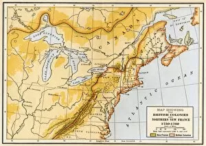
EVNT2A-00019Map showing British colonies and northern New France during the French and Indian War, 1750s. Printed color lithograph of a 19th century illustration
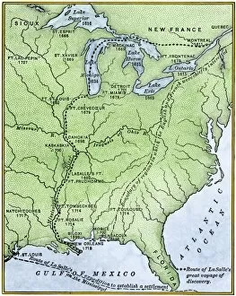
EXPL2A-00171Map showing the route of La Salles explorations in North America, late 1600s. Hand-colored woodcut of a 19th-century illustration
EXPL2A-00218French missionary Louis Hennepins map of the Mississippi River valley, Gulf Coast, and Great Lakes after LaSalle expeditions 1697
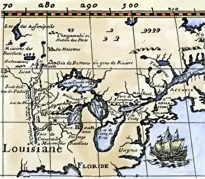
EXPL2A-00329Louis Joliets map of New France, 1673-1674, including the upper Mississippi River he and Jacques Marquette discovered. Hand-colored halftone reproduction
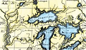
EXPL2A-00350French map of the Great Lakes and upper Mississippi River region, circa 1700. Hand-colored 19th-century woodcut reproduction
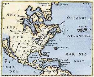
EXPL2A-00375Map of North America as known in the mid-1600s. Hand-colored woodcut reproduction of an illustration in Campanius, 1702
PEXP2A-00026Antoine de La Mothe, Sieur de Cadillac landing on the shore of Lake Saint Clair where he founded Fort Detroit, 1701. Hand colored woodcut of a 19th-century illustration by Howard Pyle
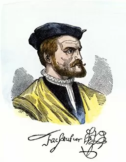
PEXP2A-00081Jacques Cartier portrait with his autograph. Hand-colored woodcut of a 19th-century illustration
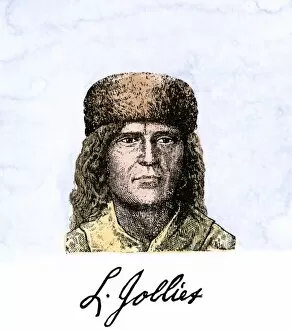
PEXP2A-00055Louis Joliet, with his autograph. Hand-colored 19th-century woodcut of an illustration
EXPL2A-00016Hennepins map of New France and Louisiana - La Carte de la Nouvelle France, 1683. Hand-colored 19th-century woodcut reproduction of the original map
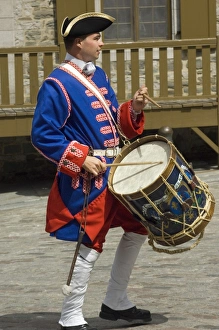
Drummer reenactor in olc QuebecColonial French army reenactor portraying a drummer in 18th-century Quebec. Digital photograph
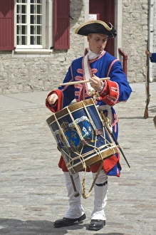
Drummer reenactor in old QuebecColonial French army reenactor portraying a drummer in 18th-century Quebec. Digital photograph
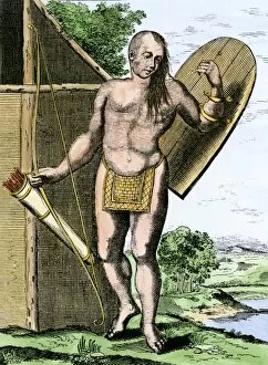
NATI2A-00149A Canadian Native American holding shield, bow, and arrows in a quiver. Hand-colored woodcut
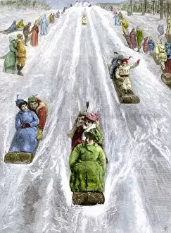
HREC2A-00035Toboggan slide in a park in Montreal, Canada, 1880s. Hand-colored woodcut of a 19th-century illustration
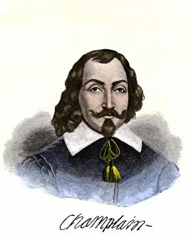
PEXP2A-00074Samuel de Champlain portrait, with his autograph. Hand-colored 19th-century engraving reproduction of the Moncornet portrait
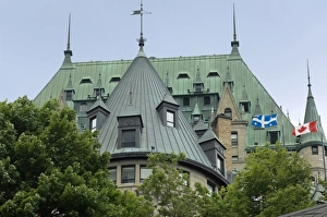
Chateau Frontenac in old QuebecChateau Frontenac in the historic district of Quebec City. Digital photograph
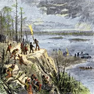
EXPL2A-00109Samuel de Champlain and his Huron allies going to fight the Iroquois, Lake Champlain, 1600s. Hand-colored woodcut of a 19th-century illustration
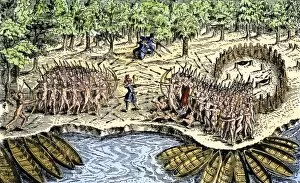
EXPL2A-00110Samuel de Champlains defeat of the Iroquois at Lake Champlain, opening the settlement of New France, 1600s. Hand-colored woodcut
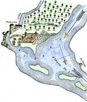
EXPL2A-00183Samuel de Champlains fortified camp at Quebec on the St Lawrence River, 1600s Hand-colored 19th-century woodcut of a 17th-century map
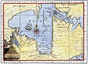
EXPL2A-00190Map of Hudsons Bay, Canada, showing Hudsons Strait, 1722. Hand-colored 19th-century woodcut reproduction of an 18th-century map
Champlains Quebec settlement, 1613Champlains settlement at Quebec in New France, 1613. Hand-colored woodcut of a 17th-century illustration
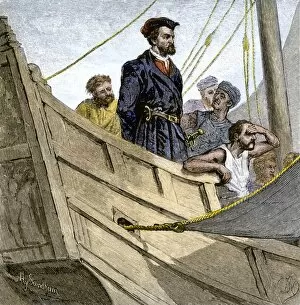
EXPL2A-00232Jacques Cartier aboard ship arriving on the shore of Canada, 1534. Hand-colored woodcut of a 19th-century illustration
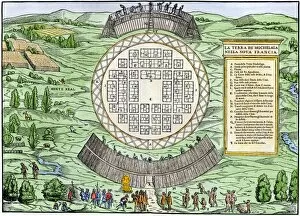
EXPL2A-00246Hochelaga, site of Montreal, shown as a Native American village in Lescarbots map, 1609. Hand-colored 19th-century woodcut reproduction of a 17th-century document
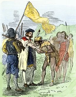
EXPL2A-00247Jacques Cartier embraced by Donnacona, a native Canadian Huron chief, Gaspee Peninsula, 1535. Hand-colored woodcut of a 19th-century illustration
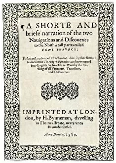
EXPL2A-00251Title page of the London edition of Jacques Cartiers book about his discoveries in Canada, printed in 1580. Watercolor wash over a 19th-century printed halftone reproduction
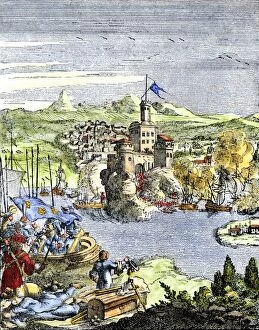
EXPL2A-00249French colonists building fort at Hochelaga, a native village and the site of Montreal, Canada, 1600s. Hand-colored halftone reproduction of a 17th-century illustration
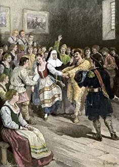
GCAN2A-00012French-Canadians enjoying a dance in early Quebec. Hand-colored woodcut of a 19th-century illustration
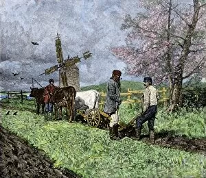
GCAN2A-00008French-Canadian farmers plowing in the Saint Lawrence valley of Quebec, 1800s. Hand colored woodcut of a 19th-century illustration
GCAN2A-00006Catholic clergyman of the Order of St. Sulpice, Quebec, Canada, circa 1700. Hand-colored woodcut of a 19th-century illustration
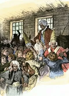
GCAN2A-00003British official reading the Decree of Expulsion to Acadians in Canada, 1755. Hand-colored woodcut of a 19th-century illustration
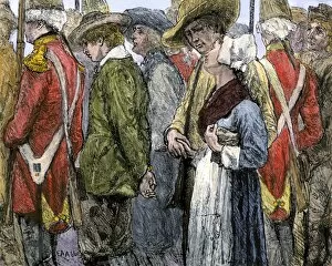
GCAN2A-00002British removing Acadians from Canada in 1755. Hand-colored woodcut of a 19th-century illustration
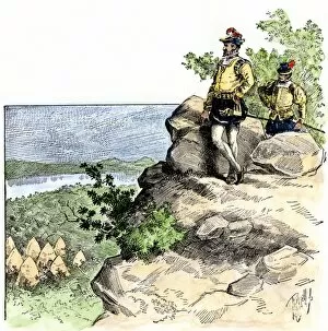
EXPL2A-00087Jacques Cartier on the summit of Mont Real, now Montreal, Canada, 1535. Hand-colored woodcut of a 19th-century illustration
EXPL2A-00080Capture of French Quebec by the English, 1629. Hand-colored woodcut reproduction from Hennepin 1698
EXPL2A-00058Samuel de Champlains map of the Gaspee and Gulf of the Saint Lawrence River, 1632. Hand-colored woodcut reproduction of the original map