mail_outline sales@mediastorehouse.com
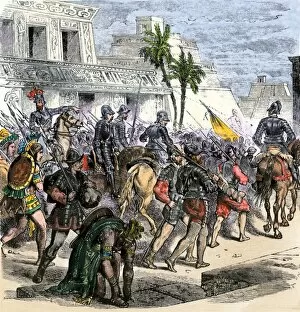
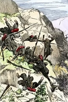
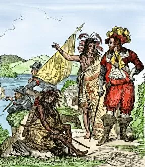
EXPL2A-00368Cortes marches out of Aztec Tenochtitlan to battle the army of Narvaez, 1519. Hand-colored woodcut of a 19th century illustration
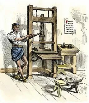
BUSN2A-00065Stephen Dayes press, the first printing press in America, Cambridge, Massachusetts, 1640. Hand-colored woodcut
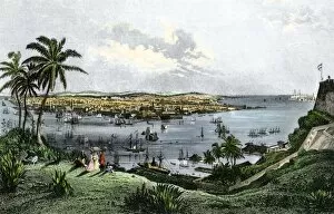
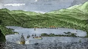
GATL2A-00005Harbor of Havana, Cuba, in the 1800s. Hand-colored engraving of a 19th-century illustration
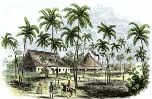
GATL2A-00006Sugar plantation in Cuba, 1850s. Hand-colored woodcut of a 19th-century illustration
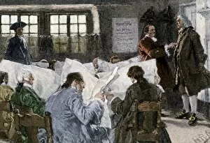
HREC2A-00028Men reading newspapers in a library reading-room, 1700s. Hand-colored woodcut of a 19th-century illustration by Howard Pyle
GATL2A-00017Sailing-ship firing on a fort in Jamaica during colonial times. Hand-colored woodcut
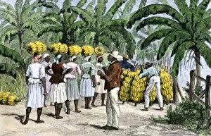
GATL2A-00022Jamaican women carrying bananas to a seaport, 1800s. Hand-colored woodcut of a 19th-century illustration
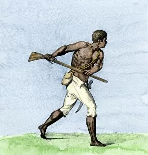
GATL2A-00024Leonard Parkinson, a captain of Maroons during a Negro insurrection in Jamaica, 1700s. Hand-colored woodcut reproduction of a contemporary illustration
PBLA2D-00010Quill pen in the hand of the Phyllis Wheatley statue, Boston Womens Memorial. Digital photograph
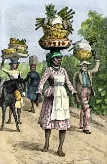
GATL2A-00028Native people on their way to market in Kingston, Jamaica, circa 1890. Hand-colored woodcut of a 19th-century illustration
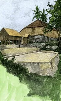
GATL2A-00034Plantation coffee-mill, surrounded by stone terraces, Jamaica, circa 1890. Hand-colored halftone reproduction of a 19th-century illustration
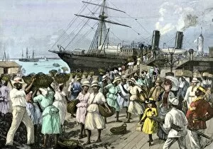
GATL2A-00035Native women carrying coal onto a steamship at Kingston, Jamaica, 1880s. Hand-colored woodcut of a 19th-century illustration
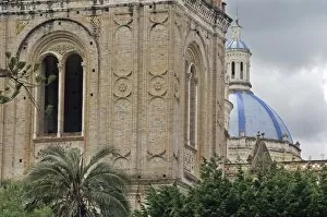
GLAT2D-00067New cathedral in the Spanish colonial city of Cuenca, Ecuador. Digital photograph
GLAT2D-00068Arches facing the Spanish colonial plaza of Cuenca, Ecuador. Digital photograph
GLAT2D-00069Door of the old cathedral in the Spanish colonial city of Cuenca, Ecuador. Digital photograph
GLAT2D-00070Door of the new cathedral in the Spanish colonial city of Cuenca, Ecuador. Digital photograph
GLAT2D-00071Window of the new cathedral in the Spanish colonial city of Cuenca, Ecuador. Digital photograph
GLAT2D-00072Windows and balconies in the Spanish colonial city of Cuenca, Ecuador. Digital photograph
GLAT2D-00073Windows and balconies in the Spanish colonial city of Cuenca, Ecuador. Digital photograph
GLAT2D-00075Courtyard in the Spanish colonial city of Cuenca, Ecuador. Digital photograph
Colonial oven, Charleston, South CarolinaOutdoor oven, Charles Towne Landing Historic Site, reconstructed settlement, South Carolina. Digital photograph
GLAT2D-00076Tiled roof and trim detail in the Spanish colonial city of Cuenca, Ecuador. Digital photograph
Handmade candles drying, Charles Towne Landing Historical Site, reconstructed settlement in South Carolina. Digital photograph
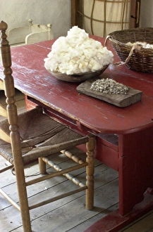
Cotton cleaned by hand, South CarolinaCotton to be cleaned, Charles Towne Landing colonial historic site, South Carolina. Digital photograph
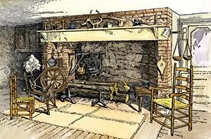
HSET2A-00080Spinning-wheel beside a colonial kitchen fireplace. Hand-colored woodcut of a 19th-century illustration
EVNT2A-00083Battle of Ayacucho, when Bolivars forces under General Sucre established Perus independence from Spain, 1824. Hand colored woodcut of a 19th-century illustration
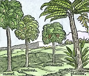
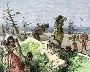
EXPL2A-00100Bananas and other fruit trees of Hispaniola, from a sketch published in 1572. Hand-colored woodcut of a 19th-century reproduction of an illustration from Benzoni 1572
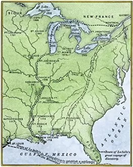
EXPL2A-00171Map showing the route of La Salles explorations in North America, late 1600s. Hand-colored woodcut of a 19th-century illustration
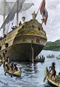
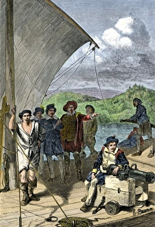
EXPL2A-00209Henry Hudsons ship " Half Moon" arriving at Manhattan Island, 1609. Hand-colored halftone of a 19th-century illustration
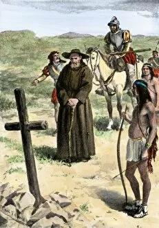
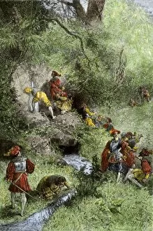
EXPL2A-00211Father Juan de Padilla finds the cross set by Coronado, 1540s. Hand-colored halftone of a 19th-century illustration
EXPL2A-00213Henry Hudsons attack on a Native American village on the Atlantic coast, 1609. Hand colored woodcut of a 19th-century illustration
EXPL2A-00218French missionary Louis Hennepins map of the Mississippi River valley, Gulf Coast, and Great Lakes after LaSalle expeditions 1697
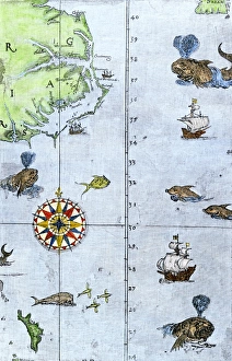
Virginia and North Carolina coast, 1500sJohn Whites map of the Atlantic coast of North Carolina and Virginia, 1500s. Hand-colored 19th-century woodcut reproduction
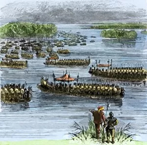
EXPL2A-00258De Sotos expedition met by Chief Aquixos Native Americans in canoes on the Mississippi River, 1542. Hand-colored woodcut of a 19th-century illustration
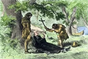
EXPL2A-00257Death of Father Marquette in Michigan, returning from a mission to the Ilinois Indians, 1675. Hand-colored woodcut of a 19th-century illustration
EXPL2A-00260De Soto discovering the Mississippi River after an overland journey, 1540. Hand-colored woodcut of a 19th century illustration
EXPL2A-00263Juan Ponce de Leons expedition searching for the Fountain of Youth in Florida, 1500s. Hand-colored woodcut of a 19th-century illustration
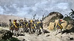
EXPL2A-00293Francisco Pizarro draws a line in the sand in Panama daring his men to follow him to Peru, 1530. Hand-colored woodcut of a 19th-century illustration
EXPL2A-00329Louis Joliets map of New France, 1673-1674, including the upper Mississippi River he and Jacques Marquette discovered. Hand-colored halftone reproduction
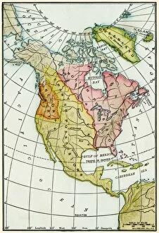
EXPL2A-00330North American colonies at the close of the French and Indian War, 1760s. Printed color lithograph 19th century
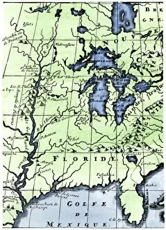
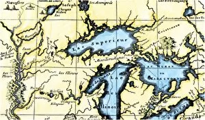
EXPL2A-00350French map of the Great Lakes and upper Mississippi River region, circa 1700. Hand-colored 19th-century woodcut reproduction
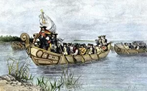
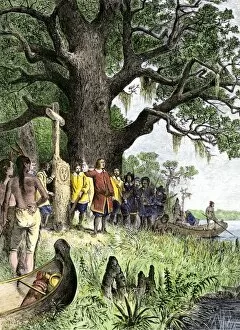
PEXP2A-00026Antoine de La Mothe, Sieur de Cadillac landing on the shore of Lake Saint Clair where he founded Fort Detroit, 1701. Hand colored woodcut of a 19th-century illustration by Howard Pyle
Early exploration of the Maine coastEnglish explorers sailing up the Penobscot River on the coast of Maine. Hand-colored woodcut of a 19th-century illustration
HOUS2A-00035Daughter bringing the cattle home. Hand-colored woodcut of a 19th-century illustration
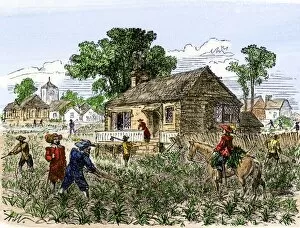
AGRI2A-00130Cultivation of tobacco in colonial Virginia. Hand-colored woodcut of a 19th-century illustration
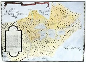
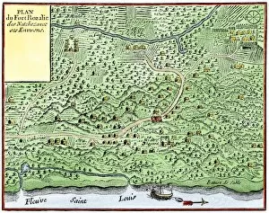
EXPL2A-00124Fort Rozalie des Natchez on the Mississippi River 1700s - North is to the right. Hand-colored woodcut of a map published in 1770. Fleuve Saint Louis was the French name for the Mississippi River
EXPL2A-00118LaSalle at the mouth of the Mississippi River claims Louisiana for France 1682. Hand-colored woodcut of a 19th-century illustration
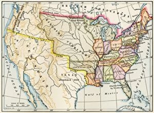
EXPL2A-00022Map of the United States in 1819, showing territory under Spanish and British control. Printed color halftone of a 19th-century illustration