mail_outline sales@mediastorehouse.com
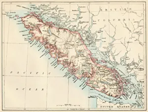
Vancouver Island map, 1870sMap of Vancouver Island, British Columbia, Canada, 1870s. Lithograph reproduction of a 19th-century illustration
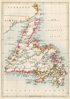
Newfoundland, 1870sMap of Newfoundland, Canada, 1870s. Printed color lithograph
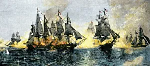
Battle of Lake Erie, War of 1812British and American ships engaged in the Battle of Lake Erie, 1813. Hand-colored woodcut of a 19th-century illustration
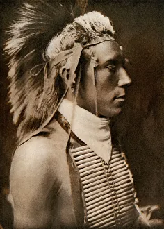
Young Crow IndianA Crow boy in dance costume, 1905. Printed reproduction of a photograph by Edward Curtis
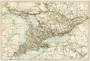
Ontario, 1870sMap of Ontario, Canada, 1870s. Printed color lithograph
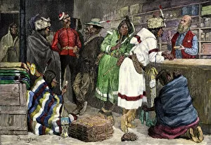
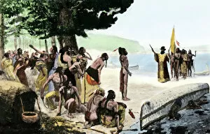
BUSN2A-00012Native Americans exchanging furs for goods at a Hudson Bay Company post. Hand-colored 19th-century woodcut of a Frederic Remington illustration
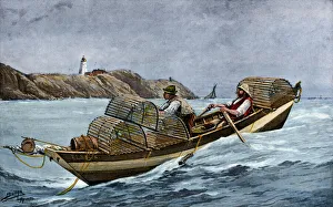
Lobster boat off the Atlantic coast of Maine and CanadaLobster fishermen in the Grand Manan Channel between Maine and New Brunswick, 1890s. Hand-colored halftone reproduction of a 19th-century illustration
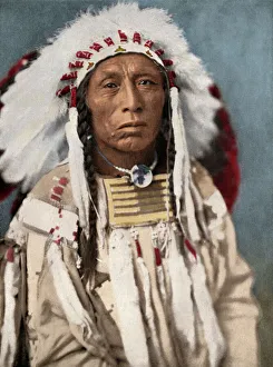
Crow chiefCrow Indian chief in a traditional war bonnet and clothing, circa 1900. Digitally colored halftone of a photograph
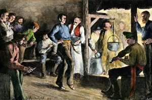
BUSN2A-00110Woodsman dancing to a fiddle in a logging camp at night, 1800s. Hand-colored woodcut of a 19th-century illustration
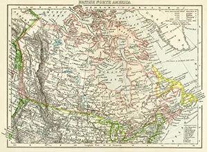
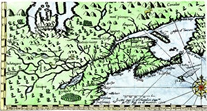
Canada map, 1870sMap of British North America, or the Dominion of Canada, 1870s. Printed color lithograph
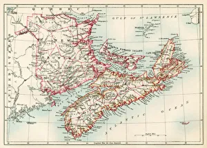
New Brunswick and Nova Scotia, 1870sMap of Nova Scotia, Prince Edward Island, and New Brunswick, 1870s. Printed color lithograph
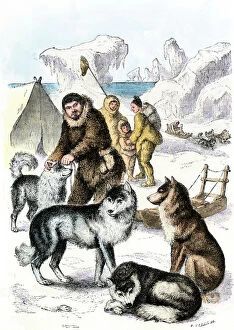
NATI2A-00009Innuit family with dog team and sled, . Hand-colored woodcut of a 19th-century illustration
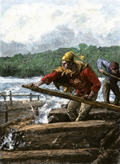
Rafting furs from the northwoods to marketFur traders steering a raft through rapids of a river. Hand-colored woodcut of a 19th-century illustration
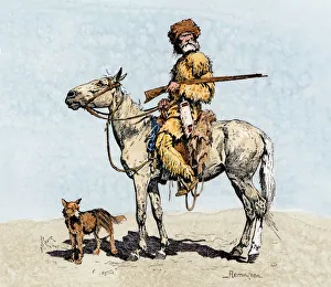
Mountain man in the old westOld trapper in the American West, 1800s. Hand-colored woodcut of a 19th-century Frederic Remington illustration
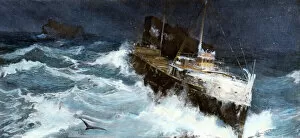
TRAN2A-00040Freighter struggling through a storm on Lake Superior, circa 1900. Hand-colored halftone reproduction of an illustration
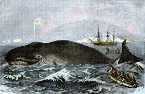
BUSN2A-00109Longboat crew attacking a whale with hand harpoons in the Arctic, 1800s. Hand-colored woodcut of a 19th-century illustration
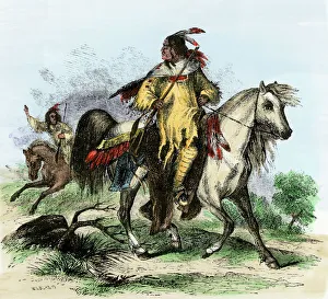
Blackfeet horsemen, 1850sBlackfeet warriors carrying guns on horseback, 1850s. Hand-colored woodcut of a 19th-century illustration
EXPL2A-00128Landing of Jean Nicolet on the Wisconsin shore of Lake Michigan, 1634, the first European to reach that region. Hand-colored halftone of a 19th-century illustration
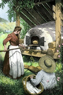
HOUS2A-00141French-Canadian woman baking bread in an outdoor oven, circa 1900. Hand-colored halftone reproduction of a turn-of-the-century illustration
EVNT2A-00048British capturing Quebec in the Battle of the Plains of Abraham, French and Indian War, 1759. Hand-colored woodcut
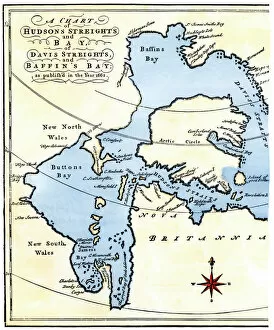
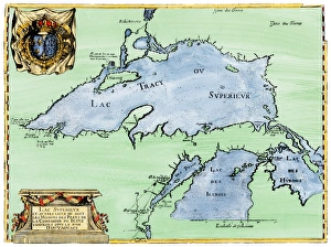
EXPL2A-00284Early map of Hudsons Strait and Hudsons Bay, 1662, in Arctic Canada. Hand-colored 19th-century woodcut reproduction
EXPL2A-00184Part of the 1613 Samuel de Champlain map of New France. Hand-colored woodcut of a 19th-century reproduction of the original ma
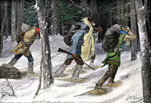
BUSN2A-00177Native American trappers carrying furs on snowshoes in a forest of the Pacific Northwest Hand-colored woodcut of a 19th-century Frederic Reminigton illustration
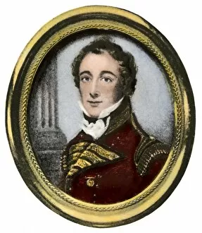
PCAN2A-00004Isaac Brock, British commander of Upper Canada, War of 1812. Hand-colored halftone reproduction of a 19th-century portrait
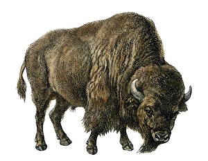
American buffaloBison, or American buffalo. Hand-colored woodcut of a 19th-century illustration
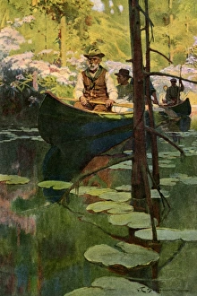
Canoeists on a slow-moving streamWoodsmen in canoes floating on a tranquil river, circa 1900. Printed color halftone reproduction of a Schoonover illustration
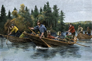
Racing heavy canoes on a northern river, 1800sA bateau (boat) race in the north woods, 1800s. Hand-colored woodcut of a 19th-century illustration
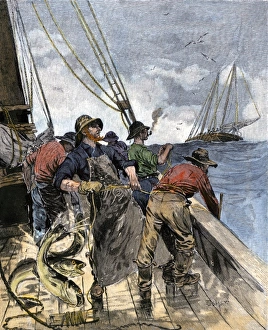
Cod fishing with hand lines, 1800sCod fishermen hauling in hand-lines from the deck of a boat on the North Atlantic, 1800s. Hand-colored woodcut of a 19th-century illustration
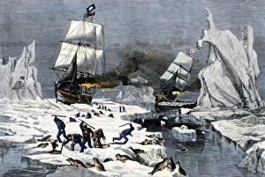
Fur seal hunt in the Arctic, 1800sClubbing seals to death for their fur, 1800s. Hand-colored woodcut of a 19th-century illustration
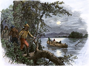
Frontiersmen on the upper Missouri River, 1800sHalf-breeds and French voyageurs towing a boat in the upper Missouri River, 1800s. Hand-colored woodcut of a 19th-century illustration
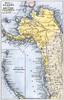
Alaska and British Columbia map, 1872Map of Alaska, the Aleutian Islands, and British Columbia, 1872. Hand-colored woodcut of a 19th-century illustration
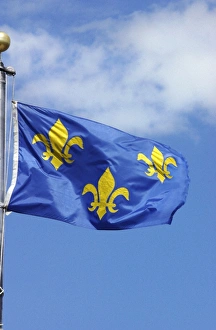
Flag of France, 1700sFrench flag marking La Verendrye expeditions claim of the northern Great Plains for France in 1743, Pierre, South Dakota. Digital photograph
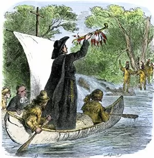
EXPL2A-00194Father Jacques Marquette holding a peace pipe to greet Native Americans during his journey to the upper Mississippi River, 1673. Hand-colored woodcut of a 19th-century illustration
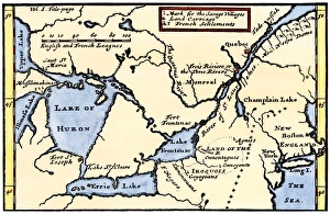
French map of the Great Lakes, 1703La Hontans map of the Great Lakes and Saint Lawrence valley, 1703. Hand-colored 19th-century woodcut reproduction of an 18th century illustration
French settlement of the Great Lakes, 1600sFrench Jesuit map of Lake Superior, Upper Michigan, and Wisconsin, 1600s. Hand-colored woodcut of a 17th-century illustration
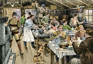
Lumberjacks having dinner, 1800sDinner in a logging camp in the Northwest, 1880s. Hand-colored woodcut of a 19th-century illustration
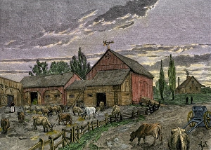
Canadian farm on the frontier, 1800sCattle and barns of a Canadian homestead about 1850. Hand-colored woodcut of a 19th-century illustration
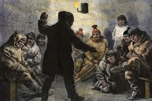
Netsilik Inuit entertainmentNetsilik Eskimo men in an igloo playing a game, circa 1880. Hand-colored woodcut of a sketch by Schwatkas Arctic expedition
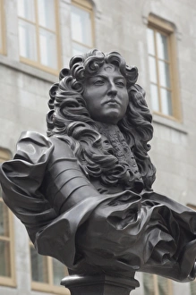
Statue of Louis XIV in old QuebecBust of French King Louis XIV in the historic district of Quebec City, Canada. Digital photograph
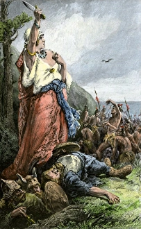
Vikings battling natives on the coast of VinlandFreydis defends her fellow Norse settlers from Native Americans, or Skraelings, 1009. Hand-colored woodcut of a 19th-century illustration
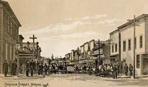
Vancouver, British Columbia, 1870sWagons and shops on Cordova Street in Vancouver, British Columbia, Canada, 1887. Lithograph reproduction of a 19th-century illustration
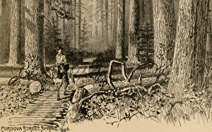
Vancouver Island corduroy road, 1800sHorseback traveler through a forest on Vancouver Island, Canada, 1880s. Lithograph reproduction of a 19th-century illustration
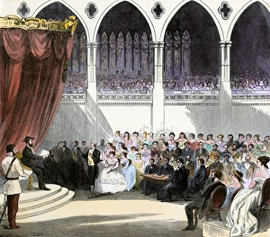
First independent Canadian Parliament session, 1867Opening of the first Parliament of the new Dominion of Canada, 1867. Hand-colored woodcut of a 19th-century illustration
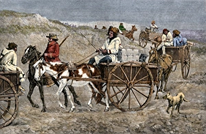
Trappers hauling furs to a Canadian trading postFur train from the north arriving at a Canadian trading post, 1800s. Hand-colored woodcut of a 19th-century Frederic Remington illustration
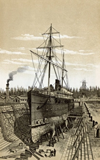
Vancouver Island shipyard, 1800sDrydock at Esquimalt, British Columbia, 1880s. Lithograph reproduction of a 19th-century illustration
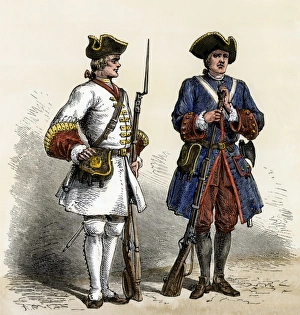
French soldiers in North America, early 1700sCanada and Louisiana defended by French soldiers in the early 1700s. Hand-colored woodcut of a 19th-century illustration
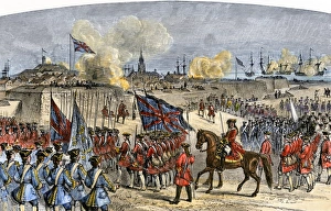
Louisbourg surrendered by the French in Canada, 1758Surrender of Louisbourg to the British under General Jeffrey Amherst, French and Indian War. Hand-colored woodcut of a 19th-century illustration
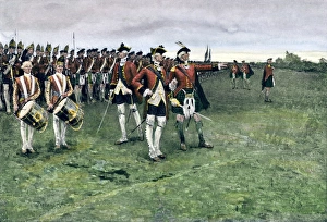
British army gathering to capture Quebec, 1759General Wolfe assembling the British army on the Plains of Abraham to take Quebec, 1759. Hand-colored halftone reproduction of a Frederic Remington illustration