mail_outline sales@mediastorehouse.com
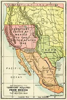
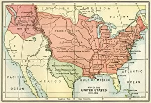
U. S. territory gained from MexicoMap of territory acquired by the U.S. from Mexico. Color lithograph of a 19th-century illustration
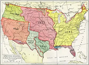
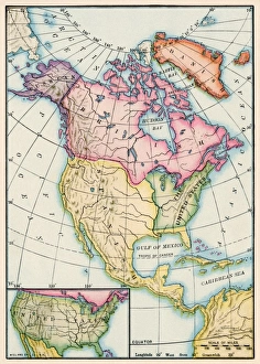
Growth of the United States to 1853U.S. map, showing territorial growth to 1853. Printed color lithograph of a 19th-century illustration
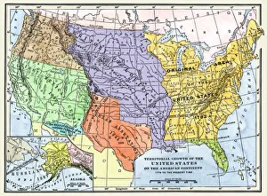
US territorial acquisition during the 1800sMap showiing the territorial growth of the continental US 1776 to 1899. Hand-colored woodcut of a 19th-century illustration
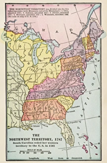
Northwest Territory mapMap of the old Northwest Territory, 1787. Printed color lithograph of a 19th-century illustration
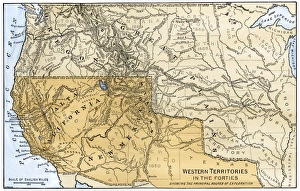
Western boundary with Mexico, 1840sMexican possessions and western US territories in the 1840s. Hand-colored woodcut of a 19th-century illustration
North American colonies in 1733European claims in North America in 1733, when the last English colony, Georgia, was founded. Color lithograph
North American territories in 1783North America at the close of the Revolution - Treaty of Paris, 1783. Printed color lithograph
EXPL2A-00038Map of the U.S. boundary disputes with Spain and Great Britain, 1810-1812. Printed color lithograph of a 19th-century illustration
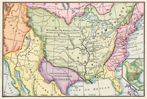
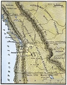
EXPL2A-00210Map of Oregon Territory showing boundary of US with English Canada under dispute until 1846. Hand-colored woodcut of a 19th-century illustration
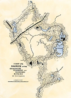
Maine map used in Arnolds invasion of Quebec, 1775Montresors map of inland Maine, used for Arnolds march to Quebec, 1775. Hand-colored woodcut of a 19th-century illustration
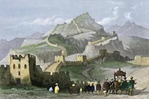
GASI2A-00001The Great Wall of China. Hand-colored engraving
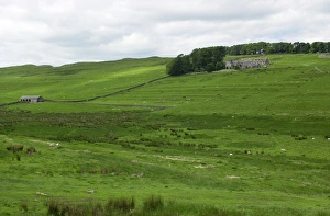
Hadrians Wall across northern EnglandHadrians Wall, an ancient Roman fortification, crossing fields on the moors of Northumbria, England. Digital photograph
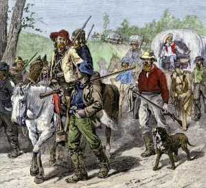
Pro-slavery voters from Missouri entering Kansas Territory, 1850sMissouri " border ruffians" entering Kansas to vote for slavery in the territory, 1850s. Hand-colored woodcut of a 19th-century illustration
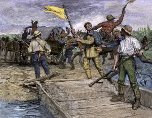
Proslavery voters invading Kansas, 1850sPro-slavery forces ferrying Missouri voters to the Kansas shore to vote against free soil, 1850s. Hand-colored woodcut of a 19th-century illustration