mail_outline sales@mediastorehouse.com
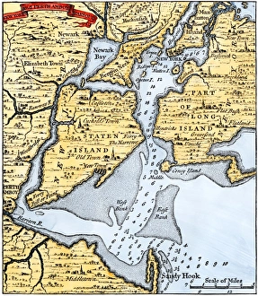
New York harbor chart, 1733Popples map of New York City and the surrounding area, 1733. Hand-colored woodcut reproduction of an 18th-century illustration
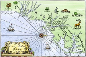
Carolina coast map, 1600sMap of the Carolinas, showing Charleston and the Outer Banks, north on the right. Hand-colored woodcut reproduction of a 17th-century map
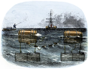
Confederate explosive mines blocking a river, Civil WarBarrel torpedo, or mine, used by Confederates to blockade a southern river mouth, 1860s. Hand-colored woodcut of a 19th-century illustration
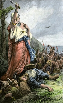
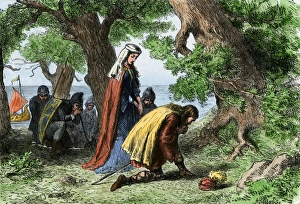
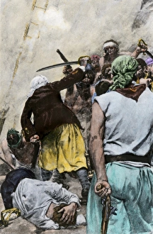
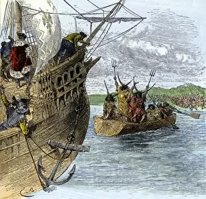
Vikings battling natives on the coast of VinlandFreydis defends her fellow Norse settlers from Native Americans, or Skraelings, 1009. Hand-colored woodcut of a 19th-century illustration
Vikings discovering VinlandNorse settlers Thorfin and Gudrida landing on Vinland. Hand-colored woodcut of a 19th-century illustration
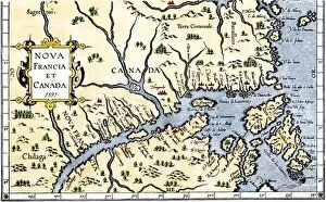
EXPL2A-00325Map of New France and Canada, 1597. Hand-colored 19th-century woodcut reproduction of a 16th-century map printed in Wytfliet
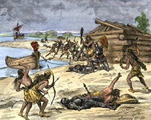
Norse settlers in battle with New World nativesViking expedition leader Thorwald fatally wounded by natives on the coast of Canada, 1002 AD. Hand-colored woodcut of a 19th-century illustration
Africans jumping from a slave ship, 1700sAfrican captives leaping off a slave-ship near the coast of Africa, 1700s. Hand-colored halftone reproduction of a 19th-century illustration
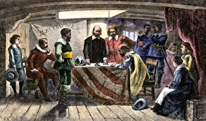
Mayflower Compact signed by the Plymouth colonists, 1620Pilgrims agreeing to govern themselves according to the Mayflower Compact, 1620. Hand-colored woodcut of a 19th-century illustration
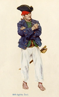
PirateBuccaneer in the classic days of piracy. Printed halftone reproduction of a watercolor by Walter Appleton Clark
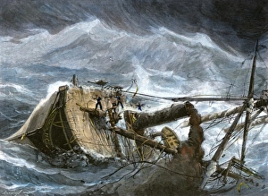
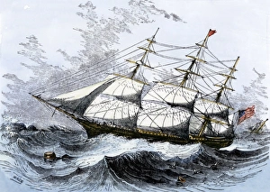
Steamship in a hurricaneAmerican steamship " Yantic" heeled over in a hurricane, 1880s. Hand-colored woodcut of a 19th-century illustration
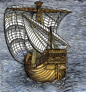
Spanish caravel tacking before the wind, from a drawing attributed to Columbus. Hand-colored 19th-century woodcut reproduction of a 16th-century illustration
Colonial sailors fighting pirates aboard shipFighting off Carolina pirates in colonial days. Hand-colored halftone reproduction of a 19th-century illustration
American clipper ship, close-hauled on a wind. Hand-colored woodcut of a 19th-century illustration
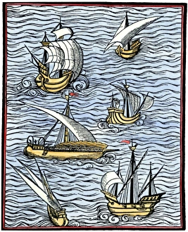
Portuguese caravelsCaravels, from " Libre de cololat tractat dels fet maritims, " Portugal, 1502. Hand-colored 19th-century woodcut reproduction of a 16th-century illustration
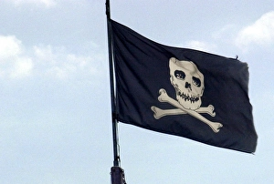
Pirate flagJolly Roger flag flying in former pirate seaport, Savannah, Georgia. Digital photograph
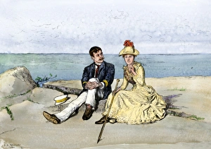
Tourists overlooking the Atlantic Ocean from Mt. Desert Island, MaineHikers atop Newport Mountain, Mt Desert Island, Maine, 1880s. Hand-colored woodcut of a 19th-century illustration
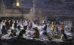
Coney Island beach lit by electric light, 1880sSwimming by electric light at Coney Island, New York, 1880s. Hand-colored woodcut of a 19th-century illustration
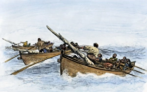
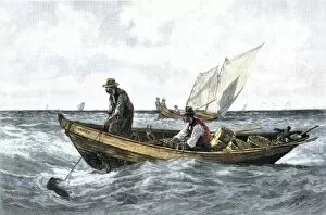
Longboats pursuing a whale, 1800sLongboats racing to harpoon a whale. Hand-colored woodcut of a 19th-century illustration
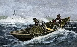
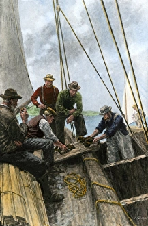
BUSN2A-00123Lobstermen hauling traps off the coast of Maine, 1800s. Hand-colored woodcut of a 19th-century illustration
Maine lobster catch, early 1900sLobstermen loading their catch from a dory to a sailboat, circa 1900. Hand-colored halftone reproduction of a 20th-century illustration
BUSN2A-00150North Atlantic cod-fishing in the 1880s Hand-colored woodcut of a 19th-century illustration
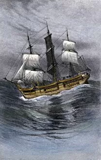
BUSN2A-00138Old wooden whaling-ship under sail. Hand-colored woodcut of a 19th-century illustration
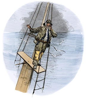
Thar she blowsWhaling schooner lookout calling, " There she blows!" Hand-colored woodcut of a 19th-century illustration
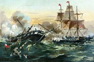
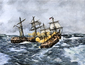
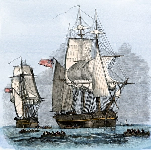
EVNT2A-00022Naval duel between the frigate USS " Constitution" and the British ship " Guerriere, " War of 1812. Printed color lithograph of a 19th century painting
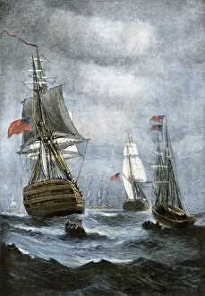
EVNT2A-00009British ships blockading Chesapeake Bay at the outset of the War of 1812. Hand-colored halftone of a 19th century illustration
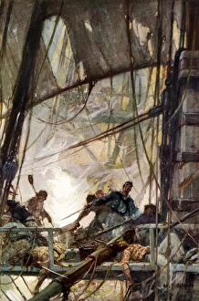
War of 1812 sea fight on the USS ChesapeakeFighting at the mizzentop of the frigate Chesapeake during a naval battle, War of 1812. Printed halftone reproduction of a W. J. Aylward painting
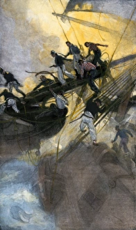
War of 1812 naval battleAmerican sailors from the " Frolic" boarding the British ship " Wasp, " War of 1812. Hand-colored halftone reproduction of a 19th-century illustration
Sea battle of the Wasp and Frolic, War of 1812USS " Wasp" crosses " Frolic s" bow and fires at close range, War of 1812. Hand-colored halftone reproduction of a 19th-century illustration
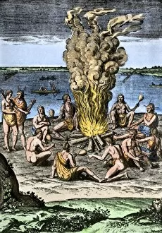
NATI2A-00151Native Americans around a fire on the Virginia/North Carolina coast, 1500s. Hand-colored woodcut reproduction of an illustration from Hariot
EXPL2A-00065World map of the flat earth printed by Beatus Rhenanus Bildaus Rheinau early 1500s - North is left, Mediterranean Sea middle Printed color lithograph reproduction 19th century
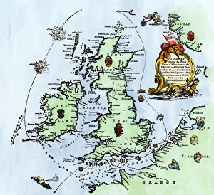
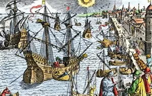
Spanish Armadas route in 1588Chart of the Spanish Armadas course, 1588. Hand-colored engraving
Chesapeake Bay entrance before settlers arrivedEntrance to Chesapeake Bay, as it appeared to early explorers and colonists. Hand-colored woodcut of a 19th-century illustration
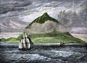
Peak of Tenerife, Canary IslandsSailing ships passing the Peak of Tenerife, or Teyde, Canary Islands, 1800s. Hand-colored woodcut of a 19th-century illustration
EXPL2A-00233Cartiers ships leaving St. Malo, France, to sail for North America, 1530s. Hand-colored woodcut of a 19th-century illustration
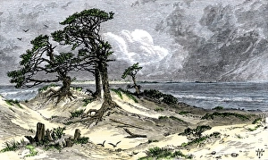
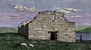
Norse settlement ruins in GreenlandRuins of a Viking church at Katortok, Greenland, view in 1800s. Hand-colored woodcut of a 19th century illustration
The search for Sir John Franklins Arctic expedition, 1850s" Resolute" and four other ships leaving England to search for Franklins lost Arctic expedition, 1852. Hand-colored woodcut of a 19th-century illustration
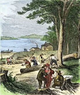
PEXP2A-00078Captain Adrian Block buildng a ship in Narragansett Bay, 1613-14. Hand-colored woodcut of a 19th-century illustration
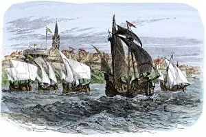
EXPL2A-00107Ships in busy Lisbon harbor, circa 1600. Hand-colored woodcut of a 19th-century reproduction of the original illustration from DeBry
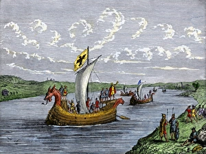
Viking explorers on the North American coastViking settlers exploring the North American coast. Hand-colored woodcut of a 19th-century illustration
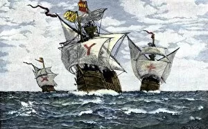
EXPL2A-00009Three ships of Columbus approaching the New World, 1492. Hand-colored woodcut of a 19th-century illustration
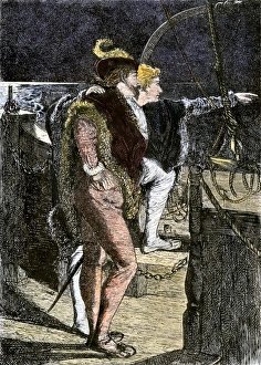
Columbus first sighting the New WorldColumbus getting his first sight of the New World from the deck of the Santa Maria, 1492. Hand-colored woodcut of a 19th-century illustration
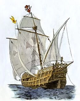
EXPL2A-00089Caravel " Santa Maria, " the flagship of Columbus first voyage and which sank off Hispaniola in 1492. Hand-colored woodcut of a 19th-century illustration
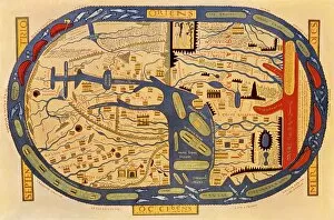
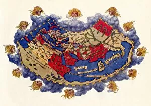
EXPL2A-00061Ptolemys world map, circa 150 AD, from the edition of 1472. Color halftone reproduction of the first printed edition of 1472
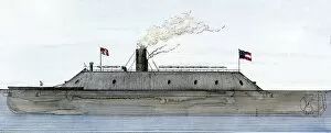
EVCW2A-00140Confederate ironclad " Merrimac, " from a sketch made the day before the battle with Union " Monitor, " 1862. Hand-colored woodcut of a 19th century illustration
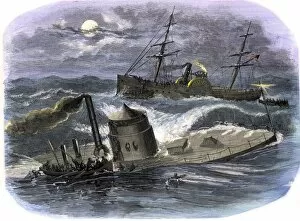
EVCW2A-00113Sinking of the ironclad USS Monitor in a gale off North Carolina, 1862, crew making for the USS Rhode Island. Hand-colored woodcut of a 19th century illustration
EXPL2A-00234Huron chief Donnacona warns Cartiers expedition not to sail up the St Lawrence River, 1535. Hand-colored woodcut of a 19th-century illustration
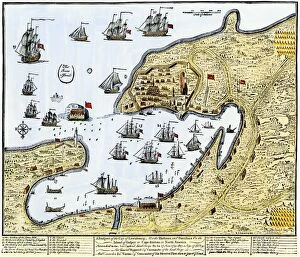
GCAN2A-00016Louisbourg, Canada, besieged by New Englanders under the British flag, 1745. Hand-colored woodcut of a contemporary chart