Home > Africa history
Mounted Print : Map of Cape Colony, South Africa


![]()
Mounted Prints from North Wind
Map of Cape Colony, South Africa
South Africa when a British colony, 1870s.
Printed color lithograph of a 19th-century illustration
Media ID 5876533
© North Wind Picture Archives
Africa African British British Colony British Empire Colonial Colony South Africa South African
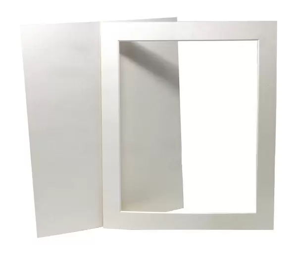
10"x8" Mount with 8"x6" Print
Printed on 8"x6" paper and suitable for use in a 10"x8" frame (frame not included). Prints are mounted with card both front and back. Featuring a custom cut aperture to match chosen image. Professional 234gsm Fujifilm Crystal Archive DP II paper.
Photo prints supplied in custom cut card mount ready for framing
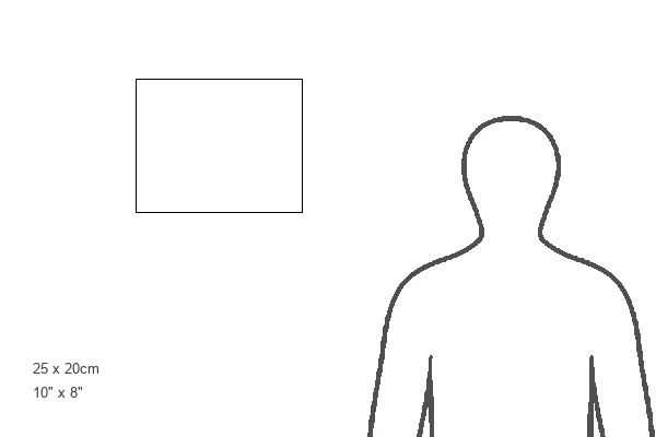
Estimated Image Size (if not cropped) is 20.3cm x 14.7cm (8" x 5.8")
Estimated Product Size is 25.4cm x 20.3cm (10" x 8")
These are individually made so all sizes are approximate
Artwork printed orientated as per the preview above, with landscape (horizontal) orientation to match the source image.
FEATURES IN THESE COLLECTIONS
> Maps
MADE IN THE UK
Safe Shipping with 30 Day Money Back Guarantee
FREE PERSONALISATION*
We are proud to offer a range of customisation features including Personalised Captions, Color Filters and Picture Zoom Tools
SECURE PAYMENTS
We happily accept a wide range of payment options so you can pay for the things you need in the way that is most convenient for you
* Options may vary by product and licensing agreement. Zoomed Pictures can be adjusted in the Cart.