Home > Maps
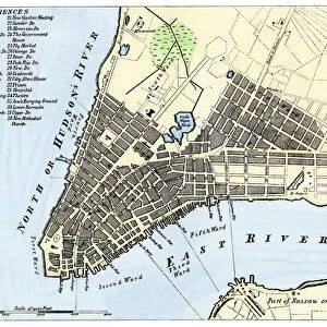
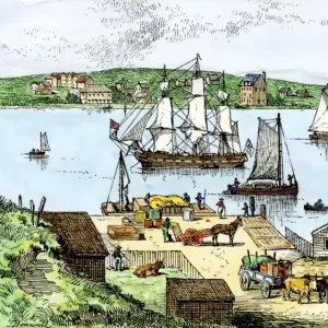
New York harbor chart, 1733

![]()
Wall Art and Photo Gifts from North Wind
New York harbor chart, 1733
Popples map of New York City and the surrounding area, 1733.
Hand-colored woodcut reproduction of an 18th-century illustration
Media ID 5882559
© North Wind Picture Archives
1700s 18th Century Atlantic Atlantic Ocean Chart Colonial Colonist Colony English English Colony Harbor Manhattan New Jersey New York New York City
FEATURES IN THESE COLLECTIONS
> Maps
MADE IN THE UK
Safe Shipping with 30 Day Money Back Guarantee
FREE PERSONALISATION*
We are proud to offer a range of customisation features including Personalised Captions, Color Filters and Picture Zoom Tools
SECURE PAYMENTS
We happily accept a wide range of payment options so you can pay for the things you need in the way that is most convenient for you
* Options may vary by product and licensing agreement. Zoomed Pictures can be adjusted in the Basket.