mail_outline sales@mediastorehouse.com
216 items
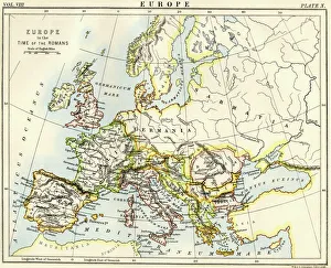
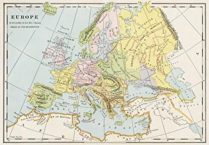
Map of Europe under the Roman EmpireMap of Europe in the time of the Roman Empire. Printed color lithograph of a 19th-century illustration
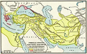
Persian Empire about 500 BCMap of the Persian Empire under Darius I, with principal satrapies, about 500 BC. Color lithograph reproduction of a 19th-century illustration
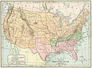
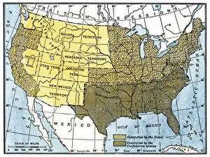
United States during the Civil WarMap of the United States 1861 to 1865. Printed color lithograph of a 19th-century illustration
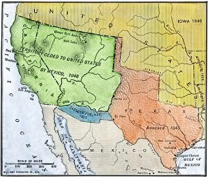
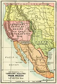
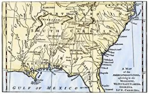
EXPL2A-00265Map of the territory ceded by Mexico to the US after the Mexican-American War, 1848-1853. Hand-colored woodcut of a 19th-century illustration
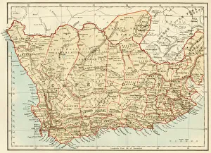
Map of Cape Colony, South AfricaSouth Africa when a British colony, 1870s. Printed color lithograph of a 19th-century illustration
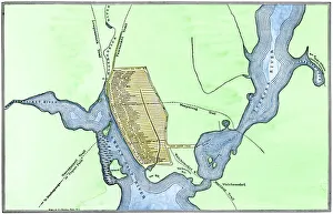
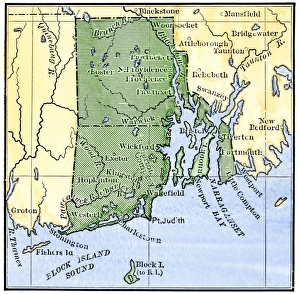
Providence, Rhode Island, 1664Map of Providence, Rhode Island, in 1664, showing property of original proprietors. Hand-colored 19th-century woodcut reproduction of the document
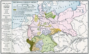
Germany before World War IMap of the German Empire before World War I, circa 1912. Printed color lithograph
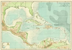
EXPL2A-00377Chart of the West Indies sea depths and land elevations. Printed color lithograph of a 19th-century illustration
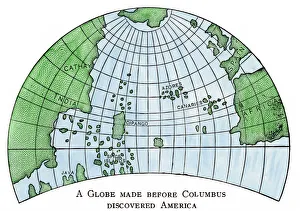
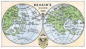
Globe of 1492, lacking the New WorldDiagram of Martin Behaims globe, made just before Columbus discovered America. Hand-colored woodcut of a 19th-century illustration
Civil War territory map, 1861Map showing Confederate-held territory at the end of 1861. Hand-colored woodcut of a 19th-century illustration
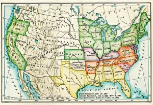
EVCW2A-00100US map showing seceding states by date, American Civil War, 1860 and 1861. Printed color lithograph 19th century
U. S. territory gained from MexicoMap of territory acquired by the U.S. from Mexico. Color lithograph of a 19th-century illustration
EXPL2A-00184Part of the 1613 Samuel de Champlain map of New France. Hand-colored woodcut of a 19th-century reproduction of the original ma
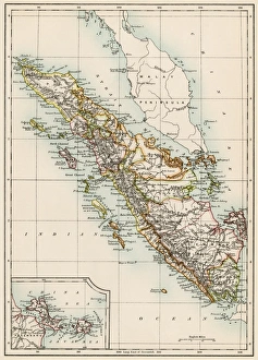
Sumatra, 1800sMap of Sumatra, 1870s. Color lithograph of a 19th-century illustration
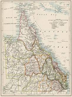
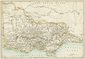
Queensland, Australia, 1800sMap of Queensland, Australia, 1870s. Color lithograph reproduction of a 19th-century illustration
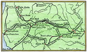
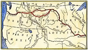
HSET2A-00123Map of the principal westward trails in the 1800s. Hand-colored woodcut of a 19th-century illustration
Map of colonial Rhode Island, 1660sMap of Rhode Island, showing the disputed colonial boundaries, 1660s. Hand-colored woodcut of a 19th-century illustration
United States map in 1830Territories of the United States in 1830. Printed color lithograph
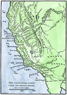
California under Mexican rule, 1800sMap of Alta California under Mexican government, early 1800s. Hand-colored woodcut of a 19th-century illustration
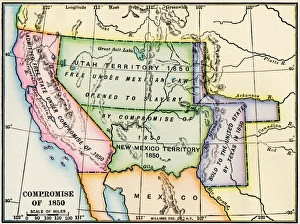
Western US after the Compromise of 1850Map showing the western US territories after the Compromise of 1850. Printed color lithograph of a 19th-century illustration
Southeast Indian tribe locations in 1776Map of southeastern Native American Nations about 1776. Hand-colored woodcut
Victoria province, Australia, 1800sMap of Victoria, Australia, 1870s. Color lithograph reproduction of a 19th-century illustration
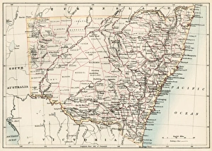
New South Wales map, 1800sMap of New South Wales, Australia, 1870s. Color lithograph reproduction of a 19th-century illustration
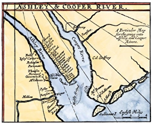
Map of colonial Charleston, South Carolina, 1600sColonial map of the Ashley and Cooper rivers, site of Charleston, South Carolina, 1600s. Hand-colored 19th-century woodcut reproduction of a document
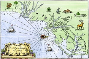
Carolina coast map, 1600sMap of the Carolinas, showing Charleston and the Outer Banks, north on the right. Hand-colored woodcut reproduction of a 17th-century map
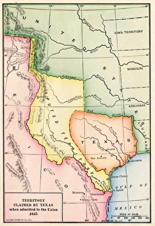
Territory claimed by Texas, 1845Map of the territory claimed by Texas when admitted to the U.S. in 1845. Printed color lithograph of a 19th-century illustration
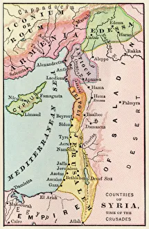
Mideast map during the CrusadesMap of the Middle East at the time of the Crusades. Printed color lithograph
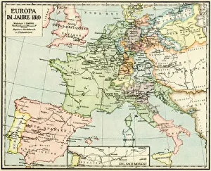
Europe in 1810Map of Europe in 1810, during the Napoleonic Wars (in German). Printed color lithograph reproduction of a 19th-century illustration
Europe in the mid-1500sMap of Europe during the early Protestant Reformation. Printed color lithograph of a 19th-century illustration
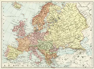
Map of Europe, 1870sMap of Europe in the 1870s. Color lithograph reproduction of a 19th-century illustration
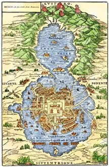
EXPL2A-00294Tenochtitlan, capital city of Aztec Mexico, an Island connected by causeways to land, 1520s. Hand-colored 19th-century woodcut reproduction of an early Spanish colonial map
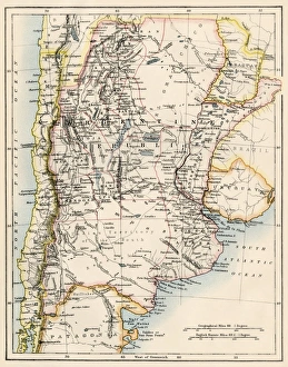
Map of Argentina in the 1800sMap of Agentina, Uruguay, and Paraguay in the 1870s. Color lithograph reproduction of a 19th-century illustration
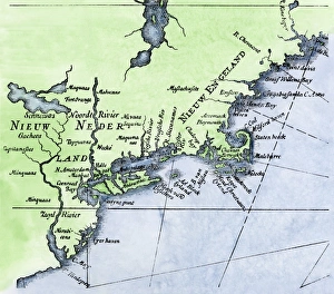
Dutch map of New Netherland and New EnglandNew Netherland and New England, circa 1630. Hand-colored 19th-century woodcut reproduction of DeLaets map
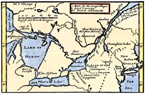
French map of the Great Lakes, 1703La Hontans map of the Great Lakes and Saint Lawrence valley, 1703. Hand-colored 19th-century woodcut reproduction of an 18th century illustration
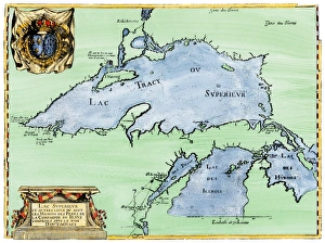
French settlement of the Great Lakes, 1600sFrench Jesuit map of Lake Superior, Upper Michigan, and Wisconsin, 1600s. Hand-colored woodcut of a 17th-century illustration
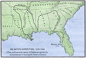
Map of DeSotos route, 1540sDe Soto expeditions route across southeast North America, 1539-1542. Hand-colored woodcut of a 19th-century illustration
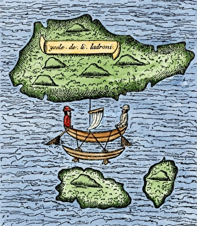
Mariana Islands in the Pacific discovered by Magellan, 1521The Ladrones, later called the Marianas, and a native outrigger drawn by Pigafetta on the Magellan expedition, 1521. Hand-colored woodcut reproduction of a 16th-century illustration
Behaims 1492 globe showing a round Earth but no New WorldDiagram of globe by Martin Behaim, without the New World, created in 1492. Hand-colored woodcut of a 19th-century illustration
EXPL2A-00035Map of the Lewis and Clark route across Louisiana Territory, 1804-1806. Hand-colored woodcut of a 19th-century illustration
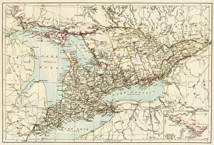
Ontario, 1870sMap of Ontario, Canada, 1870s. Printed color lithograph
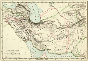
Extent of the Persian empireMap of the ancient Persian empire. Printed color lithograph of a 19th-century illustration
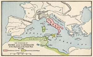
Rome and Carthage, 264 BCTerritories of Rome and Carthage at the outset of the Punic Wars, 264 BC. Color lithograph
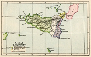
Sicily during the First Punic War, 264 BC. Color lithograph
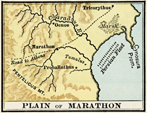
Plain of Marathon in ancient GreeceMap showing the Plain of Marathon, site of the battle in 490 BC. Color lithograph of a 19th-century illustration
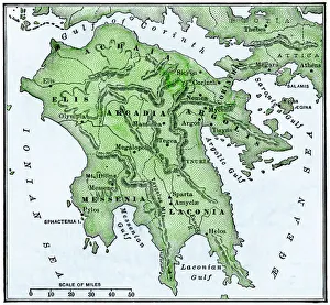
Map of the Peloponnesus of ancient Greece. Hand-colored woodcut of a 19th-century illustration
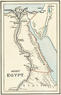
Map of ancient Egypt. Printed color lithograph
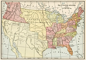
United States in 1825Map of the United States and Unorganized Public Lands in 1825. Printed color lithograph
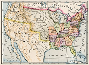
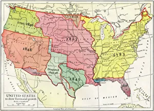
Growth of the United States to 1853U.S. map, showing territorial growth to 1853. Printed color lithograph of a 19th-century illustration