mail_outline sales@mediastorehouse.com
147 items
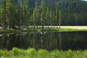
Pecos Wilderness lake, New MexicoGlacial lake in the Pecos Wilderness, Sangre de Cristo Mountains, New Mexico. Digital photograph
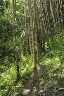
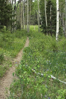
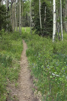
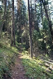
Pecos Wilderness trail, New MexicoTrail through aspen forest in the Pecos Wilderness, Sangre de Cristo Mountains, New Mexico. Digital photograph
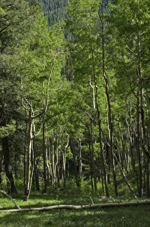
Pecos Wilderness aspen grove, New MexicoAspen forest in the Pecos Wilderness, Sangre de Cristo Mountains, New Mexico. Digital photograph
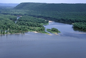
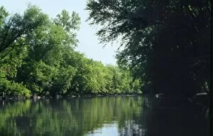
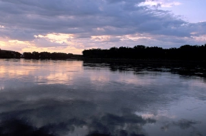
Wisconsin River junction with the MississippiWisconsin River joining the Mississippi River, first explored by Marquette and Joliet, 1673. Photograph
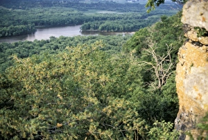
Wisconsin River near its Mississippi River junctionWisconsin River, seen from bluffs near its junction with the Mississippi River, first taken by Marquette and Joliet in 1673. Photograph
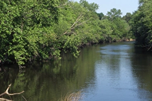
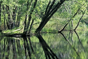
Fox River near Princeton, WisconsinFox River, taken by Marquette and Joliet to reach the Mississippi, 1673. Photograph
Fox River, WisconsinFox River, taken by Marquette and Joliet to reach the Mississippi, 1673. Photograph
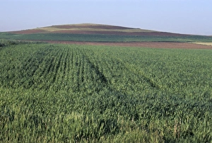
Drumlin, a glacial feature on the Ice Age Trail, WisconsinDrumlin, a glacial remnant now planted with corn, southern Wisconsin. Photograph
EXPL2P-00061Lewis and Clark trail over Lolo Pass, Bitterroot Mountains, Montana. Photograph
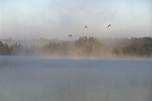
Mallards over the Wolf River, WisconsinWild ducks in morning fog flying over Post Lake on the Wolf River, Wisconsin. Photograph
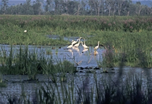
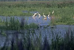
Great egrets in a Wisconsin wetlandGreat egrets, Horicon Marsh National Wildlife Refuge, Wisconsin. Photograph
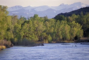
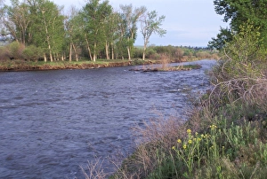
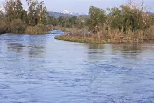
Tobacco Root Mountains and the Jefferson River, MontanaJefferson River, named for Thomas Jefferson by Lewis and Clark. Photograph
Clark Fork, MontanaClark Fork River, named for William Clark, named by Lewis and Clark expedition in Montana. Photograph
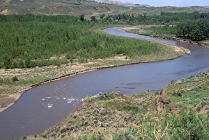
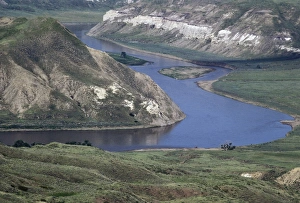
Judith River near its junction with the Missouri River, MontanaJudith River, named by Lewis and Clark, Montana. Photograph
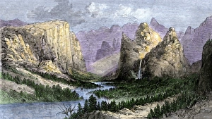
Yosemite Valley wildernessYosemite Valley before it became a national park, viewed in the 1850s. Hand-colored woodcut of a 19th-century illustration
Yosemite visitors, 1870sHorseback riders descending into Yosemite Valley, 1870s. Hand-colored woodcut of a 19th-century illustration
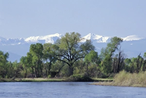
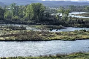
Madison River near its junction to form the Missouri River, MontanaMadison River approaching the Missouri River headwaters at Three Forks, Tobacco Root Mountains in the distance. Digital photograph
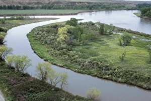
Missouri River headwaters, Three Forks, MontanaMadison and Jefferson Rivers join to form the Missouri River, Tobacco Root Mountains in the distance. Photograph
Missouri River headwaters, Three Forks, MontanaMissouri River headwaters, discovered by Lewis and Clark, Three Forks, Montana. Photograph
Coalbanks Landing on the Missouri River, MontanaDawn over the Missouri River at Coalbanks Landing, a Lewis and Clark campsite in Montana. Photograph
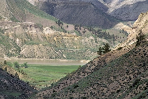
White Cliffs area of the Missouri River, MontanaMissouri River in the White Cliffs backcountry, described by Lewis and Clark, now a wild and scenic river area. Photograph
Judith Landing on the Missouri River, MontanaMissouri River at Judith Landing, a Lewis and Clark campsite in Montana. Photograph
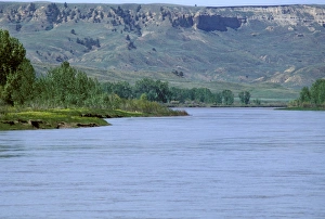
Marias River joining the Missouri River, MontanaMarias River junction with the Missouri River, a Lewis and Clark campsite in Montana. Photograph
Coalbanks Landing, Missouri River, MontanaMissouri River at Coalbanks Landing, a Lewis and Clark campsite in Montana. Photograph
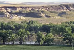
Missouri River in the Missouri Breaks area, MontanaMissouri Breaks backcountry of the Missouri River, first described by Lewis and Clark, Montana. Photograph
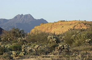
Four Peaks Wilderness in the mountains of central ArizonaFour Peaks Wilderness, viewed from the Dutchmans Trail in the Superstition Mountains Wilderness Area, Arizona. Digital photograph
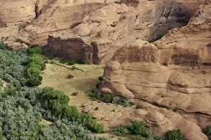
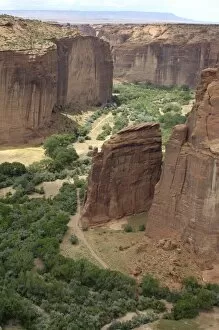
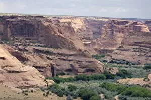
Canyon de Chelly, ArizonaRed sandstone of Canyon de Chelly, on the Navajo Nation Reservation, Arizona. Digital photograph
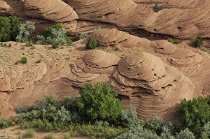
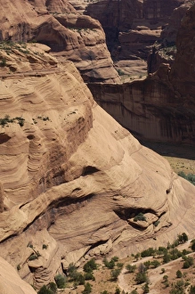
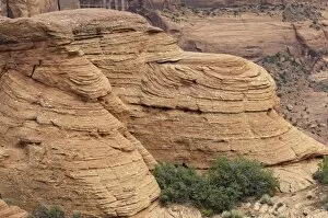
Sandstone shapes in Canyon de Chelly, ArizonaEroded sandstone shapes in Canyon de Chelly, on the Navajo Nation Reservation, Arizona. Digital photograph
Canyon de Chelly sandstone, ArizonaEroded sandstone cliffs of Canyon de Chelly, on the Navajo Nation Reservation, Arizona. Digital photograph
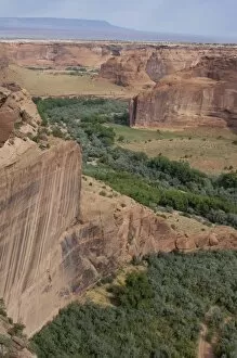
Canyon de Chelly, ArizonaCanyon de Chelly, on the Navajo Nation Reservation, Arizona. Digital photograph
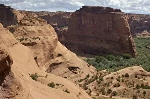
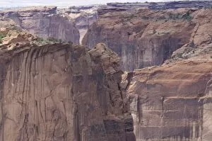
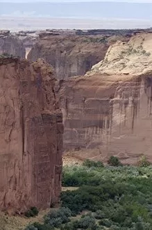
Cliffs of Canyon de Chelly, ArizonaSandstone walls of Canyon de Chelly, on the Navajo Nation Reservation, Arizona. Digital photograph
Canyon de Chelly, ArizonaSandstone formations of Canyon de Chelly, on the Navajo Nation Reservation, Arizona. Digital photograph
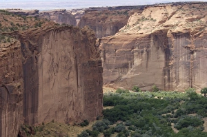
Cliffs of Canyon de Chelly, ArizonaSandstone cliffs of Canyon de Chelly, on the Navajo Nation Reservation, Arizona. Digital photograph
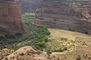
Canyon de Chelly, ArizonaCliff walls of Canyon de Chelly, on the Navajo Nation Reservation, Arizona. Digital photograph
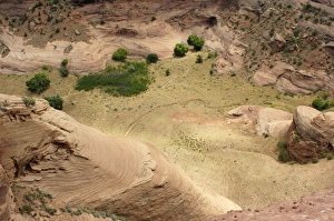
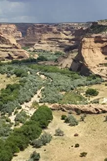
Trail in Canyon de Chelly, ArizonaTrail on the floor of Canyon de Chelly, on the Navajo Nation Reservation, Arizona. Digital photograph
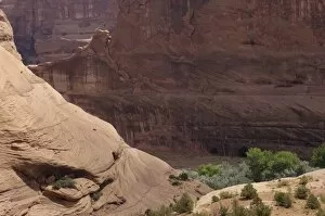
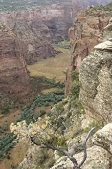
Rimrock of Canyon de Chelly, ArizonaEroded sandstone on the rim of Canyon de Chelly, on the Navajo Nation Reservation, Arizona. Digital photograph
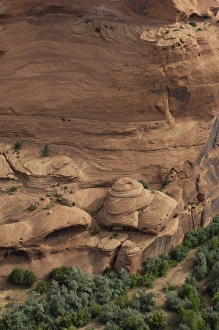
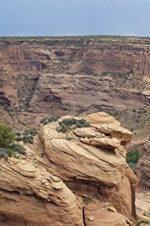
Canyon de Chelly sandstone, ArizonaEroded sandstone formations in Canyon de Chelly, on the Navajo Nation Reservation, Arizona. Digital photograph
Canyon de Chelly, ArizonaSandstone cliffs of Canyon de Chelly, on the Navajo Nation Reservation, Arizona. Digital photograph
Cliffs of Canyon de Chelly, ArizonaRed sandstone cliffs of Canyon de Chelly, on the Navajo Nation Reservation, Arizona. Digital photograph
Canyon de Chelly cliffs, ArizonaSandstone cliffs of Canyon de Chelly, on the Navajo Nation Reservation, Arizona. Digital photograph