mail_outline sales@mediastorehouse.com
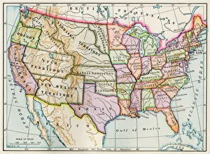
United States in 1860United States and territories at the beginning of the Civil War. Printed lithograph map
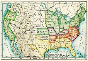
EVCW2A-00100US map showing seceding states by date, American Civil War, 1860 and 1861. Printed color lithograph 19th century
United States in the 1870sUnited States map, 1870s. Color lithograph
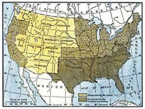
Civil War territory map, 1861Map showing Confederate-held territory at the end of 1861. Hand-colored woodcut of a 19th-century illustration
United States map in 1830Territories of the United States in 1830. Printed color lithograph
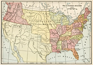
United States in 1825Map of the United States and Unorganized Public Lands in 1825. Printed color lithograph
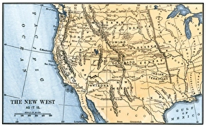
Western frontier in the 1880sMap of the American West in the 1880s. Hand-colored woodcut of a 19th century illustration
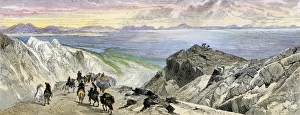
Pioneers approaching the Great Salt Lake, UtahMormon Trail settlers approaching the Great Salt Lake, Utah, 1800s. Hand-colored woodcut of a 19th-century illustration
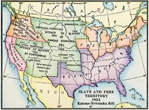
EXPL2A-00312Map of slave and free areas of the United States in 1854, at the time of the Kansas-Nebraska Bill. Printed color lithograph 19th century
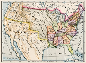
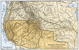
Western boundary with Mexico, 1840sMexican possessions and western US territories in the 1840s. Hand-colored woodcut of a 19th-century illustration
Western US frontier, early 1800sMap of the western frontier in the United States, 1800s. Hand-colored woodcut of a 19th-century illustration
United States territory in 1830Map of the United States in 1830. Printed color lithograph
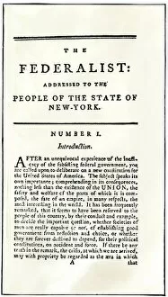
PREV2A-00052Title page of " The Federalist, " 1788, urging ratification of the new U.S. Constitution. Woodcut reproduction with a watercolor wash
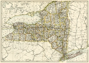
New York map, 1870sMap of New York State, 1870s. Printed color lithograph of a 19th-century illustration
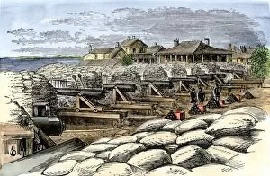
EVCW2A-00129Sandbag battery at Fort Moultrie with artillery aimed at Fort Sumter during the American Civil War. Hand-colored woodcut of a 19th century illustration
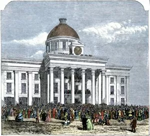
EVCW2A-00011Jefferson Davis inaugurated as president of the Confederate States of America at the state house in Montgomery, Alabama, 1861. Hand-colored woodcut of a 19th century illustration
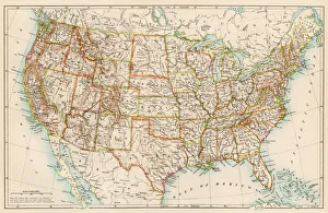
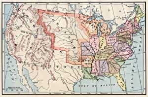
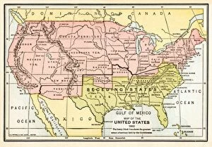
EVCW2A-00009Map of the United States in 1861, at the start of the Civil War. Printed color lithograph 19th century