mail_outline sales@mediastorehouse.com
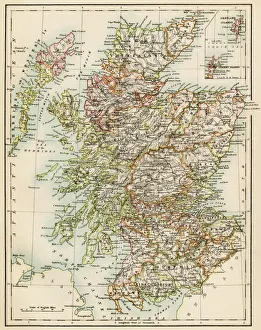
Scotland map, 1870sMap of Scotland, 1870s. Printed color lithograph
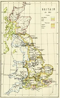
Map of Britain in 597 ADMap of territory controlled by Celts, Picts, Anglos, Saxons, and other tribes in Britain in 597 AD. Printed color lithograph of a 19th-century illustration
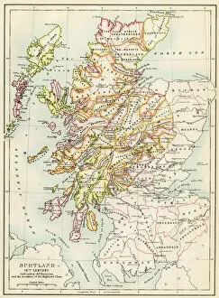
GGBR2A-00076Map of Scotland in the 1520s, showing territories of the Highland Clans. Printed color lithograph of a 19th century illustration
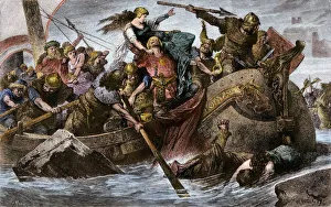
Viking raid under Olaf IViking raid along the English Channel led by Olaf Tryggvason, 900s AD. Hand-colored woodcut of a 19th-century illustration
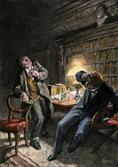
Dr. Jekyll and Mr. HydeTransformation of Dr Jekyll into Mr Hyde, a scene from Robert Louis Stevensons novel. Hand-colored engraving of a 19th-century illustration
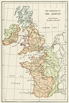
Angevin kings holdings in France and BritainBritish Isles and France under the Angevins, 1100s-1400s. Color lithograph reproduction of a 19th-century illustration
Robert Burns character Tam O ShanterTam O Shanter chased by a witch, from a poem by Robert Burns. Hand-colored halftone reproduction of a John Faed illustration
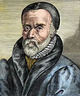
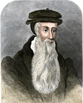
William Tyndale, English translator of the New Testament. Hand-colored woodcut of a 19th-century illustration
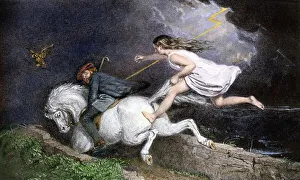
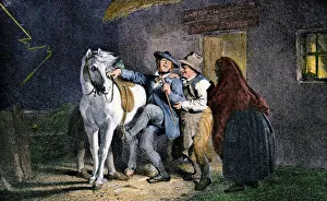
Robert Burns character Tam O ShanterTam O Shanter about to ride, from a poem by Robert Burns. Hand-colored halftone reproduction of a 19th-century John Faed illustration
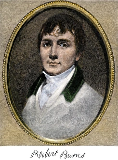
Poet Robert BurnsRobert Burns, with his autograph. Hand-colored woodcut reproduction of a painting
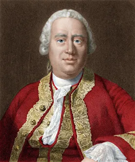
David HumePhilosopher David Hume. Digitally colored steel engraving
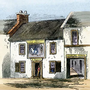
Robert Burns site Tam O Shanter TavernTam O Shanter Tavern of poems by Robert Burns. Hand-colored woodcut of a 19th-century illustration
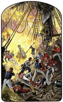
EVRV2A-00216Sea fight between the American ship Bonhomme Richard and the British HMS Serapis, 1779. Hand-colored woodcut of a 19th-century illustration
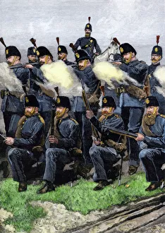
British riflemen, 1880sQueens Edinburgh Rifle Volunteer Brigade at training camp, Scotland, 1880s. Hand-colored woodcut of a 19th century illustration
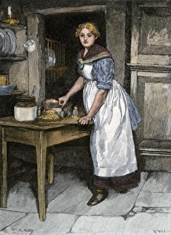
Scots housewife preparing haggis, 1800sChopping the ingredients for haggis in Scotland, 1800s Hand-colored woodcut of a 19th-century E. A. Abbey illustration
John KnoxReligious reformer John Knox. Hand-colored engraving
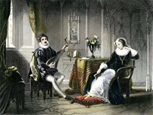
PROY2A-00047Mary, Queen of Scots, courted by Chatelar. Hand-colored engraving
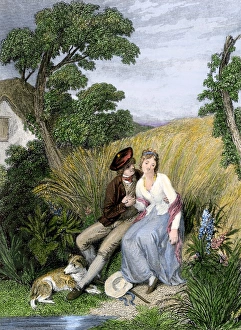
Robert Burns poem illustrationCourtship in a field of barley, from a poem by Robert Burns. Hand-colored engraving of a 19th-century illustration
Spanish Armadas route in 1588Chart of the Spanish Armadas course, 1588. Hand-colored engraving
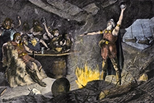
Vikings raiders ready to set sailDanish Vikings preparing to raid the British coast. Hand-colored woodcut of a 19th-century illustration
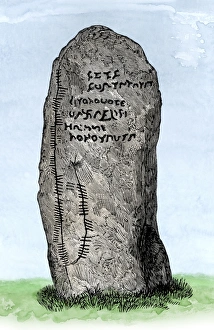
Ogham stone, ScotlandOgham inscription on a stone at Newton, Aberdeenshire, Scotland. Digitally colored woodcut of a 19th-century illustration
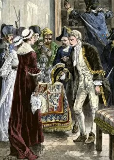
PNAV2A-00013John Paul Jones and the Rangers crew raiding the Earl of Selkirks castle, 1777. Hand-colored woodcut of a 19th-century illustration
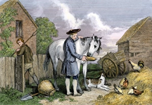
Robert Burnss literary mare, MaggieFarmer addressing his mare Maggie, illustration of a poem by Robert Burns. Hand-colored engraving of a 19th-century illustration
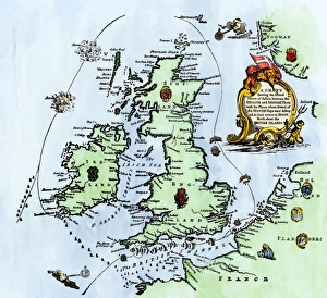
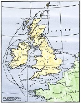
EVRV2A-00215Routes of the American ships Ranger and Bonhomme Richard raiding the British Isles during the American Revolution. Hand-colored woodcut of a 19th-century illustration
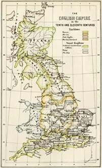
GGBR2A-00069Map of English holdings in the 10th and 11th centuries, showing earldomes and vassal kingdoms. Printed color lithograph, 19th-century