mail_outline sales@mediastorehouse.com
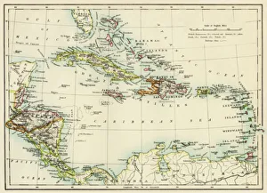
Caribbean islands, 1870sMap of West Indies and the Caribbean Sea, 1800s. Printed color lithograph
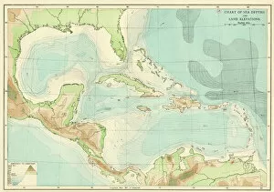
EXPL2A-00377Chart of the West Indies sea depths and land elevations. Printed color lithograph of a 19th-century illustration
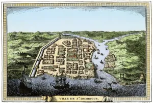
Santo Domingo, early 1700sBusy port of Santo Domingo on Hispaniola, early 1700s. Hand-colored woodcut reproduction of an 18th-century illustration
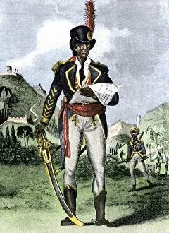
PLAT2A-00007Toussaint Louverture, liberator of Haiti. Hand-colored woodcut
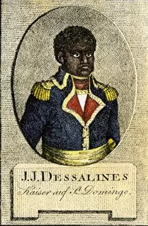
PLAT2A-00008Jean-Jacques Dessalines, emperor Jacques I of Haiti. Hand-colored woodcut
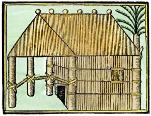
EXPL2A-00376Native house on Hispaniola, 1500s. Hand-colored 19th-century woodcut reproduction from Oviedo, edition of 1547
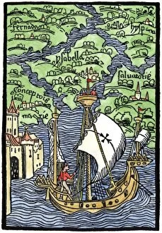
EXPL2A-00203Isabella, the settlement founded by Columbus on Hispaniola, 1493. Hand-colored woodcut reproduction
EXPL2A-00006Columbuss hospitable reception by Guacanagari, Caribbean chief, after shipwreck of Santa Maria, 1492. Hand-colored woodcut of a 19th-century illustration
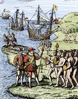
EXPL2A-00004Expedition of Christopher Columbus landing at Hispaniola, 1492. Hand-colored woodcut of a 19th-century illustration
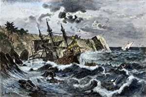
EXPL2A-00036Wreck of Columbuss flagship Santa Maria on the coast of Hispaniola, 1492. Hand-colored woodcut of a 19th-century illustration
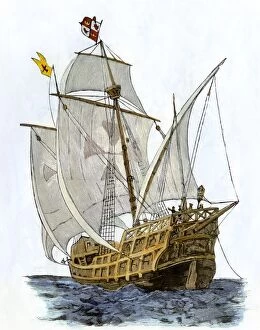
EXPL2A-00089Caravel " Santa Maria, " the flagship of Columbus first voyage and which sank off Hispaniola in 1492. Hand-colored woodcut of a 19th-century illustration
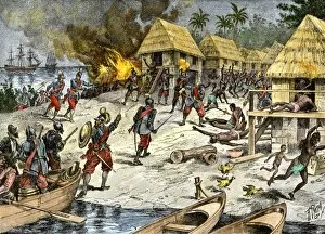
EXPL2A-00084Bartholomew Columbuss cruel destruction of native villages on Hispaniola. Hand-colored woodcut of a 19th-century illustration
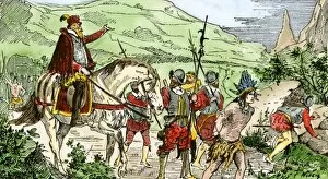
PEXP2A-00069Nicolas de Ovandos army on Hispaniola setting out for Xaragua, 1500s. Hand-colored woodcut of a 19th-century illustration
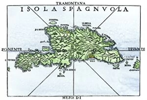
EXPL2A-00227Map of Hispaniola in 1534, from cartography of Peter Martyr and Oviedo. Hand-colored 19th-century woodcut reproduction of a 16th-century map
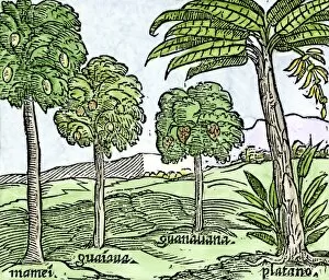
EXPL2A-00100Bananas and other fruit trees of Hispaniola, from a sketch published in 1572. Hand-colored woodcut of a 19th-century reproduction of an illustration from Benzoni 1572
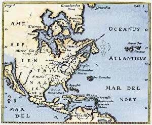
EXPL2A-00375Map of North America as known in the mid-1600s. Hand-colored woodcut reproduction of an illustration in Campanius, 1702
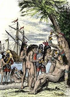
EXPL2A-00005Columbus giving hawks bells to natives after landing in the Caribbean, 1492. Hand-colored woodcut of a 19th-century illustration
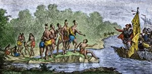
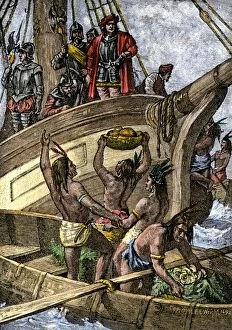
EXPL2A-00002Caribbean natives bring provisions to the shipwrecked crew of Columbus, 1492. Hand-colored woodcut of a 19th-century illustration