mail_outline sales@mediastorehouse.com
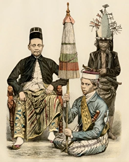
Java official and his attendants, 1800sRegent of Java, his bodyguard, and an attendant, 1800s. Antique hand colored print
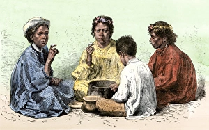
Hawaiians eating poi, 1800sHawaiian family eating poi, a dish made from taro root, mid-1800s. Hand-colored woodcut of a 19th-century illustration
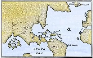
EXPL2A-00147World map after the disoveries of Columbus and Balboa, showing the prevalent idea that South America was attached to Asia. Hand-colored woodcut of a 19th-century illustration
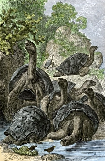
Galapagos tortoises. Hand-colored woodcut of a 19th-century illustration
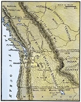
EXPL2A-00210Map of Oregon Territory showing boundary of US with English Canada under dispute until 1846. Hand-colored woodcut of a 19th-century illustration
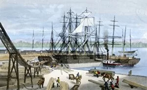
BUSN2A-00178Loading lumber onto ships in Puget Sound, Washington State, 1880s. Hand-colored lithograph of a 19th-century illustration
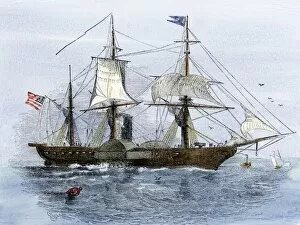
PNAV2A-00010USS Mississippi, flagship of Mathew Perrys expedition to Japan, 1852. Hand-colored woodcut of an 1852 illustration
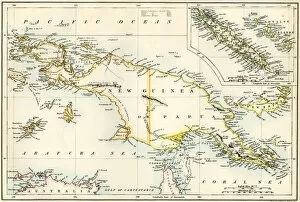
GPAC2A-00023Map of New Guinea and New Caledonia, 1870s. Printed color lithograph of a 19th-century illustration
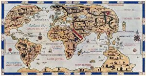
EXPL2A-00354Dauphin Map by Pierre Desceliers made for Prince Henry (who became Henri II) by order of the French King Francis I, 1546. Printed color halftone reproduction 19th century
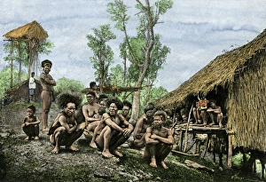
Papuan natives, 1800sGroup of Koyari chiefs and their families, southeast New Guinea, 1800s. Hand-colored engraving reproduction of a 19th-century photograph
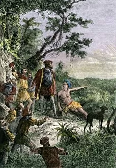
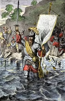
EXPL2A-00222Vasco Nunez de Balboa discovering the Pacific Ocean, 1513. Hand-colored woodcut of a 19th century illustration
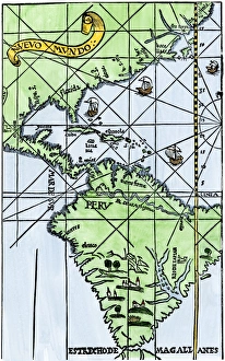
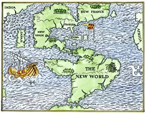
South America mapped after Magellans voyage, 1519New World map after Magellans passage around Cape Horn in 1519. Hand-colored woodcut of a 19th century illustration
EXPL2A-00235Balboa raising his sword to claim the Pacific Ocean for Spain, 1513. Hand-colored woodcut of a 19th-century illustration
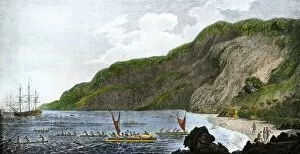
EXPL2A-00316Captain James Cook, discoverer of the Sandwich Islands, with his ships in Kealakekua Bay, where he was killed by natives in 1779. Hand-colored halftone reproduction of a painting
EXPL2A-00148New World geography according to a mapmaker of 1540. Hand-colored woodcut of a 19th-century illustration
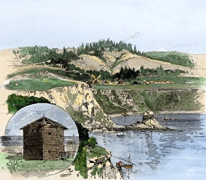
Fort Ross and a Russian blockhouse, CaliforniaFort Ross on the California coast, and an old Russian blockhouse (inset). Hand-colored woodcut of a 19th-century illustration