mail_outline sales@mediastorehouse.com
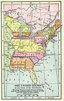
EXPL2A-00164Map of the United States at the close of the American Revolution, 1783. Printed color lithograph of a 19th-century illustration
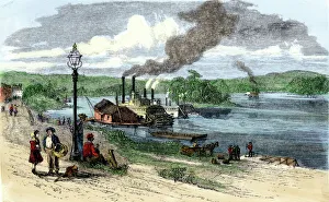
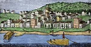
Marietta on the Ohio River, 1870sSteamboats on the Ohio River at Marietta, Ohio, 1870s. Hand-colored woodcut of a 19th-century illustration
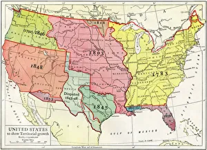
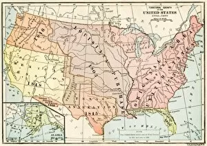
Growth of the United States to 1853U.S. map, showing territorial growth to 1853. Printed color lithograph of a 19th-century illustration
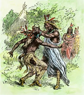
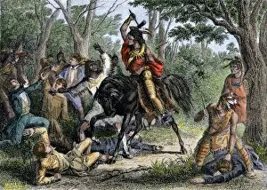
Tecumseh and his brother, The ProphetTecumseh pulling his brother, The Prophet, by the hair. Hand-colored woodcut reproduction of a 19th-century illustration
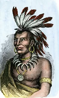
PNAT2A-00020Little Turtle, chief of Miami tribe. Hand-colored woodcut of a portrait
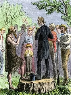
PEXP2A-00057Johnny Appleseed addressing a preacher among settlers of Ohio Territory. Hand-colored woodcut of a 19th-century illustration
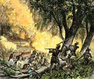
EVNT2A-00002General Waynes victory at the Battle of Fallen Timbers, opening the Ohio Valley for settlers, 1794. Hand-colored woodcut of a 19th-century illustration
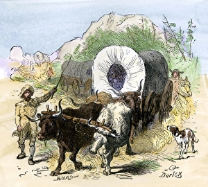
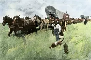
Pioneers moving west, early 1800sPioneers emigrating to the Mississippi Valley, early 1800s. Hand-colored woodcut of a 19th-century Darley illustration
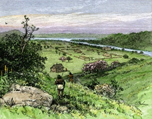
Ohio River bringing settlers to the Old NorthwestPioneers on the Ohio River settling the old Northwest Territory, late 1700s. Hand-colored woodcut of a 19th-century illustration
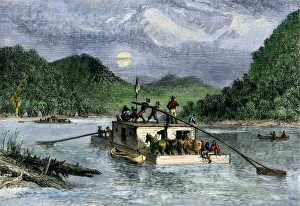
Settlers on the Ohio RiverFlatboat of settlers descending the Ohio River, 1800s. Hand-colored woodcut of a 19th-century illustration
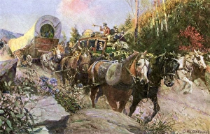
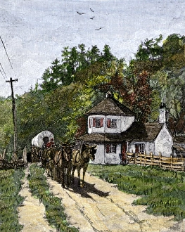
National Road wagons and stagecoach trafficMail coach and slower wagons on the National Road, early 1800s. Printed color halftone reproduction of an Arthurs illustration
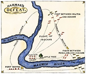
Harmars defeat at Fort Wayne, Indiana, 1791Map of General Harmars defeat by the Miami and Shawnee at Fort Wayne, Indiana, 1791 Hand-colored woodcut of a 19th-century illustration
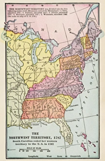
Northwest Territory mapMap of the old Northwest Territory, 1787. Printed color lithograph of a 19th-century illustration
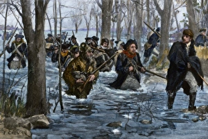
EVRV2A-00034George Rogers Clark leading American army to take Kaskaskia, Illinois, from the British during the Revolutionary War. Hand-colored halftone of a 19th-century Howard Pyle illustration
Cincinnati, Ohio, 1810Ohio River flatboat passing Cincinnati in 1810. Hand-colored woodcut of a 19th-century illustration
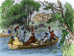
Pioneer Marietta, Ohio, 1780sBeginning of settlement of Marietta, Ohio, in 1788. Hand-colored woodcut of a 19th-century illustration
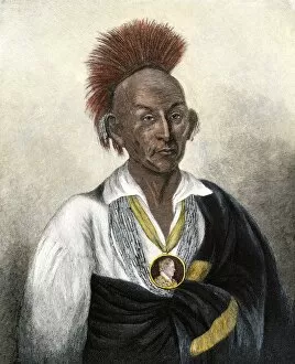
PNAT2A-00015Chief Black Hawk. Hand-colored engraving of a 19th-century portrait by Charles B. King
PNAT2A-00006Tecumseh in a British uniform. Hand-colored woodcut of a 19th-century illustration
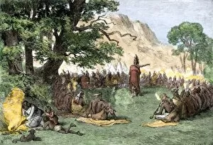
PNAT2A-00035Chief Pontiac addressing a gathering of Native Americans. Hand-colored woodcut of a 19th-century illustrations
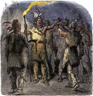
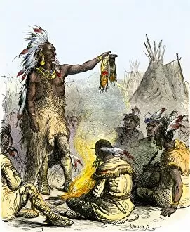
PNAT2A-00034Shawnee mystic Tenskwatawa, known as The Prophet, holding a ceremony, early 1800s. Hand-colored woodcut of a 19th-century illustration
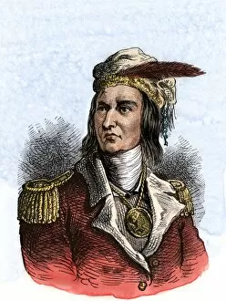
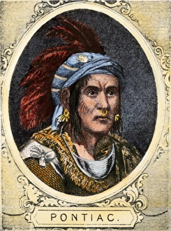
PontiacChief Pontiac of the Ottawa nation. Hand-colored halftone reproduction of a 19th-century illustration
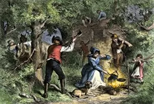
HSET2A-00002Border settlers in Ohio building a log cabin. Hand-colored woodcut of a 19th-century illustration
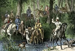
HSET2A-00105Judges, lawyers, and clients on their way to court on the frontier, late 1700s or early 1800s. Hand-colored woodcut of a 19th-century illustration
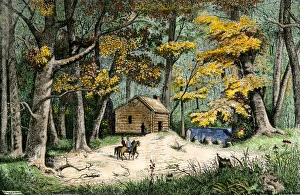
Settlement of Indianapolis, 1820First settlers cabin in Indianapolis, Indiana, 1820. Hand-colored woodcut of a 19th-century illustration
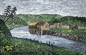
Early gristmill in Ohio Territory, 1789Water-powered mill on Wolf Creek, a tributary of the Muskingum River, Ohio Territory, 1789. Hand-colored woodcut of a 19th-century illustration
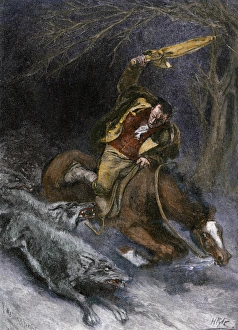
Ohio traveler attacked by wolves, early 1800sSamuel H. Huntington attacked by wolves in early Ohio. Hand-colored woodcut of a 19th-century Howard Pyle illustration
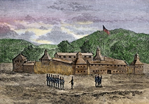
Fort Washington on the Ohio River, 1789Fort Washington on the site that became Cincinnati, Ohio, 1789. Hand-colored woodcut of a 19th-century illustration
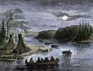
NATI2A-00132Canoes on the Ohio River traveling by moonlight Hand-colored woodcut of a 19th-century illustration
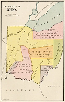
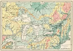
Ohios early land divisionsLand division and early settlements in Ohio Territory. Printed color lithograph of a 19th-century illustration
Toll-gate on the National RoadWestbound wagons at a National Pike toll-gate, mid 1800s. Hand-colored woodcut of a 19th-century illustration
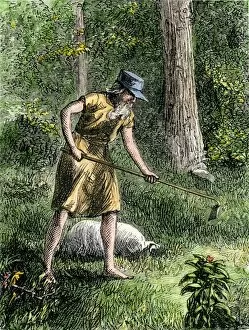
PEXP2A-00056Johnny Appleseed planting apple trees in the Ohio wilderness. Hand-colored woodcut of a 19th-century illustration
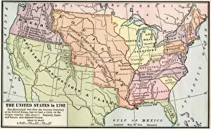
EXPL2A-00039Map of the US in 1792, showing colonial claims on Oregon Territory. Printed color halftone of a 19th century illustration
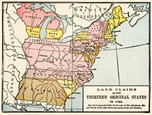
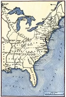
EXPL2A-00191Map showing land claims of the 13 original states in 1783. Printed color lithograph of a 19th-century illustration
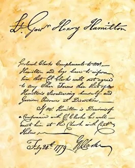
EVRV2A-00035George Rogers Clarks handwritten demand for the surrender of Vincennes, Indiana, by British Lt. Gov. Hamilton, 1779. Hand-colored 19th-century woodcut reproduction of the original document
American advance on Vincennes, Indiana, 1779George Rogers Clark leading American forces on the Wabash River during the Revolutionary War. Hand-colored halftone reproduction of a 19th-century F.C. Yohn illustration
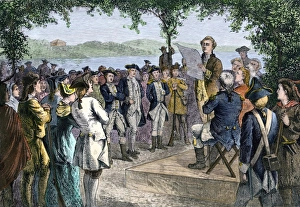
Ohio Territory government established at Marietta, 1788Ohio pioneers installing territorial government at Marietta, late 1700s. Hand-colored woodcut of a 19th-century illustration
PNAT2A-00014Ottawa chief Pontiac in tribal council, holding a wampum belt. Hand-colored woodcut of a 19th-century illustration
PNAT2A-00009Tecumseh defends the whites at Fort Meigs, Ohio, besieged by British forces in the War of 1812. Hand-colored woodcut of a 19th-century illustration
HSET2A-00053Wagon train on the National Road, early 1800s. Hand-colored woodcut of a 19th-century illustration
USOH2A-00001Settlers from Connecticut entering Ohio Territory after the American Revolution. Hand-colored halftone reproduction of a 19th-century Howard Pyle illustration
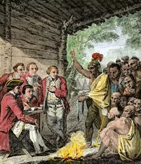
EVNT2A-00268British General Henry Bouquets council with Native Americans during Pontiacs War, 1763. Hand-colored woodcut
EXPL2A-00357Map of the Great Lakes and the St. Lawrence watershed. Printed color lithograph, 19th century
EVRV2A-00174Map showing the thirteen colonies which joined together as the original thirteen states in 1776. Hand-colored woodcut of a 19th-century illustration
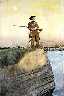
PEXP2A-00099Christopher Gist exploring the wilderness of Ohio, western Pennsylvania, and Kentucky. Hand-colored woodcut of a 19th-century illustration
EXPL2A-00041Map of territorial growth of the United States from 1783-1867. Printed color lithograph of a 19th-century illustration