mail_outline sales@mediastorehouse.com
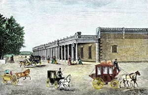
Governors Palace on Santa Fe Plaza, dating from the 1600sThe Governors Palace, the Spanish capitol of New Mexico and end of the Santa Fe Trail. Hand-colored woodcut of a 19th-century illustration
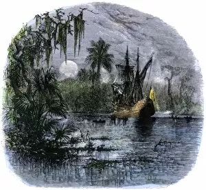
Florida explored by De Soto, 1539Bivouac of De Sotos expedition in the Florida wilderness, 1539. Hand-colored woodcut of a 19th-century illustration
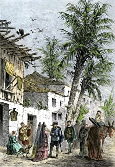
Spanish colonial days in St. Augustine, FloridaLife in Saint Augustine, Florida, when part of New Spain. Hand-colored woodcut of a 19th-century illustration
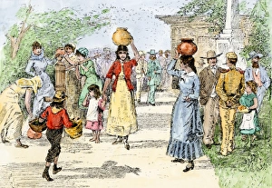
Santa Fe Plaza the center of life in New Mexico, 1800sFamilies gathering for chores and companionship on Santa Fe Plaza. Hand-colored woodcut of a 19th-century illustration
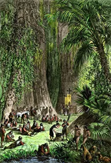
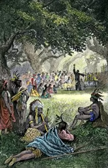
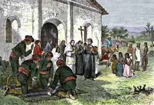
EXPL2A-00050Spanish missionaries addressing Native Americans in California. Hand-colored woodcut of a 19th-century illustration
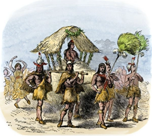
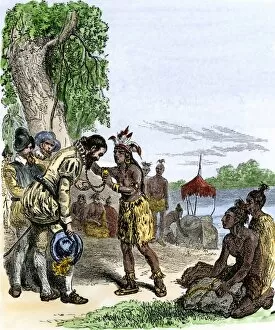
Bride brought to a Florida Native American chief, 1600sNative Americans carrying bride to a chief in Florida under Spanish, 1600s. Hand-colored woodcut of a 19th-century illustration
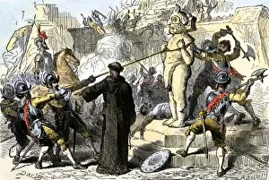
EXPL2A-00112Spanish priests destroying Aztec idols in Mexico. Hand-colored woodcut of a 19th-century illustration
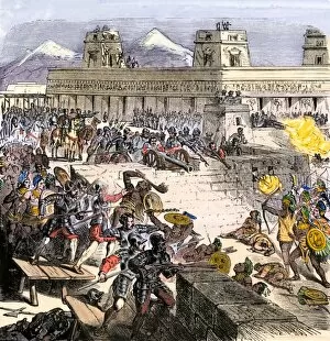
EXPL2A-00177Inca city of Cusco, Peru, in 1556, after the Spanish conquest. Hand-colored 19th-century woodcut reproduction of a 16th century illustration
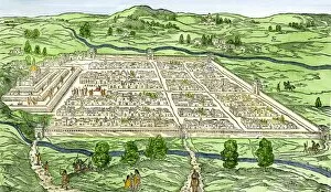
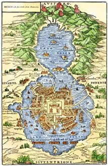
EXPL2A-00294Tenochtitlan, capital city of Aztec Mexico, an Island connected by causeways to land, 1520s. Hand-colored 19th-century woodcut reproduction of an early Spanish colonial map
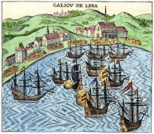
Callao, Peru, under Spanish rule, 1620Spanish colonial port of Callao, Peru, circa 1620. Hand-colored woodcut reproduction of a 17th-century illustration
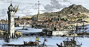
Havana as a Spanish colonial seaportPort of Havana, Cuba, in early Spanish colonial times. Hand-colored woodcut from Montanus
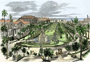
Downtown Havana in the 1850sImperial del Paseo in Spanish colonial Havana, Cuba, 1850s. Hand-colored woodcut of a 19th-century illustration
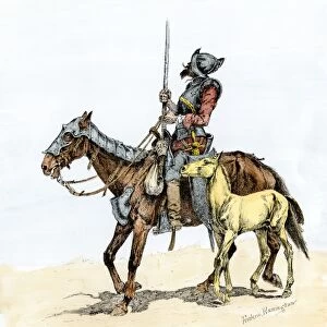
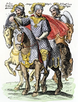
EXPL2A-00173Spanish conquistador on a horse with foal - the origin of the horse in colonial America. Hand-colored woodcut of a 19th-century Frederic Remington illustration
Balboa discovering the Pacific, 1513Spanish expedition under Balboa discovering the Pacific Ocean, 1513. Hand-colored woodcut of a 19th-century illustration
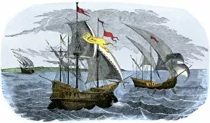
EXPL2A-00226Spanish ships of Hernando Cortes sailing to Mexico, 1519. Hand-colored woodcut of a 19th-century illustration
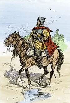
EXPL2A-00245Spanish conquistador in armor on horseback, New Spain, 1500s. Hand-colored woodcut of a 19th-century illustration
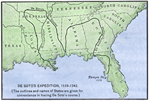
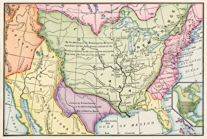
Map of DeSotos route, 1540sDe Soto expeditions route across southeast North America, 1539-1542. Hand-colored woodcut of a 19th-century illustration
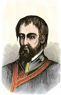
Gonzalo Jimenez de QuesadaConquistador Gonzalo Jimenez de Quesada portrait. Hand-colored 19th-century woodcut reproduction of an earlier illustration
St. Augustine, Florida, founded by Menendez de AvilesPedro Menendez de Aviles laying out Saint Augustine, Florida, 1565. Hand-colored woodcut of a 19th-century illustration
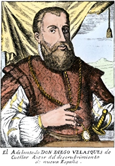
Diego Velazquez de Cuellar, Spanish conqueror of Cuba. Hand-colored 19th-century woodcut reproduction of an earlier illustration
EXPL2A-00123Spanish explorer Hernando De Soto discovering the Mississippi River, 1540. Hand-colored engraving of a 19th-century illustration
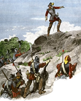
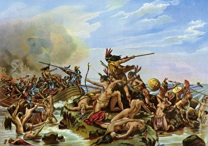
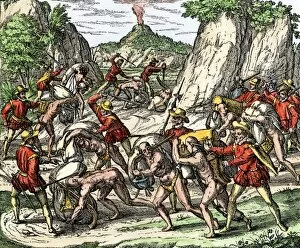
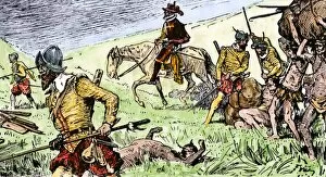
Conquistadors battling New World nativesBattle of Santa Cruz, the first bloodshed in the New World. Color lithograph of a painting by O. Graeff
North American colonies in 1733European claims in North America in 1733, when the last English colony, Georgia, was founded. Color lithograph
EXPL2A-00051California mission with padres, Spanish soldiers, and Native Americans. Hand-colored woodcut of a 19th-century illustration
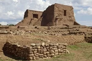
NATI2D-00500Ruins of Spanish mission at Pecos Pueblo, seat of the 17th-century Pueblo Revolt, New Mexico. Digital Photograph
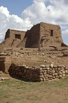
NATI2D-00499Ruins of Spanish mission at Pecos Pueblo, seat of the 17th-century Pueblo Revolt, New Mexico. Digital photograph
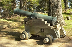
Spanish colonial cannon replica, Arkansas Post National MemorialReplica of Spanish 8-pounder used at Fort Carlos III in the 1700s, Arkansas Post National Memorial, Arkansas. Digital photograph
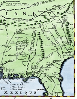
Map of part of DeSotos route, 1500sEastern portion of De Sotos route across southeastern North America, 1500s. Hand-colored woodcut reproduction of a 1593 illustration
EXPL2A-00155Mistreatment of natives used as slaves by the Spanish in Mexico, 1500s. Hand-colored 19th-century woodcut reproduction of a 16th-century illustration
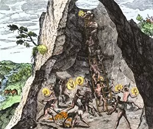
EXPL2A-00154Natives working in the Spanish mines of Mexico. Hand-colored woodcut of a DeBry engraving
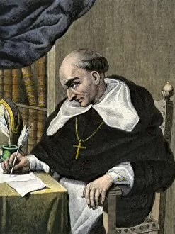
PEXP2A-00118Bartolome de Las Casas, Spanish missionary and New World historian. Hand-colored woodcut
EXPL2A-00301Spanish invaders attacked by the Aztecs in Tenochtitlan during La Noche Triste, 1520. Hand-colored woodcut of a 19th-century illustration
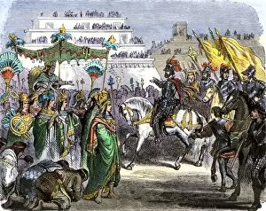
EXPL2A-00367Hernando Cortes met by Toltec dignitaries on arriving in Teotihuacan with his army, Mexico, 1519. Hand-colored woodcut of a 19th-century illustration
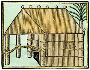
EXPL2A-00376Native house on Hispaniola, 1500s. Hand-colored 19th-century woodcut reproduction from Oviedo, edition of 1547
Spanish colonial administrators of Chile, 1600sSpanish viceroy and governor of Chile on horseback. Hand-colored woodcut from Ovales " Regno de Chile, " 1648
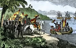
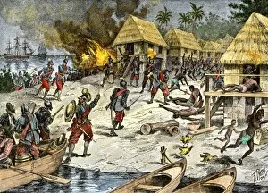
EXPL2A-00187Spanish explorer Hernando De Soto landing his expedition in Florida, 1539. Hand-colored woodcut of a 19th-century illustration
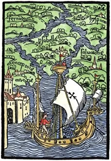
EXPL2A-00203Isabella, the settlement founded by Columbus on Hispaniola, 1493. Hand-colored woodcut reproduction
Balboa expeditions canoes on the Pacific, 1513Balboas first embarkation on the Pacific Ocean (South Sea), 1513. Hand-colored woodcut of a 19th-century illustration
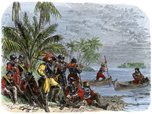
EXPL2A-00262Early explorers coming ashore along a tropical coast in the New World. Hand-colored woodcut of a 19th-century illustration
EXPL2A-00264De Soto greeted by native Cofitachequi queen in Carolina, circa 1540. Hand-colored woodcut of a 19th-century illustration
North American territories in 1783North America at the close of the Revolution - Treaty of Paris, 1783. Printed color lithograph
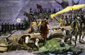
EXPL2A-00369Burial of Hernando DeSoto in the Mississippi River to keep his death secret from hostile Native Americans, 1542. Hand-colored woodcut of a 19th-century illustration
PEXP2A-00083Juan Ponce de Leon portrait. Hand-colored woodcut of a 19th-century illustration
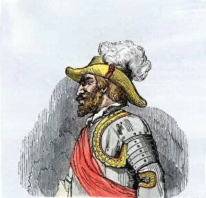
PEXP2A-00054Hernando De Soto portrait. Hand-colored woodcut of a 19th-century illustration
EXPL2A-00084Bartholomew Columbuss cruel destruction of native villages on Hispaniola. Hand-colored woodcut of a 19th-century illustration
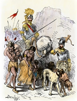
DeSoto with Native American captives, 1539De Soto expedition traveling with captive Native Americans, 1539. Hand-colored woodcut reproduction of a 19th-century Darley illustration
EXPL2A-00153Spanish conquistadors using Native American captives to carry burdens. Hand-colored woodcut of a 19th-century illustration
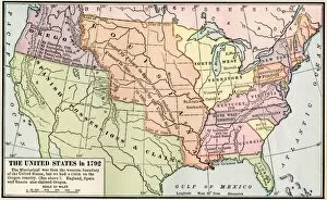
EXPL2A-00039Map of the US in 1792, showing colonial claims on Oregon Territory. Printed color halftone of a 19th century illustration