mail_outline sales@mediastorehouse.com
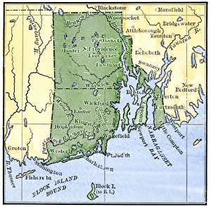
Map of colonial Rhode Island, 1660sMap of Rhode Island, showing the disputed colonial boundaries, 1660s. Hand-colored woodcut of a 19th-century illustration
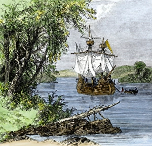
Verrazano in Narragansett Bay, 1520sGiovanni da Verrazano landing in Newport harbor, 1500s. Hand-colored woodcut of a 19th-century illustration
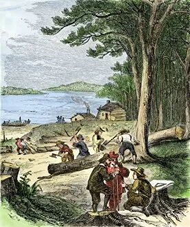
PEXP2A-00078Captain Adrian Block buildng a ship in Narragansett Bay, 1613-14. Hand-colored woodcut of a 19th-century illustration
PEXP2A-00029Giovanni da Verrazano. Hand-colored woodcut of a 19th-century illustration
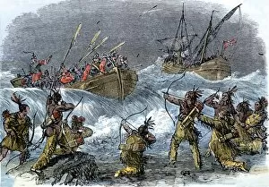
EVNT2A-00237Native Americans on Block Island attacked by Massachusetts Bay Colony Governor John Endicott during the Pequot War, 1636 Hand-colored woodcut of a 19th-century illustration