mail_outline sales@mediastorehouse.com
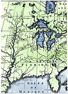
EXPL2A-00218French missionary Louis Hennepins map of the Mississippi River valley, Gulf Coast, and Great Lakes after LaSalle expeditions 1697
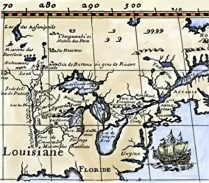
EXPL2A-00016Hennepins map of New France and Louisiana - La Carte de la Nouvelle France, 1683. Hand-colored 19th-century woodcut reproduction of the original map
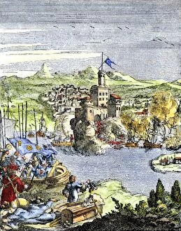
EXPL2A-00080Capture of French Quebec by the English, 1629. Hand-colored woodcut reproduction from Hennepin 1698