mail_outline sales@mediastorehouse.com
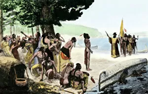
EXPL2A-00128Landing of Jean Nicolet on the Wisconsin shore of Lake Michigan, 1634, the first European to reach that region. Hand-colored halftone of a 19th-century illustration
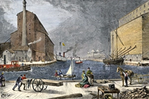
Chicago grain elevators loading ships, 1870sGrain loaded in Chicago on ships bound for the Erie Canal, 1870s. Hand colored woodcut of a 19th-century illustration
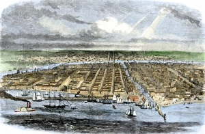
City of Chicago in 1860Overview of Chicago, looking west from Lake Michigan, 1860. Hand-colored woodcut of a 19th-century illustration
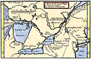
French map of the Great Lakes, 1703La Hontans map of the Great Lakes and Saint Lawrence valley, 1703. Hand-colored 19th-century woodcut reproduction of an 18th century illustration
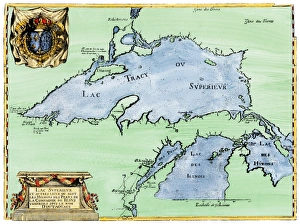
French settlement of the Great Lakes, 1600sFrench Jesuit map of Lake Superior, Upper Michigan, and Wisconsin, 1600s. Hand-colored woodcut of a 17th-century illustration
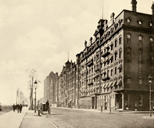
Chicagos Michigan Avenue, 1890sLeland Hotel on Michgan Avenue, Chicago, 1890 s. Albertype reproduction of a photograph
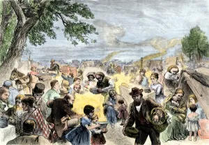
Refugees from the Chicago Fire, 1871Camp for Chicago Fire victims on Lake Michigan shore near Lincoln Park, 1871. Hand-colored woodcut of a 19th-century illustration
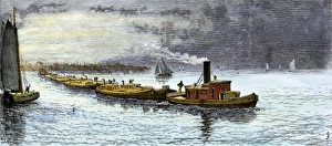
Grain barges leaving Chicago for the Erie CanalBarges loaded with grain from Chicago bound for the Erie Canal, under tow on Lake Michigan, 1870s. Hand-colored woodcut of a 19th-century illustration
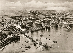
Chicagos Columbian Exposition, 1893Birds eye view of the Columbian Exposition, Chicago, 1893. Albertype reproduction of an illustration
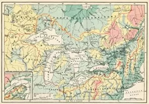
EXPL2A-00357Map of the Great Lakes and the St. Lawrence watershed. Printed color lithograph, 19th century
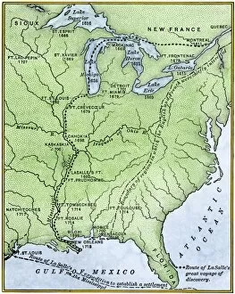
EXPL2A-00171Map showing the route of La Salles explorations in North America, late 1600s. Hand-colored woodcut of a 19th-century illustration
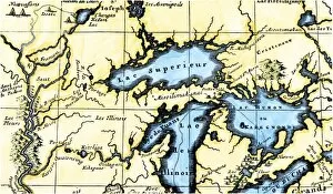
EXPL2A-00350French map of the Great Lakes and upper Mississippi River region, circa 1700. Hand-colored 19th-century woodcut reproduction
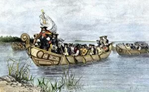
PEXP2A-00026Antoine de La Mothe, Sieur de Cadillac landing on the shore of Lake Saint Clair where he founded Fort Detroit, 1701. Hand colored woodcut of a 19th-century illustration by Howard Pyle